

- All State Parks in Big Sur Area Closed Due to Highway 1 Road Slip Out - 04/01/2024
- Giveaway Alert - 03/20/2024
- Climbing Bolt Prohibition in National Parks - 03/19/2024
Three All-Day MTB Epics from Bishop to Tahoe
Story and photos by Seth Lightcap

Sierra Adventure Rides
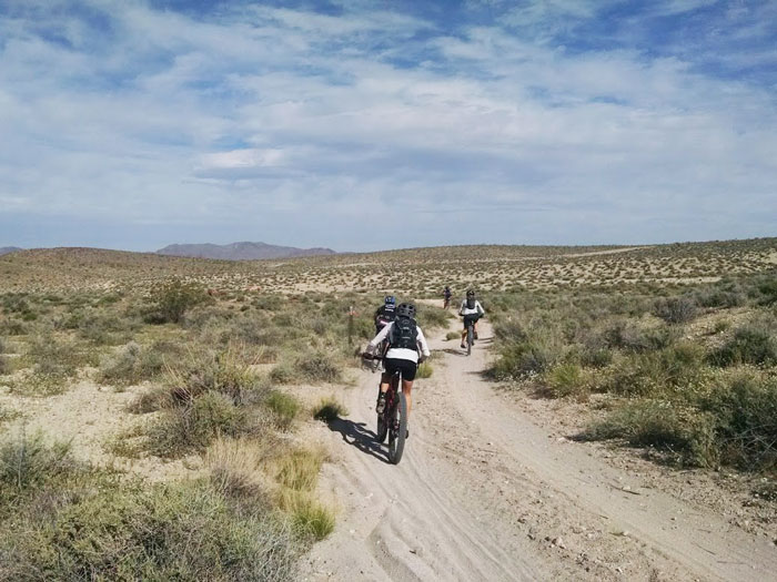
Though the dirt is decent and the rocks are wicked fun, one of the best things about mountain biking in the Sierra Nevada is the fact that there is a trail for any occasion. Whether you only have an hour to cruise or you have all day and are looking for an ass-whupping, there are countless ride options.
Finding a Sierra destination for your average three-hour ride window is easy. Chances are you’ve already spent an afternoon or two on a few great ones. But what about those dawn to dark days? Where would you pedal if you had 12 hours to burn and were allergic to riding laps?
Here’s your answer. Check the specs on the three all-day epic rides profiled here. These rides are adventure testpieces that will challenge your legs, lungs, and navigation skills with big mileage, high elevation, and tricky route finding. Don’t expect your average ‘cross the dam and head into the woods’ endeavours as all of these point-to-point routes cross rugged alpine terrain via some improbable pathways. Due to the distances, these rides also require car shuttles, so read on, feel the stoke, and inspire your friends to join you on the journey.
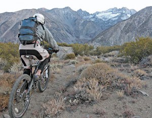
The Coyote Flat Traverse: Bishop to Big Pine
The Lowdown
The Coyote Flat Traverse is no doubt Type II fun. How else could you describe a 35-mile sufferfest that climbs 3,000 feet over an 11,000-foot plateau and includes more sandy doubletrack and hike-a-biking than singletrack? That said, this grand tour from Bishop to Big Pine is a spectacular adventure, well worth the pain if only for the glacial views and the chance to rip rarefied singletrack from the High Sierra to the Owens Valley.
This radical journey should only be attempted by strong riders with a keen sense of direction as route navigation is by far the crux of the trip. Your pedal payment won’t be the only sacrifice as the ride requires an hour car shuttle in both directions. Don’t be put off however. Just prepare well and roll with good company.
Trail/Shuttle Info
The car shuttle begins in Big Pine where you can leave a vehicle along Glacier Lodge Road. Cruise back to Bishop and make a left on W. Line Street (168), then a left on South Lake Road 13 miles later. Park at a turnout on South Lake Road just past Bishop Creek Lodge. The ride starts about a quarter mile up the paved road where you’ll make a left onto the first obvious dirt road and cross a creek on a gated bridge. The road looks like a private driveway but it’s a Forest Service easement.
Follow the road past a home then veer left and begin climbing as the road contours up the side of the valley. After grinding up 3,000 feet in six miles you’ll be greeted by stellar views as you reach the top of the plateau. At this point a map will be key as you’ll need to navigate the jeep roads across the massive Coyote Flat. When you pass a marked landing strip you’ll know you’re on the right route.
About a 1/4-mile past the airstrip you’ll reach a critical junction. If you head left you’ll climb up over a saddle and descend fast moto-banked jeep roads for about 15 miles back to Big Pine. This alternative route stays on dirt longer but misses out on the technical singletrack that awaits if you stay right and follow the original route.
If you hang right you’ll begin trending southwest following a road along a low-lying ridge until it dead ends at a hunting cabin. Riding out behind the cabin look for a faint horse trail that crosses a creek just after a barbed-wire fence. From here get ready to hike-a-bike a fair bit as the singletrack trail gets loose and steep as it climbs and meanders across a high meadow that overlooks the Palisade Glacier. After a couple miles of on/off climbing, the trail will drop sharply into rowdy technical switchbacks that cross another meadow or two before descending into the Big Pine Creek drainage and finally to trail’s end at Glacier Lodge. Zip down Glacier Lodge Road for nine miles back to your car.
Additional Info
Do not underestimate this 35-mile adventure. It is long, arduous, and extremely remote. Getting temporarily lost is probable, if not guaranteed. Prepare for a 12-14 hour day on the saddle. Following the route description in Mountain Biking Mammoth, a guidebook by David and Allison Diller, will vastly improve your odds of success as would bringing a GPS. The plateau is quite exposed so dress accordingly and abandon plans for the ride if you wake up to mixed weather. It’s also worth noting that there is a short cut variation to this ride that will take you back to Bishop after gaining the plateau. This route drops off to the north after 11 miles.
The Black Canyon of the White Mountains
The Lowdown
OK, so this one isn’t exactly in the Sierra but rather looks out upon them. The White Mountains are the massive and under-appreciated range that looms to the east of the Owens River Valley outside of Bishop. Though well-known as the home of the Bristlecone pines, the oldest living things on earth, few people recreate the sprawling escarpments of the White Mountains as they are hard to access and not quite as picturesque as their High Sierra counterparts to the west.
Riding the Black Canyon is a top-to-bottom thrill that drops from the brushy ridge crest to the streets of Bishop, a 4500-foot plummet over 10 miles. The route starts on singletrack as it traverses into the canyon but soon joins a rocky old road that winds down the mountain. You’ll want fresh brake pads, wide tires and a couple extra tubes for this one as the narrow road is undeniably loose and ridiculously fast.
Trail/Shuttle Info
A Black Canyon descent begins with a long shuttle up to the top. The best place to leave your car is at the end of Warm Springs Road, a road found a couple miles south of Bishop off Hwy 395. Follow Warm Springs Road for approximately seven miles and park at the first major intersection. Head back to 395 and drive south to Big Pine where you’ll make a left on SR-168 going toward Westgard Pass. After 13 miles on SR-168, make a left on White Mountain Road and continue until 1.1 miles past Grand View Campground where you’ll see an unmarked dirt pull-out on the left. Park here.
The trail starts as a northbound dirt road leaving the back of the pull-out. Pass the first faint road heading left but take the second left that quickly becomes a singletrack trail. The trail traverses across a few drainages before dropping into the Black Canyon after a couple miles. The bottom of the canyon is marked by a major intersection with a road, at which you’ll take a left and start ripping downhill. The route is obvious from here as you stay on the main road as it drops another seven miles through alternately lush then rocky, barren terrain. Hang on tight and don’t let the Sierra views distract you too much as the loose trail surface demands attention.
Additional Info
This ride is notorious for flat tires, especially if you have XC rubber on your bike. Throw on wider tires for better scree surfing and bring two tubes per person PLUS a patch kit. A mile-by-mile route description can also be found in the pocket-sized guidebook Mountain Biking Mammoth, a very worthy addition to your trail pack.
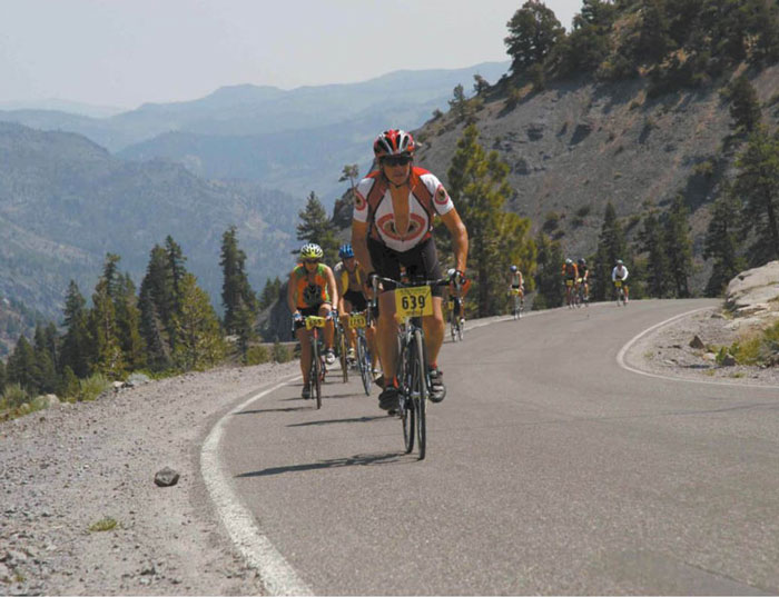
Spooner Summit to
Mr. Toad’s: Lake Tahoe
The Lowdown
The details don’t lie on this ultra-mega Tahoe Rim Trail link-up: 40 miles, 6300 feet of climbing and 7043 feet of descending. Whoa!
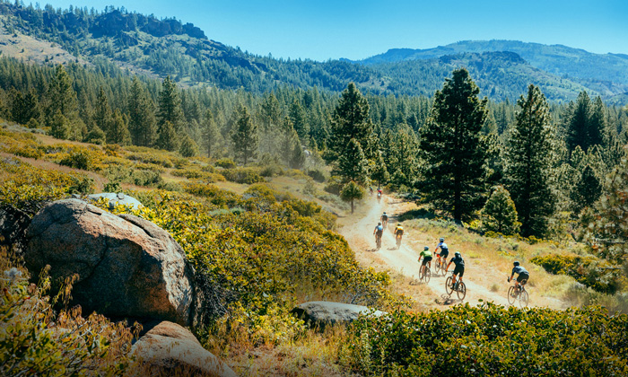
This ride requires some serious gusto but you get paid royally for the pain as you’ll travel through remote Tahoe high country before descending one of the most famous trails in the region, Mr. Toad’s Wild Ride. Other than a few intersecting portions of paved road, the entire ride is on perfect singletrack with several hyper-fast sections.
The route is locally known as the “Super Punisher” but it’s doable for mere mortals if you get an early start. The first 12 miles from Spooner Summit to Kingsbury Grade are a perfect warm-up as it climbs awhile then descends awhile leaving you well-balanced for the big push up to Mr. Toad’s. The climbing on the back half is also broken up fairly well providing opportunities to rest. A quick dip in Star Lake at the base of Freel Peak is also not to be missed.
Trail/Shuttle Info
The shuttle drop-off for this ride is at a OHV parking lot just outside of South Lake Tahoe. To reach the trailhead go south on Hwy 89/50, take a left on Pioneer Trail Road, then a right on Oneidas Road. Park at road’s end. Head back into South Lake Tahoe and drive east around the lake following US 50 to Spooner Summit. Park along the side of US 50 at the Tahoe Rim Trail parking lot.
Rolling onto the trail the route is straight forward as you follow the Tahoe Rim Trail for 12 miles as it climbs and descends about 1800 feet to the intersection of Hwy 207 (Kingsbury Grade). Once across 207 the route follows Tramway Drive up to Heavenly Ski Area where the Tahoe Rim Trail picks up again.
The next 15 miles of the route are the physical and mental crux as you climb over 3000 feet up to Freel Pass (9,700′). Dropping off Freel Pass, the pain eases for a bit as you descend awhile before climbing another couple miles to Armstrong Pass (8700′).
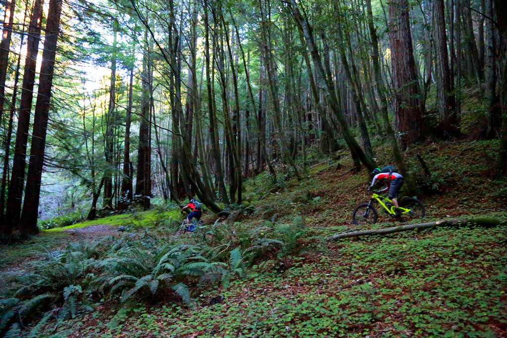
Five miles after Armstrong Pass you’ll reach the Mr. Toad’s Wild Ride turnoff, also known as the Saxon Creek Trail. Bust a right and muster some energy as you have another five miles of fast and technical singletrack to rally down to the car.
Additional Info
The sheer distance of this journey demands respect, let alone the fact that you climb 6000 feet over the 40 miles. That’s a lot of pedaling giving you ample opportunity to do stupid things like flail shifting gears and rip off a rear derailleur. Be patient climbing and don’t hesitate to put a foot down before you tie your drivetrain in a knot. The rocky sections of Mr. Toad’s are also quite challenging so keep your game tight in the last five miles. Finishing a 40-miler with a broken collarbone would put a serious damper on your day.


