


- All State Parks in Big Sur Area Closed Due to Highway 1 Road Slip Out - 04/01/2024
- Giveaway Alert - 03/20/2024
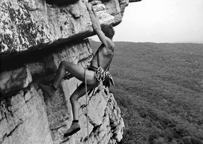
- Climbing Bolt Prohibition in National Parks - 03/19/2024
Steve Roper’s Lofty Sierra Timberline Traverse
By Leonie Sherman
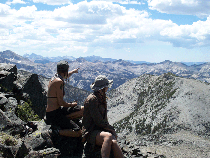
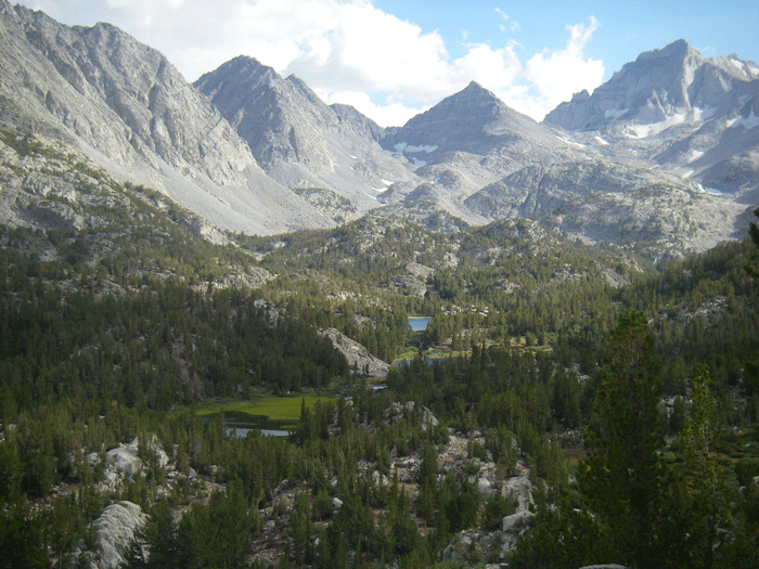
Pointing out distant peaks between Purple Lake and Duck Pass (Daniel Kangas).
I can’t seem to follow anyone else’s path — through life, love or the wilderness. So when a girlfriend asked me if I wanted to hike the John Muir Trail with her six summers ago, my answer was an emphatic “No!” 212 miles of following footsteps seemed, quite frankly, a bit dull.
“But I’ve heard of this thing called the Sierra High Route,” I told my disappointed friend. “It parallels the JMT, but stays mostly off trail and mostly above 10,000 ft. Want to try that?”
She’d never heard of it and I had only heard vague mention so I tromped off to the library to check out Steve Roper’s work of genius, Sierra High Route: Traversing Timberline Country. Four months later we were haggling over wilderness permits. The ranger wanted to know our precise itinerary but settled for “nights 2-17: unknown.”
Eighteen days later we stumbled into Twin Lakes, rangy, hungry and glowing with the magic of Sierra timberline wonder. I’ve gone back every summer since then, repeating sections, creating variations, climbing ridges. Roper’s High Route revealed stark spires, lonesome tarns and rolling lake basins. Navigating this route inspired an obsession that has defined my life and is still going strong.
Steve Roper is either a masochist or in possession of a sick sense of humor, because his High Route starts at the Road’s End trail-head in Kings Canyon National Park, at 5035 ft. On the first day of a long alpine experience, with your heaviest load and in the poorest physical condition of your trip, you’re faced with the toil of a sun-exposed 5600 ft vertical gain. You’ve been gazing at photos of granite domes and mountain vistas for months and your first sweaty hours all you see is an ocean of forest.
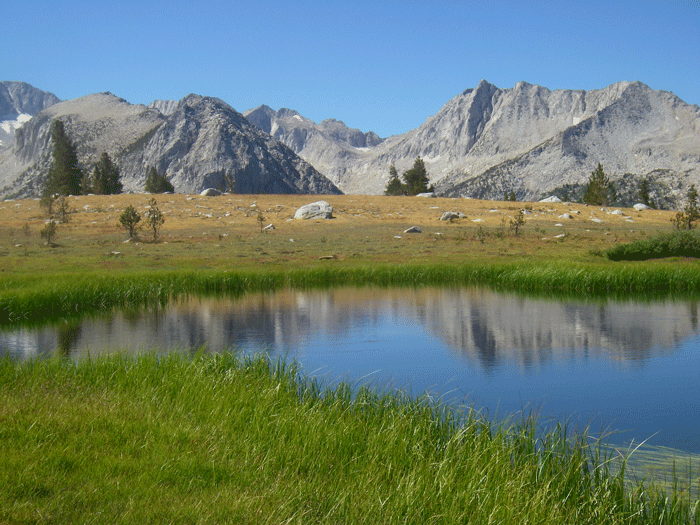
Gazing west from Pioneer Basin (Steve Hollenbeck).
But then you enter the polished slab wonderland of Granite Basin. Here you step off the trail and down the rabbit hole. The rest of your time on the High Route will feature searing cobalt skies, jagged pinnacles, fields of car-sized boulders and an ecstasy even high-grade pharmaceuticals cannot duplicate.
After your first grueling 15 miles of trail-hiking, you’ll be measuring progress by passes and basins, not by distance. You’ll reckon the difficulty of each col instead of elevation gained and lost. Numbers and dotted lines on maps will fade away, leaving only the rocks and water and sky that you feel more a part of with each carefully considered footstep.
I cried when I stepped off the trail on my first foray along the High Route. Partly from the sheer elemental beauty and the sense of having arrived, finally, at the entryway to my journey. But partly from anxiety. My companion was woefully inexperienced, so all the responsibility for route-finding, menu-planning and camp set-up fell on my bony shoulders. For the first few days of off trail travel, I worried constantly about finding the right pass and getting us safely into camp each night
But by the second week we’d settled into a comfortable routine. Each night, after camp chores, I’d pore over the map and Roper’s book so my dreams were filled with pass names and rocky terrain. Each day we’d pick our way across slabs, through talus fields, past glittering lakes, pausing to enjoy snacks, sing songs and gawk at expansive views. Each evening we’d arrive at camp bruised and exhausted, and prepare to do it all over again the next day.
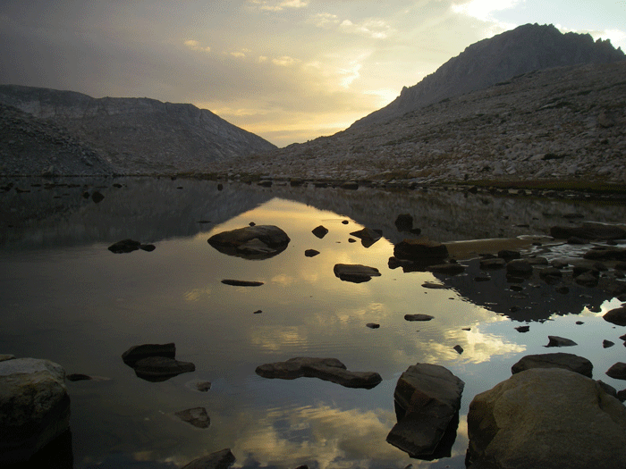
Gazing across La Salle lake at dawn (Steve Hollenbeck).
Sure, occasionally I led us into the wrong drainage, or my partner would hyperventilate on some ankle-twisting descent. But tales of the super-human endurance, high- tech gear and extreme skill-set required to follow Roper’s High Route are vastly overblown. We were able to navigate safely for eighteen injury-free days armed only with determination, an 80-ft contour map and Roper’s thorough route description.
Even for the arm-chair mountaineer with no intention of setting foot on Roper’s rocky route, his book is a worthy purchase. The first section will stoke your curiosity and interest in the early explorers of the Range of Light, crammed with fascinating natural and climbing history, all presented in Roper’s hilariously dry style.
The second section breaks the route into bite-sized chapters that will teach you the names of stunted trees and distant peaks while guiding you through some of the most rugged terrain in the Sierra Nevada. The descriptions are so thorough that a compass is hardly necessary; this is a fantastic introduction to the rigors and challenges of off-trail travel. Roper’s detailed commentary allows you adventure with a feeling of security, like climbing with a top rope. Less technical alternatives are offered for any third class terrain and deviations are encouraged.
Roper fails to give clues as to how much time any of this will require. Andrew Skurka completed the whole route in seven days, but he also Hiked the PCT, the AT and the CDT in a single season. I needed 18 days to complete just about 3/5 of the route my first time out. A fairly fit friend took 27 days to complete the route several summers ago. If you allow one full week for each of Roper’s chapters, you can pad your itinerary with plenty of time to sit and stare, or enjoy a casual afternoon at an isolated lake shore.
Don’t rush through this experience. Unless you’re Andrew Skurka, nobody cares how fast you complete your trip. Since you can’t easily track miles or even elevation, your best bet is to sink into the present moment. Just like the JMT, this is a once in a lifetime opportunity to commune with one of the gentlest most stunning mountain ranges on the planet. Unlike the JMT, you cannot space out for miles because every footstep demands deliberation when you have no trail to follow.
A standard backpacking kit is sufficient for High Route exploration. If you like to weigh every sock and portion out daily servings of trail mix, the High Route will give you plenty of opportunity to break out the scale and ziploc bags. A casual approach where you rely on trail- mates to supply sunblock or supplement your food supply might work on the Appalachian Trail but is ill- advised when you may go days without seeing others. You need to be self-sufficient, but unless you’re really in the mood an ice ax and ultra-light crampons are not necessary.
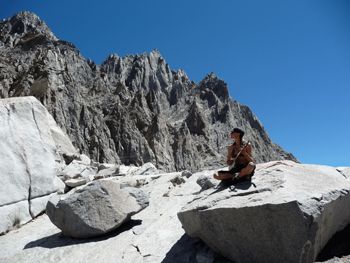
Looking towards the Palisades, plucking a tune, on top of Thunderbolt Col (Doug Robinson).
Don’t repeat my newbie mistake and go light by skimping on food. I lost over five percent of my body weight during my first jaunt along the High Route. I thought I was going light and lean; I was just hungry and grumpy. Bring slightly more calories than you think you’ll need.
Roper focuses on history and route descriptions and doesn’t delve into many logistical details, like where you might resupply en route. Here are some ideas: six miles from Dusy Basin and a mile out the road the kind folks at Parcher’s Resort will hold a stash of food, for a small fee. You can mail food to the raucous Vermillion Valley Resort, just a day’s hike from Lake Italy. Mammoth Lakes offers a plethora of options and is a decent place to stop for a beer. Food can be mailed ahead to the post office in Tuolumne Meadows, or Tioga Pass Resort may hold a box for you.
For those not enthused with a five-week adventure, the High Route can be broken into shorter loops or semi-loops. For example, starting at Road’s End, you can follow Roper’s description to Lake Basin and head north, off-trail, through the Dumbell Lakes and Ampitheatre Basin, then follow Cataract Creek down to the JMT. From there you can follow the roaring Middle Fork of the Kings River to Simpson Meadow and climb out over Granite Pass repeating the first 15 miles, but this time downhill. Or you can start at South Lake, hike into Dusy Basin and follow Roper’s directions into Humphrey’s Basin, where you can duck out over Paiute Pass and hitch-hike back to your car. The end of each chapter details easily-climbed peaks along the way.
Even though I’ve rambled Roper’s route from one end to the other, my days of High Sierra exploration are only beginning. Now when I look at a map my eye is drawn to the areas between the dotted lines that mark trails. When I think I’ve thoroughly explored a region I just hop over a ridge, or move 3⁄4 of mile to the east and a whole new panorama of wonder awaits. Sure, there are higher ranges, more glaciated ranges, wilder ranges, and I’ll never fully shake my itch to explore them. But Steve Roper and his Sierra High Route introduced me to my mountain home.
Forests, meadows, distant peaks, alpine wonderland along the High Route (Steve Hollenbeck).
——————————————————————————————————————————–
Steve Roper: The Man Behind the High Route
Forests, meadows, distant peaks, alpine wonderland along the High Route (Steve Hollenbeck).
All the Yosemite Valley climbers of the 1960s knew Steve Roper. He was the first guy to free climb the Kor-Ingalls Route on Catsleton Tower with Chuck Pratt. The guy who did the third ascent of the Nose on El Cap with Layton Kor. The first guy to climb the NW Face of Half Dome in a day. The ambassador of Camp 4. They just didn’t know he could write.
In 1964, Roper penned A Climber’s Guide to Yosemite Valley. The first book dedicated to climbing in Yosemite Valley, it contained only two minor route errors and set a new standard for climbing literature. Roper’s prose is a pleasure to read. He’s enormously knowledgeable and some of his phrases make me laugh so hard that tears roll down my cheeks. His erudite and precise vocabulary influenced the way an entire generation of climbers talk.
In the next two decades he published more than half a dozen guidebooks, including the enormously influential Fifty Classic Climbs of North America. Along with Allen Steck he founded and edited Ascent, the first writer-based climbing journal ever. His reputation gradually changed from “that incredible climber” to “that incredible writer.”
Many young climbers start out pulling on plastic at their local climbing gym. But Steve Roper started out on Sierra Club expeditions. As a young boy he was fascinated with the austere country above tree line. That life-long love affair led to his first publication of Timberline Country: Sierra High Route in 1982. Republished in 1997 by the Mountaineers, this is not just an excellent guidebook, it’s a whole new concept. Nobody before had written about an off-trail ramble hundreds of miles long, combining the best aspects of through-hiking and cross-country exploration.
“I think the idea first came to me around 1980,” Roper recalls. “Three of us had just finished our fourth day of cross- country timberline walking. We had seen lovely scenery and, though it was August, hardly any people. I blurted out, ‘Wouldn’t it be something if we could hike along the 10,000 ft level like this for weeks all the way to Yosemite?’”
Back home, he studied maps and journals obsessively. He took two summers to gather notes and wear out boots and companions in his quest for the ideal passage – limited trail time, no ropes required. Anyone who has ever attempted a cross-country scramble aided only with binoculars, a map and imagination is familiar with some of the dilemmas Roper faced: certain passes which seemed reasonable on a map were too sheer or scrappy for most backpackers. “I had lots of fun,” Roper confesses, “and lots of trouble explaining to my friends that the project constituted a ‘real job.’”
His rationale for focusing on that stark alpine wonderland that hovers above 10,000 ft is simple. “One can hike forests nearly anywhere,” Roper explains. “And too much talus is tedious. But that narrow band bordering the 10,000 ft level in the High Sierra is unique.” John Muir, Ansel Adams and David Brower all devoted their lives to praise of that same magical zone.
More than three decades after its first publication, the Sierra High Route is more popular than ever. But Roper takes the most pride in the feelings he has inspired. “People who go to remote places are more likely to spread the word about taking care of wilderness,” he says. That was the original message of his boyhood Sierra Club explorations, and what he hopes to be remembered for.


