MAGAZINE
Current Issue
Previous Issue
All Issues
Stories
Backpacking & Hiking
Biking
Climbing
Sailing
Scuba
Snow Sports
Surfing
SUP
Swimming
Whitewater
Events
Upcoming Events
Biking
Run/Walk
Snow Sports
Triathlon/Duathlon
Swim
Miscellaneous
Event Recaps
Event Profiles
Post your event
Earn Your Beer + Gear
Earn Your Beer Column
Gear
Earn your Beer Shop
Authors
Anthea Raymond
Chris Van Leuven
Dierdre Wolownick
Ella Suring
James Murren
Krista Houghton
Kurt Gensheimer
Leonie Sherman
Liam Nir
Marissa Neely
Matt Niswonger
Matt Johanson
Videos
Biking Videos
Climbing Videos
Film Trailers
Skiing & Snowboarding
Surfing Videos
Buzz
Destination
EarthTalk
Ear to the Ground
Gear We Love
Industry News
Switchback
Badass Books
Contest
Gift Giving Guide
SHOP
Earn Your Beer
Gift Guide
DEALS & DISCOUNTS
Search
Search
Search
Popular Searches
Biking
Industry News
Event Profile
Magazine Archives
Lifestyle
EarthTalk
Climbing
Snow Sports
Skiing
Backpacking & Hiking
Backcountry Skiing
Running
Surfing
Snowboarding
Water Sports
Miscellaneous
Event Profiles
Videos
Kayaking
Cross Country Skiing
Event Recaps
Editor's Note
SUP
Whitewater
Gear
Fat Tire Tuesday
Racing
Gift Giving Ideas
EPiC
Environment
STAY INSPIRED!
E-mail
Subscribe
Subscribe
Get monthly web exclusive content & event updates delivered straight to you.
Follow Us
SUPPORT ASJ
SUPPORT ASJ
What are You Looking For?
Search
Search
Search
Popular Searches
2021 Gift Giving Guide
2022 Gift Giving Guide
50 Lessons in 50 Years
Adventure Mom
Adventure Racing
Angry Singlespeeder
Artists
ASJ Roadshow
Athlete Profile
B&B
Backcountry Skiing
Backpacking & Hiking
Badass Books
Beer Worth Earning
Biking
Biking Videos
BIPOC
Black Lives Matter
Blogs
Book Reviews
Brewing
Chris Van Leuven
Climbing
Climbing Videos
Contest
COVID-19
Cross Country Skiing
Current Issue
Cycling Shops and Retail
Destination
Digital Archives
Ear to the Ground
Earn Your Beer
Earn Your Beer // Column
EarthTalk
Editor's Note
Environment
EPiC
Event Profile
Event Profiles
Event Recaps
Fall Membership Drive
Fat Tire Tuesday
Festivals
Film Trailers
First Tracks Friday
Funny Videos
Gear
Gear Junkie
Gear We Love
Get Wet Wednesday
Gift Giving Guide
Gift Giving Guide 2023
Gift Giving Guide 2025
Gift Giving Ideas
Green Living
Grocery, Health Food & Juice Bars
Guide Stories
Gym
Hiking Videos
Industry News
Kayaking
Kurt Gensheimer
Learning to Fly
Leonie Sherman
Lifestyle
Lifestyle Advertorials
Magazine Archives
Membership Drive
Miscellaneous
Miscellaneous
Mountain Biking
Mountain Monday
Mountaineering
Nelly
Opinion
Our Contributors
Outdoor Specialty Stores and Outfitters
Overlanding
Paddle Boarding
Paddling Videos
Photography
Products
Profiles in Courage
Racing
Restaurants, Breweries, Coffee Shops
Roadtrip Diversions
Running
Sailing
Scuba
Skiing
Skiing & Snowboarding Videos
Snow Sports
Snowboarding
Sponsored Content
SUP
SUP Racing
Surfing
Surfing Videos
survey
Feb/March 2011
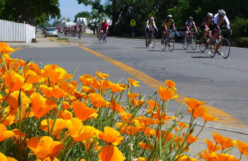
Spinning to Paradise and Back
Biking
02/01/2011
by
ASJ Staff
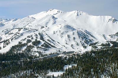
Mammoth Extends Reach
Skiing
02/01/2011
by
ASJ Staff
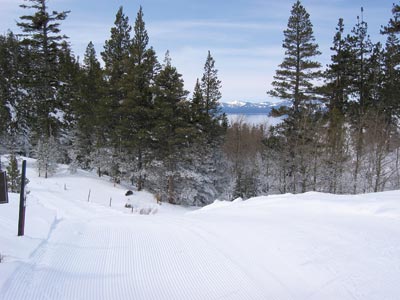
Scenic Sliding at Spooner Lake XC
Backcountry Skiing
02/01/2011
by
ASJ Staff
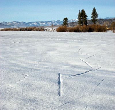
Skate Skiers Unbound
Backcountry Skiing
02/01/2011
by
ASJ Staff
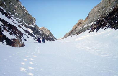
Three Classic Eastside Couloirs
Backcountry Skiing
02/01/2011
by
ASJ Staff
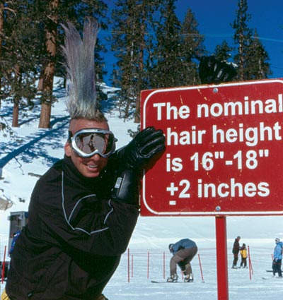
Face Rats: An Endangered Species from Heavenly’s Golden Age
Skiing
02/01/2011
by
ASJ Staff