

- California Enduro Series Announces 2024 Schedule - 11/19/2023
- ASHLAND MOUNTAIN CHALLENGE 2023 – CES RACE REPORT - 10/04/2023
- China Peak Enduro 2023 – CES Race Report - 09/04/2023
A worthy objective for Sierra ski mountaineers
By Josh Pearlman
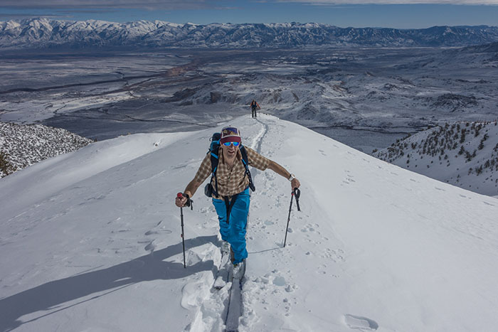
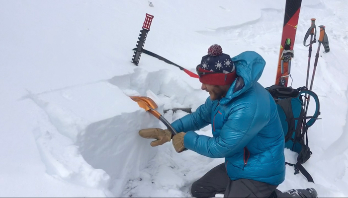
Local mountain guide Howie Schwartz California dreamin’ in short sleeves (Peter Clark).
Mount Tom is situated in the middle of the southern Sierra Nevada. This area – known simply as the “Eastside” – spans nearly 400 miles and boasts an impressive 21 designated Wilderness areas and two national parks.
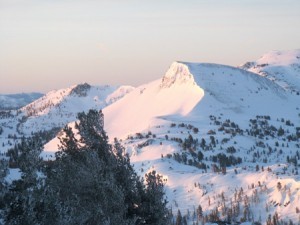
Just northwest of Bishop, as the Owens Valley begins a steep climb toward Mammoth Lakes, the 13,658-foot Mt. Tom becomes visible as it noticeably dominates all of the surrounding peaks. This peak, a must-do in the Eastside backcountry ski circuit, is named after Thomas Clark who bagged the summit sometime in the 1860s.
It is unclear who first skied Mt. Tom, but based on the active scene there in the 1970s and 1980s, it was most likely done by Galen Rowell or Doug Robinson or someone in that group. Today, Mt. Tom is the logical next step for the experienced backcountry skier who has nailed the classics such as Dana, Laurel, Morrison or Bloody, and is ready to move on to the bigger southern peaks such as Whitney, Split or Williamson. If you can ski Mt. Tom, then you can probably ski Mt. Whitney in a day with a slightly earlier start and a noticeably later return time.
In 2001 I was living in Mammoth Lakes and fully immersed in the ski mountaineering culture there. Mt. Tom seemed like a noble goal, so I got together with three friends and we hatched a plan to skin up to the top of Elderberry Canyon, climb the technical headwall to the top of the peak, and then ski back down.
Mammoth Lakes was a smallish community back then, full of ultra-fit dirtbags who knew the magic of climbing and skiing in the Southern Sierra and were willing to train hard and take risks. I was working at Lakefront Restaurant and trying to save money, even though it was easy to blow a whole day’s wages just sitting at the bar and planning adventures.
Mt. Tom was perfect for us. It was a big gnarly objective but not necessarily dangerous. We had our plan and waited for the perfect weather window and conditions. Problem was, we weren’t the only ones with Tom in our scopes. It was time to step up and get it done before someone else did.
Shortly thereafter we were skinning up the old mining road that leads to the top of Elderberry Canyon. It was 3am and we had 4,600 vertical feet of skinning before the technical climbing on the summit headwall was to begin.
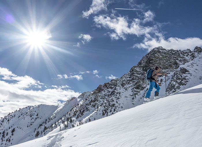
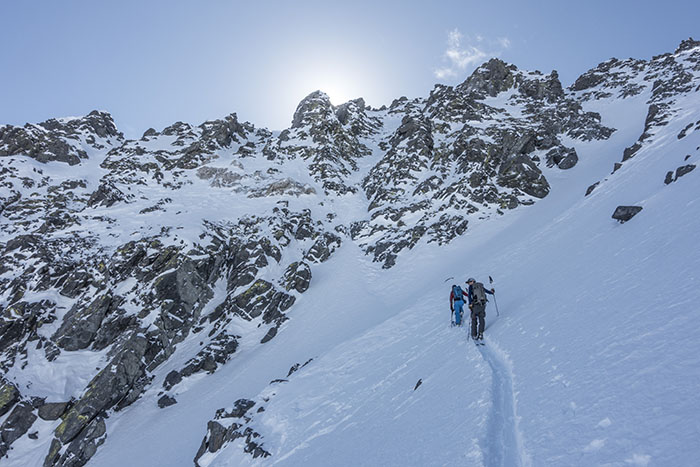
We threw our skis and skins in our packs and started the tedious climb up a rocky spur to gain the summit ridge at just under 13,000 feet. Fighting for breath, we reached the summit, which is absolutely spectacular. To the west we saw Bear Creek Spire, and the spiky skyline of the Minarets to the north. Up and down, over and under, around and across, the lengthy summit ridge is a wonderful and exhausting final push that seems to take forever.
The climb took nine hours and we were lost in the weary euphoria of a successful ascent, smug with the knowledge that we would soon be descending at full speed. It only takes about 15 minutes to descend Mt. Tom on skis, but those minutes feel like the ultimate prize to a ski-mountaineer who has earned every inch of a blissful run.
The whole way down we were human projectiles, with flapping Gore-Tex and fluttering pack straps. It felt as if we were going 100 miles per hour, although in reality it was probably half of that speed. It’s hard to comprehend that we were able to ski down a mountain for such an extended period of time. On and on, we occasionally stopped to spot each other and to catch our breath. Pumped on adrenaline and knees shaking with exhaustion, we finally reached the car, literally riding up to and touching the hood of my trusty old Subaru.
Pausing, we looked back at the mountain in silent praise, basking in the experience as the last ten hours began catching up to us. We started to chuckle, which turned into loud laughter as the high began to overwhelm our bodies. It had been a perfect day in the mountains, no avalanches or injuries, politics or war, bills or mortgages. A simple test of body and soul, just four buddies with a bit of ambition that had, once again, left us with ear to ear grins and an incomparable buzz rivaled by nothing else on earth.
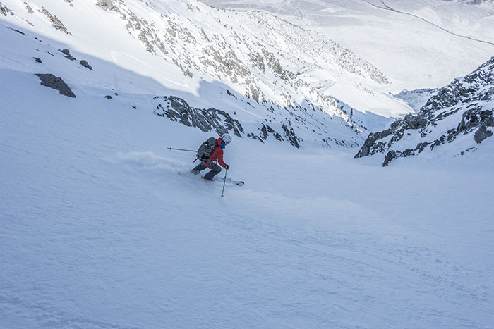
Savoring every turn of the massive descent (Peter Clark).
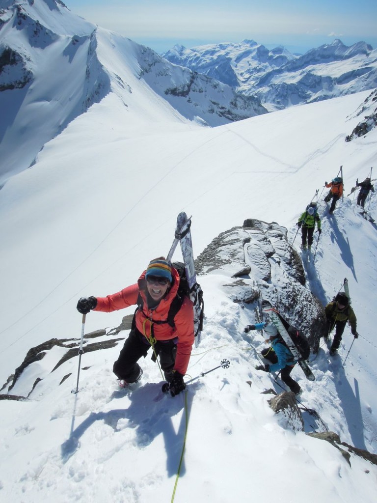
Traversing Tom high in the Horton Creek drainage (Peter Clark).
Jim Barnes contemplates the 4,000-foot descent from the headwall of Horton Creek (Peter Clark).
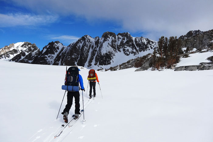
Skinning up the Horton Creek drainage (Peter Clark).
Skiing Mt. Tom
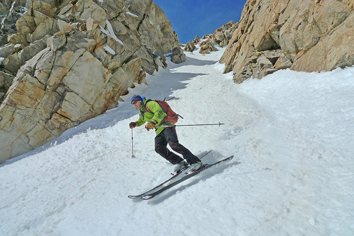
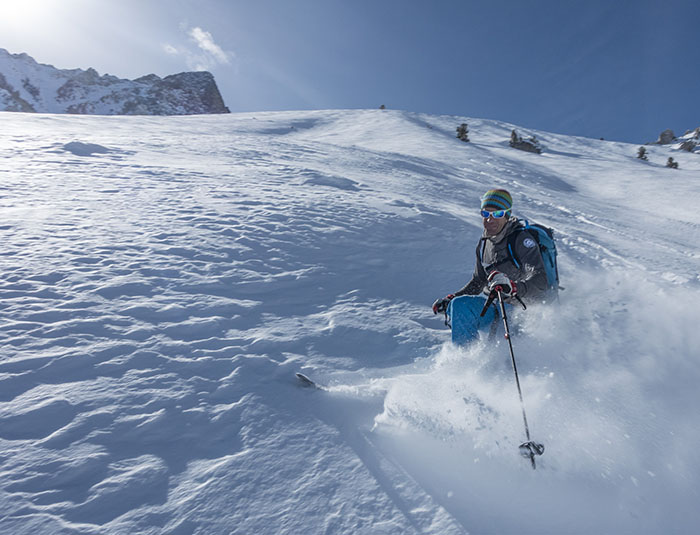
Skiing the corn on the south face during an unseasonable June-uary (Peter Clark).
Getting there:
• From Bishop head North on US 395 toward Mammoth Lakes for ten miles.
• Turn left (west) on Pine Creek Rd. to Rovana
• Mt. Tom sits directly above Rovana and numerous obvious dirt roads lead to the bottom of the well-defined drainage known as Elderberry Canyon.
• Drive as far as you can towards the foot of the canyon and park it, on big snow years one can drive right to the snowline.
When to go:
• I have found the best time has been in March or April. After a good year the snow blankets the entire peak avoiding having to hike 1,000 feet or more of scrub on a dismal year.
• Mid-winter snow conditions can be exceptional with high altitude blower powder on the headwall that gradually firms up as you descend through the enormous Elderberry Canyon. But with short days, unstable weather and variable avalanche conditions, it can sometimes be a gamble on success.
Resources:
• The town of Mammoth Lakes, 7,880′, 30 miles north on US 395, sports numerous restaurants, hotels, breweries and bars.
• Mammoth Mountaineering Supply, run by longtime Mammoth hardman Dave Talsky is the local climbing shop with a very knowledgeable staff and a wide variety of backcountry gear.
• Mammoth Mountain is a fantastic ski area, and with a top elevation of 11,053′ it is a great way to acclimate before pushing it to 13,658′.
• Bishop, 4,150′, has numerous restaurants, hotels, breweries and bars as well. It has more of a western cowboy feel compared to the ski bums and LA social crowds of Mammoth. It also has a large year around climbing community with endless bouldering and sport climbing in the surrounding hills and washes within just a few miles of town.
• In Bishop, check out Eastside Sports to outfit you with any necessary gear or knowledge. Todd Vogel and his staff are amazing.
Guidebooks:
• The High Sierra- Peaks Passes And Trails by R.J. Secor
• Backcountry Skiing In The High Sierra by John Moynier
—JP


