


Discover the magic of this mountain oasis
By Leonie Sherman

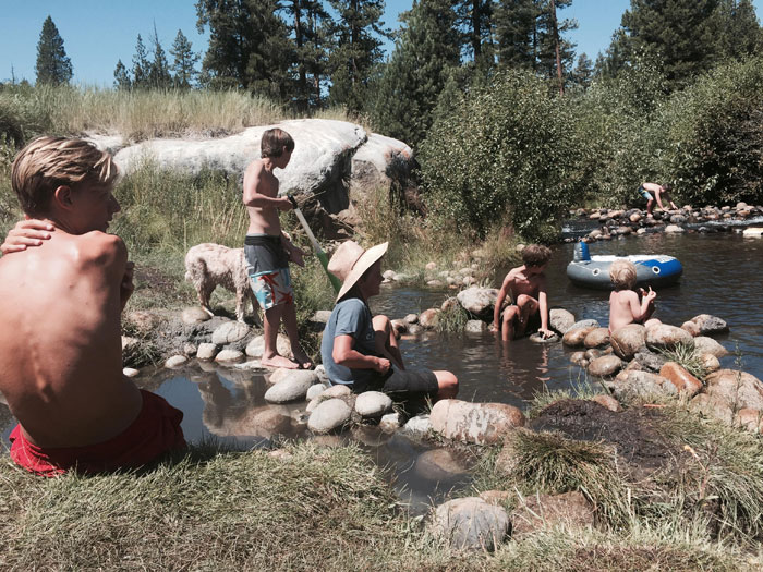
Nine years ago I hiked into Mono Hot Springs after six days of cross country rambling. My companion and I were delighted to find friendly folks willing to share their food and their campsite. We sang songs and played dominos around a crackling fire. The next morning we soaked in a concrete hot tub known as “Old Pedro” while morning birdsong filled the air and the forest glowed with the new light of day. 
The next winter a boyfriend and I decided to ski to the hot springs during a blizzard. Locals still gossip about our dramatic failure. One dry January I rode my bike 16 terrifying icy miles to visit the steaming healing waters. In late autumn three years ago, I came for day hikes and scrambles. Now I come just to sit in dappled shade in the lazy boy chairs made of rounded river rocks by the banks of the San Joaquin and watch the river. Mono Hot Springs is a destination in its own right.
The hot springs are located in Sierra National Forest, sandwiched between Yosemite and Sequoia Kings Canyon National Parks. The lack of law enforcement, splendid surroundings and laid back atmosphere attracts diverse users ranging from hunters to hippies, families to thru-hikers.
After driving through the bustling chaos of Fresno, six lanes of expressway fade into the meandering California State Route 168, which dead ends sixty-five miles later at Huntington Lake. A right turn connects to Kaiser Pass Road, which closes at the first snow fall and opens sometime in late May. After forty-five minutes of cautious driving along the twisting rutted single lane road, a small faded sign points half a mile downhill to Mono Hot Springs Resort.
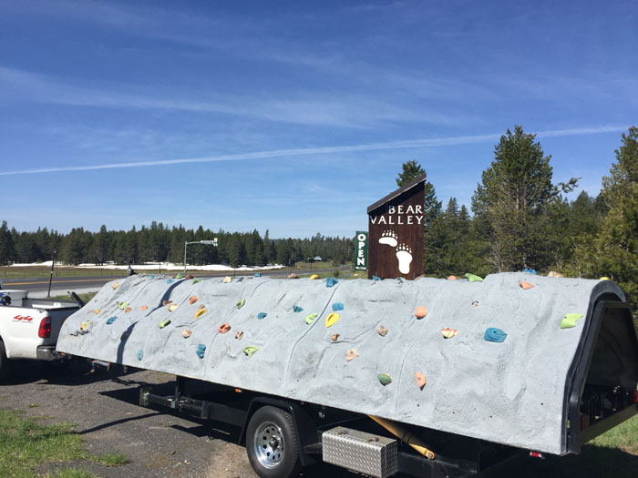
Don’t be fooled by the “R” word; the grounds consist of a dozen scattered cabins, a tiny restaurant with a sprawling deck, a sparsely stocked general store and a run-down spa with a resident massage therapist and a few private tubs. There’s even a post office. A quiet National Forest Campground perches on the banks of the rushing San Joaquin, with dispersed camping available all around. The hot springs beckon across a slippery foot bridge. The resort closes in late autumn, but a winter caretaker will welcome you during the cold dark months.
At 6,500 feet, the winters never get desperately cold and the summers never get desperately hot. Ravens frolic all year round; climate change and warming temperatures mean the few resident bears barely even hibernate. Springtime is a profusion of blossoms in the wet meadows. Summer invites river frolicking. A mile away, the crystal waters of Doris Lake beckon to swimmers and cliff jumpers alike. Autumn encourages crisp hikes.
Once you’ve made the arduous journey, there’s plenty to enjoy without getting back in your car. Days pass in a pleasant haze of fishing, jumping in the river, chatting to fellow campers, scrambling on nearby granite, soaking in hot springs and camp chores. An artesian well provides water for all. Memorial Day is particularly crowded and July 4th features a funky DIY parade.
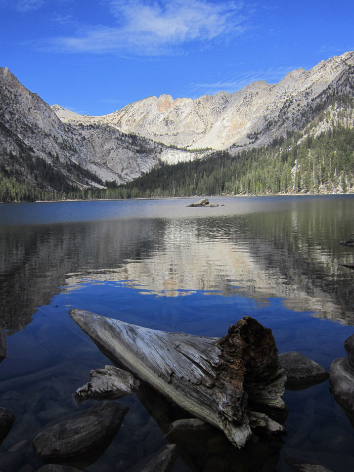
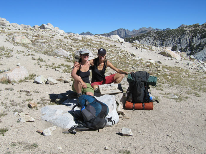
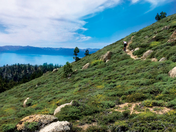
For those who want to venture further afield, a fifteen minute drive up Kaiser Pass Road ends at the dam at Lake Edison and the Vermillion Resort, a raucous re-supply point for thru-hikers. Devil’s Bathtub, a stunning lake at 9,100 feet, is a five mile hike and a great destination for an excursion. A sweet twenty-mile loop over Goodale and Silver Passes, each around 11,000 feet, brings you past alpine lakes and under the dramatic Vermillion Cliffs.
Southeast of the hot springs, a half hour drive dead ends at another artificial body of water, Florence Lake. A water taxi traverses the placid waters to Lost Valley at the eastern shore. A gentle four and a half mile hike passes Blayney Hot Springs, in a marshy meadow, and the busy Muir Trail Ranch. Just a mile and a half further the trail intersects the 240 mile John Muir Trail and all the possibilities that trek engenders.
While the remote location gives Mono Hot Springs charm and appeal, and lends a Wild West free-for-all kind of vibe, it also dooms the place to a serious lack of oversight. A few years ago a guy shot a bear from his car; he was long gone by the time a ranger arrived on the scene. Illegal campfires are a huge issue during hunting season. Fresno’s half a million residents are only a two and a half hour drive away.
Frequent visitors talk about creating a Sierra National Park that would protect the entire spine of California from abuse. Implementation is a long way off, and the impact of more visitors might not compensate for the increase in protection.
Despite being surrounded by five designated wilderness areas, Lake Edison, Lake Florence and the hot springs themselves are granted only the meager protection of being part of Sierra National Forest. As in all of our national forests, funding for resource management and education are dwindling. If we want to continue to enjoy these magical places, it’s up to each of us to ensure their future protection.
We All Live Downstream
Sitting in the steaming waters of Old Pedro one morning, watching the rushing waters of the San Joaquin, I got to wondering: where does all that water come from? And where is it going?
I caught a ride across Florence Lake, hiked for a day and turned south to trace the south fork of the San Joaquin up Goddard Canyon to it’s headwaters at Martha Lake. In eleven and a half miles of trail between Lost Valley and the McClure Meadow junction, I encountered about a hundred people. During two days following the South Fork of the San Joaquin, I saw five.
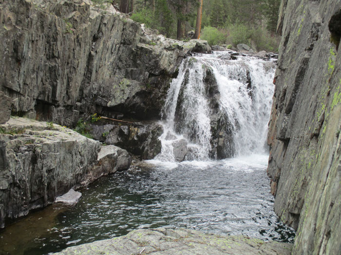
The South Fork carves a steep path through Goddard Canyon. Fed by swollen creeks, the river drops and foams in several fifty foot falls. The roar of rushing water is constant. Above 10,500 ft the river is reduced to a gentle flow that wanders across bench-like alpine meadows. The blue ribbon ends abruptly in the flat expanse of Martha Lake. At 11,000 ft, this glacial lake reigns over an austere landscape of rock and sky, framed by 13,500 ft Mt. Goddard.
The San Joaquin is the longest river in central California. Five million people depend on it’s waters for agricultural and municipal use. But the complex system of diversions and canals that makes so much agriculture and settlement possible comes at a great price. Construction of the Friant Dam in the 1940s virtually eliminated any flow upstream of the Merced River, and eradicated an entire salmon run.
As the climate shifts and population continues to grow, we face an intricate dance of balancing human needs with our impact on other species. Can we learn to live with less, and thereby restore some of the damage we’ve created? There’s no finer place to contemplate the things that matter than a lonely tarn at 11,000 ft. – LS


Great read, great part of the world.