Hiking the ultra classic route from Echo Lakes to Barker Pass
Photos and story by Dave Zook
“What has been will be again, what has been done will be done again; there’s nothing new under the sun.” 
While this biblical refrain from the Old Testament may have been written to touch upon the cyclical nature of human life and injustice, it is also a good description of the vast majority of Lake Tahoe outdoor adventures.
Virtually everything that can be hiked, biked, skied, run or climbed in the Tahoe area already has been. Ever since the 1960 Olympics, there has been an explosion in tourism with athletic-minded individuals making the Tahoe pilgrimage to test themselves in the outdoors. The fiercest and fittest guys and gals still push farther into remote areas and achieve firsts, but for the majority, if you’re in the Tahoe Basin, you’re on well-traveled terrain.
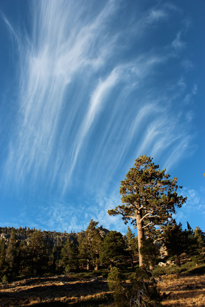
The 32-mile stretch of trail from Echo Lakes in South Lake to Barker Pass epitomizes the phrase “well-traveled terrain.” Not only is this section part of the popular 165-mile Tahoe Rim Trail (TRT), it also overlaps with the world-renowned Pacific Crest Trail (PCT), and crosses into Desolation Wilderness, a wilderness area with an estimated 120,000 visitors per year.
But don’t let the crowds deter you. There is a reason the trail is so popular — it charts a course through some of the most awe-inspiring alpine terrain in the world. My friend Anthony Santos and I recently set out to survey this stretch in a two-day, one-night exploratory mission to find out why so many people love this hike.
Logistics
The easiest transportation scheme is to be chauffeured to the Barker Pass trailhead on the West Shore and then picked up to the south at Echo Lakes in South Lake Tahoe the next day. Lacking a chauffeur we settled for a two-car shuttle instead.
From Tahoe City, we each drove the 90-minutes south to Echo Lakes and dropped one car. Then we carpooled back up the highway and up the twisty Barker Pass road through Blackwood Canyon to the trailhead. With burrito and gas stops, we were on the trail nearly four hours after originally leaving, making the shuttle logistics a bit of a hassle.
Freedom of the Hills
And then it’s pure, true hiking. Left-right-left. For hours. From Barker Pass you descend into the lush forests, ripe with lodgepole pines, red firs, and a few remaining wildflowers like the Sierra larkspur. I knew this not from an intricate understanding of Tahoe’s flora but from the maestro himself John Muir and his paperback field guides, one of which Anthony had tucked away.
“I could rally this trail on my bike,” said Anthony, itching to let the wheels of efficiency do their thing. “I just don’t actually do a lot of hiking trips that are based just around hiking, so I’m always looking at trails from a biking perspective,” he added.
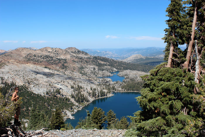
I realized I didn’t either, and perhaps much of the younger generation looks more to geared machines and ropes and boats to traverse through wilderness. But we settled into the cutting-edge technology of caveman conveyance and seven miles in, saw the veritably pleasant Lake Richardson, displaying banks of yellow and orange shrubbery, signs of fall as we were close to Labor Day.
The goal was to camp near Dicks Pass for the night at the 19-mile mark, but we called it at Middle Velma Lake, about four miles short but within the Desolation Wilderness boundary.
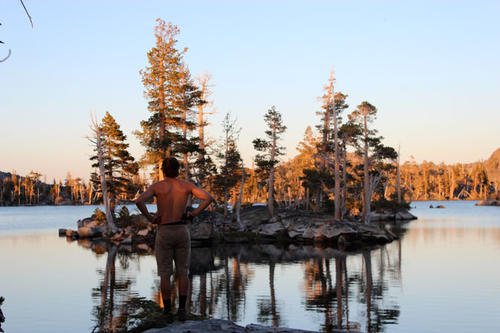
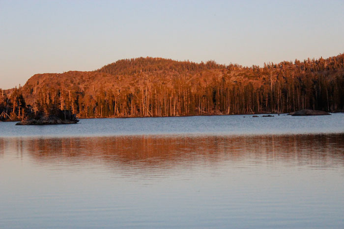
With only a few other campers dotting the lake with their jittery headlight beams, it felt right. With enough room for hundreds of campers around the wide lake, the human presence of others had no suffocating effect on our solace. Santos took a swim and I looked on at the many tiny pine-ridden islands that floated on what was now a pink and orange lake. “Next time we swim and camp out there,” I said, pointing to a fifty square-foot oasis with pines instead of palm trees.
We ate couscous with sausage, had a few nips of reposado tequila, and slept. We could have chosen to boil some water the night before to have it chilled for the next day, but we blanked on that and did it in the morning, leaving us a few hot liters of Velma for the midday heat.
Winter Recon
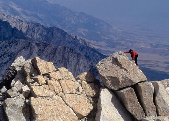
The second day would bring pay dirt in the form of some of the most renowned Tahoe mountainscapes in all of the Basin. The trail goes around huge (for Tahoe) mountains and a handful of crystalline lakes.
We paused at every lake to drink it in, always figuratively and sometimes literally, as we ran out of boiled water and drank raw from a few lakes. Not wise, but we survived and tested our gastrointestinal mettle. I aligned my solar radio to Reno’s classic rock station, 105.7, and ZZ Top and Pink Floyd bounced off the granite-rimmed emerald green lakes, perfectly still save a few birds diving for the kill.
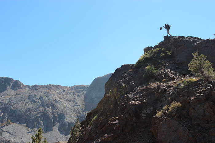
Ascending Dicks Pass, the 1,300-foot ascent was demanding, but reasonable considering the jagged topography. We stood at the pass, sweating in the hot, windy, and golden grassy field at 9,300 feet, and feasted our corneas on a view of big peaks and lakes.
Anthony and I enjoy a good snow pursuit, and as we were in some hallowed Tahoe backcountry ground, we let our imaginations go berserk. The trip evolved into rambling about our bold plans for powder season.
“You could climb this ridge to Dicks, ski the south facing slope in the morning and smash back up to the north or west side and rip a huge line in the afternoon,” said Anthony.
And for about six hours we gawked at what might be skied come winter, envisioning it with a big fat layer of Sierra cement to act as a base, and maybe six inches of fresh on top. The thoughts snapped our woozy legs to a fresh strength.
Tour de Lakes
Our attention steered from mountains to water. Fontanillis Lake laid warped and still, butted against the ice polished granite slabs. Dicks Lake lay right below its summit’s namesake and seemed an aesthetically inspiring place to camp. Circular Gilmore Lake proved too good to not swim with a steep dropoff and open beaches. From there it was Susie Lake, Heather Lake, Lake Aloha and the grand finale of Echo Lake.
Each watering hole beckoned a rest and some meditation and reflection. But the day was flying by; Anthony’s phone/camera ran out of batteries, and snacks were diminished.

But a final swim in Lake Aloha couldn’t be missed. Shallow from the late season and low snowfall it was more like an alpine bath in about six inches of water, the view south toward Pyramid Peak showing miles of connecting granite slabs spread out like a rocky meadow.
The last miles grinded our ankles and knees from the 10-plus hours of hiking. Passing Echo Lake we re-entered a form of civilization as a few dozen houses and huts lined the lake, and a boat taxi ferried its residents around.
Relieved to see the Subaru waiting, we hightailed it to South Lake, feeling our pampered stomachs yearn for hot food after nearly 48 hours away from an oven. Relief came in the form of a well-stocked Chinese buffet and a cold Tsingtao.
Looking over a map a few days later, surrounding the PCT/TRT route were a scribbling of dozens of jeep roads, old and new trails, primitive trails, and more. They too have surely been explored before, but to our eyes and feet they looked like just another way to become an ant in the mountains. And whether or not more ants have been there before couldn’t matter less to me, as it was a fresh path to us.