
An 80-mile trek through the San Rafael Wilderness
By Chuck Graham
Twelve miles into an eighty mile backcountry trek, swaying meadows swept across the rugged horizon of the Sierra Madre Mountains. This was the San Rafael Wilderness, a small part of the Los Padres National Forest.
The rolling meadows were surrounded by sandstone rock outcroppings and draped in a colorful display of lupine and other native flowers. 
Earlier in the day my wife kindly dropped me off in a shady grove of oak trees at Aliso Park in Cuyama, straddling the border of Santa Barbara and San Luis Obispo Counties. From the trailhead I headed west following steep switchbacks ascending a range cloaked in chaparral to the crest of the Sierra Madres.

Later in the afternoon I hiked west to Lamar Johnson’s rustic, weather-beaten cabin. Built in the early 1900s, over the years it has served as a safe haven for hunters and backpackers alike. As snowflakes gently fell from the sky, I was grateful for the creaky cabin. A late winter storm was brewing outside.
The Sisquoc River
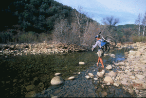
Once the storm had cleared, I left Johnson’s cabin and jumped on the Jackson Trail and descended the steep, rocky route to the Sisquoc River. Over the next two days, I headed east/southeast, rock hopping and bushwhacking the runnel’s steady flow.
The Sisquoc possessed countless emerald green pools, river sand beaches and a trail that continuously vanished then reappeared with nearly every crossing. In 1968, Congress deemed the Sisquoc a “Wild and Scenic River.” The act preserves selected rivers in free-flowing condition, and protects their flora and fauna, as well as geological,

historical and cultural assets. The Sisquoc eventually empties out at the Guadalupe Sand Dunes and the Pacific Ocean.
I continued hiking eastward, rock hopping over shallow pools and gushing tributaries, passing by tree frogs and lizards sunbathing atop river-strewn boulders. I followed the south fork upriver where the trail was swallowed up by dense chaparral. Occasionally I found myself on all fours thrashing through the gouging manzanita and fragrant sage, while being showered with pesky ants and biting ticks.
When I was finally able to stand upright, the Sisquoc had narrowed, and the temperature had dropped. Now I was trekking beneath dense canopies of alders, sycamores and pines. I was approaching Upper Bear Camp, and evidence of Ursus americanus (American Brown Bear) was abundant. Claw marks were gouged into trees, and fresh scat and spoor were everywhere. Fortunately there were no bear sightings within the glow of my fire.

From The Mountains to the Sea
At sunup I reached the dirt road that leads to Big Pine Mountain. A northwest wind blew through the pines on the 6,490-foot summit. I ate lunch and took in the expansive views of the Santa Ynez Mountains (one of the few ranges in the entire U.S. that runs east to west) and the Channel Islands National Park. The archipelago seemed so close, but I was still 40-miles from the coast.
From Bluff Camp I headed down a trail entering the Dick Smith Wilderness, and crisscrossed along a tranquil creek, where again the trail vanished and then reappeared. At times I waded through waist-deep water, tearing through dense thickets, while watching western pond turtles swim for the dark shallows to escape detection.
When the creek broadened into a series of dreamy pools, they brought great relief to my aching feet. I soaked my tired dogs in the frigid water and listened to waterfalls cascading from pool to pool. From that same

location I was lulled to sleep by the steady stream and my small, dying fire crackling inside the gritty alcove of a sandstone boulder.
At dawn, I tied rope to my backpack and lowered it down. I then down-climbed three waterfalls, until I came upon an old lithium mine, tucked away in steep, crumbling shale. Getting the lithium from the mine to the civilized world seemed a laborious task to say the least. An old, rusty lantern still hung from a hook pounded into solid rock. A creaky wheel barrel sat in the entrance of the mine almost appearing ready for another load of rock.
After exiting the mine and sliding down loose shale by the seat of my shorts, I moved quickly down the creek for several rocky miles until I reached the shade of a creek-side oak tree.
West of that sturdy oak was a dry, seasonal creek-bed, and across from it was a lichen-covered sandstone rock face. Narrow handholds led 25 feet up to several small caves and alcoves. A tiny oak tree grew out of a fissure that zigzagged up the sandstone face.

I quickly scrambled up the steep slab and shimmied my way into a narrow opening. The cave wasn’t big enough to sit up in, so I leaned back with my hands behind my head and marveled at the elaborate Chumash Indian rock art before me. Creatures of the forest from bears to ticks were painted on the rock walls along a trail that seemed to depict the surrounding area of the immediate wilderness.
Just above that cave, a smaller grotto exhibited more artwork establishing the connection the Chumash had with the mountains, the sea and even the islands. The rock art was minimal, but distinctly depicted their maritime culture. The gritty canvas revealed a row of dolphins breaching out of the ocean, painted on rock many miles from the coast, an excursion commonly made by the Chumash.
Finishing my trek, I felt a kinship to the Chumash and the rugged beauty of an area the tribe was a part of for centuries.
———————————————————————————————————————————————————————————–
What to Bring
Everyone’s pack and needs will be different, but here are some essentials; Los Padres National Forest Map, compass, headlamp, batteries, sunscreen, hat, sunglasses, small first aid kit, water filter, lighter.
How to prepare
Hike, backpack, trail run and mountain bike.
Best Time to Go
Late fall through spring is the best time to experience the Los Padres National Forest. Summer is too hot and buggy and finding water sources lessen.
Other Options
You don’t have to do an eighty mile trek to enjoy this wilderness. There are lots of shorter routes and plenty of day-trips whether you’re hiking, backpacking, mountain biking or horseback riding revealing incredible locales hidden in the chaparral. Refer to the Los Padres National Forest map for potential options.