Don’t Let the Runoff Pass You By
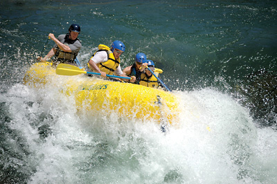
By Pete Gauvin • Photo courttesy of OARS (www.oars.com)

It happens season after season: By the time many California rafters and kayakers get into river mode, streams up and down the state are drying up and coming off the menu.
No doubt, we’re lucky to still have some great rivers that run into and through the summer, either via dam control or watersheds that hang high in the Sierra. 
But if you appreciate variety in your whitewater diet, then spring is your smorgasbord. Not only do you have a bounty of rivers to choose from, but from March into June they’re usually at their peak ripeness, and that translates into sweet rapids and beautiful green scenery.
So get down to the pool to practice your roll, sort out your river gear, and start thumbing the guidebooks. The table is set. Get ready to dig in.
Here are eight tasty spring rivers to whet your appetite.
Cal Salmon River
Ask anyone who’s paddled the Cal Salmon and you’re likely to hear extended praise for this wild river tumbling through the Klamath National Forest near the Oregon border. “The Cal Salmon should definitely be on your to-do list,” says Jeff Kellogg of Clavey River Equipment in Petaluma.
Due to its remoteness, the “Cal Salmon” – so-called to distinguish it from the better-known (and easier) Salmon River in Idaho – is never crowded. With headwaters in the Marble Mountains and Trinity Alps, the river flows from the heart of the Coast Range into a bedrock gorge containing many Class IV rapids and at least three white-knuckle Class V rapids.
The most popular run, from Nordheimer Creek to Wooley Creek, is 10 miles long. But there are also great runs above – on the main river and on the North and South Forks – and below, from Wooley Creek into the Klamath River.
Bring your rain gear: This area can get upwards of 80” per year and spring storms are not uncommon.
North Fork of the Yuba
Draining the 8000-foot peaks near Yuba Pass, the North Fork Yuba is a medium-size river that offers up some tough rapids. The most common run is the Goodyear’s Bar run just downstream from Downieville, the well-preserved gold mining town turned mountain-biking mecca. Although mostly Class IV, this run includes the infamous Maytag, a Class V rapid with a big, sticky hole that any repairman would loathe to visit. Experts can take on 10 miles of river above, the Downieville Run, which includes the extended Class V sections of Moss Canyon and Rossasco Ravine.
There is plenty of good camping in this lush forested canyon along Highway 49. Bring your mountain bike for a multi-sport weekend.
Upper Sacramento
Despite the fact that it parallels Interstate 5, the Upper Sacramento River – 36 miles of river between Box Canyon Dam (Lake Siskiyou) and Lake Shasta – is a rewarding river experience both in terms of scenery and excitement.
Below Box Canyon Dam, the river run through a lush canyon of moss-covered cliffs with occasional side creeks and waterfalls, and nearly continuous Class IV rapids. The typical 12.5-mile day stretch serves up more than 50 rapids, providing nearly constant action. You’ll gain a completely different perspective of California’s mightiest river system; no longer will you think of it as just a big, slow, lumbering river flowing into San Francisco Bay.
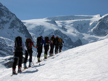
Got a few extra days? Double up your adventures with a ski mountaineering trip to Mt. Shasta. When the river is running is usually the best time for climbing and skiing this magical mountain.
North Fork American
Just because you’ve been down the South Fork of the American on a scorching hot summer day with scores of other boaters, don’t think you’ve experienced the best the American River system has to offer.
The North Fork American flows through a deep, steep-walled canyon just a couple miles south of Interstate 80. It has become one of the classic advanced/expert runs in the state.
With its headwaters beginning at only 8500 feet near Squaw Valley, it fortunes are directly tied to the snowpack. Thus, once the ski resort closes, it’s only about a month or two before the river’s spigot is turned off and runnable flows are gone. With a good snowpack, you can usually count on flows between mid-March and mid-June.
The most popular run is the nine-mile Class IV Chamberlain Falls run. Just upstream is the 14.5-mile, for-experts-only Giant Gap run, which requires a two-mile hike down to the put in. If you don’t want to brave this Class V run yourself, there are a couple outfitters that offer guided raft trips. It’ll be a trip you won’t soon forget.
The Eel River
Coastal range streams like the Eel are often overlooked by rafters and kayakers come spring. But the rain-soaked Eel usually flows until June and offers one of the few long overnight float trips in California.
The Dos Rios to Alderpoint run (46 miles, 3-5 days) on the main Eel is a classic spring float with excellent scenery and a wilderness feel, despite the railroad tracks that follow its course. It features intermittent Class III rapids and numerous sandy beaches for camping.
Still more remote, the Middle Fork of the Eel is considered one of the best
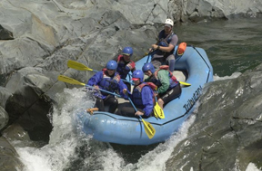
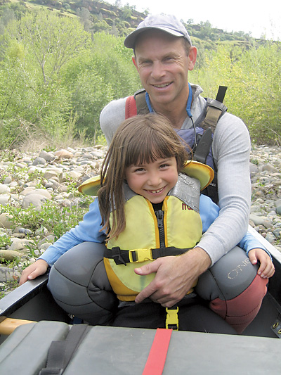
Photo courtesy of Tributary Whitewater (www.whitewatertours.com)
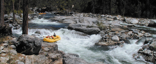
long wilderness runs in California. It drains from a higher watershed of 7000-foot peaks in the Yolla Bolly Wilderness, thus its season runs a bit longer with the benefit of snowmelt. The Black Butte River to Dos Rios run on the Middle Eel ranges from Class II to Class IV over its 30-mile length. Got a full week? You can combine this with the Dos Rios-Alderpoint run for a float 76-mile float.
(Note: You’ll need to arrange your own trip on the Eel; there are no known outfitters at this time. A good resource is Friends of the Eel River, www.eelriver.org.)
Kaweah River
The Kaweah flows out of Sequoia National Park east of Visalia. It is one of the steepest rivers in the U.S., dropping nearly 11,000 feet from its headwaters in only 20 miles. Despite this, it is one of the lesser-known Sierra rivers.
The Kaweah deserves more attention from rafters and kayakers, as it serves up one of the most continuously rocking runs you’ll find. The common run starts at the Gateway Bridge on Highway 198, just west of the entrance station for the park. (Note: It’s illegal to kayak or raft inside the national park.) Amid large boulders, Class IV and V rapids greet you from the get-go. The action continues relatively unabated for six miles. You can take out here at the North Fork Drive bridge, but most trips float another four miles of Class II-III water (plus one IV) to the aptly named Terminus Reservoir.
East Fork Carson
Why would advanced and expert rafters and kayakers drive over the Sierra each spring to float the Class II Carson? Because it’s unique, it’s beautiful and it’s got hot springs.
Flowing eastward from Markleeville into Nevada, the Carson makes for an amazing overnight trip, with beautiful high desert ranch land views and camping spots with hot springs right on the river.
BONUS TRIP:
Illinois River, Oregon
The Illinois is in southern Oregon, but it’s about the same distance driving from the Bay Area as the Cal Salmon. A tributary of the Rogue River, the Illinois is considered by some guides to be their favorite trip in the world. Although similar in scenery to the Rogue, it has better rapids and fewer people. There are only two commercial outfitters and each is given only one permit per week.
The 32-mile run is rated Class IV-plus, with one Class V. Because it is entirely a rain-fed river and there’s no dam upstream, flows can drop out of runnable levels after extended dry periods. This is usually not a problem through April. Come May, it’s a bit more iffy.