


- All State Parks in Big Sur Area Closed Due to Highway 1 Road Slip Out - 04/01/2024
- Giveaway Alert - 03/20/2024
- Climbing Bolt Prohibition in National Parks - 03/19/2024
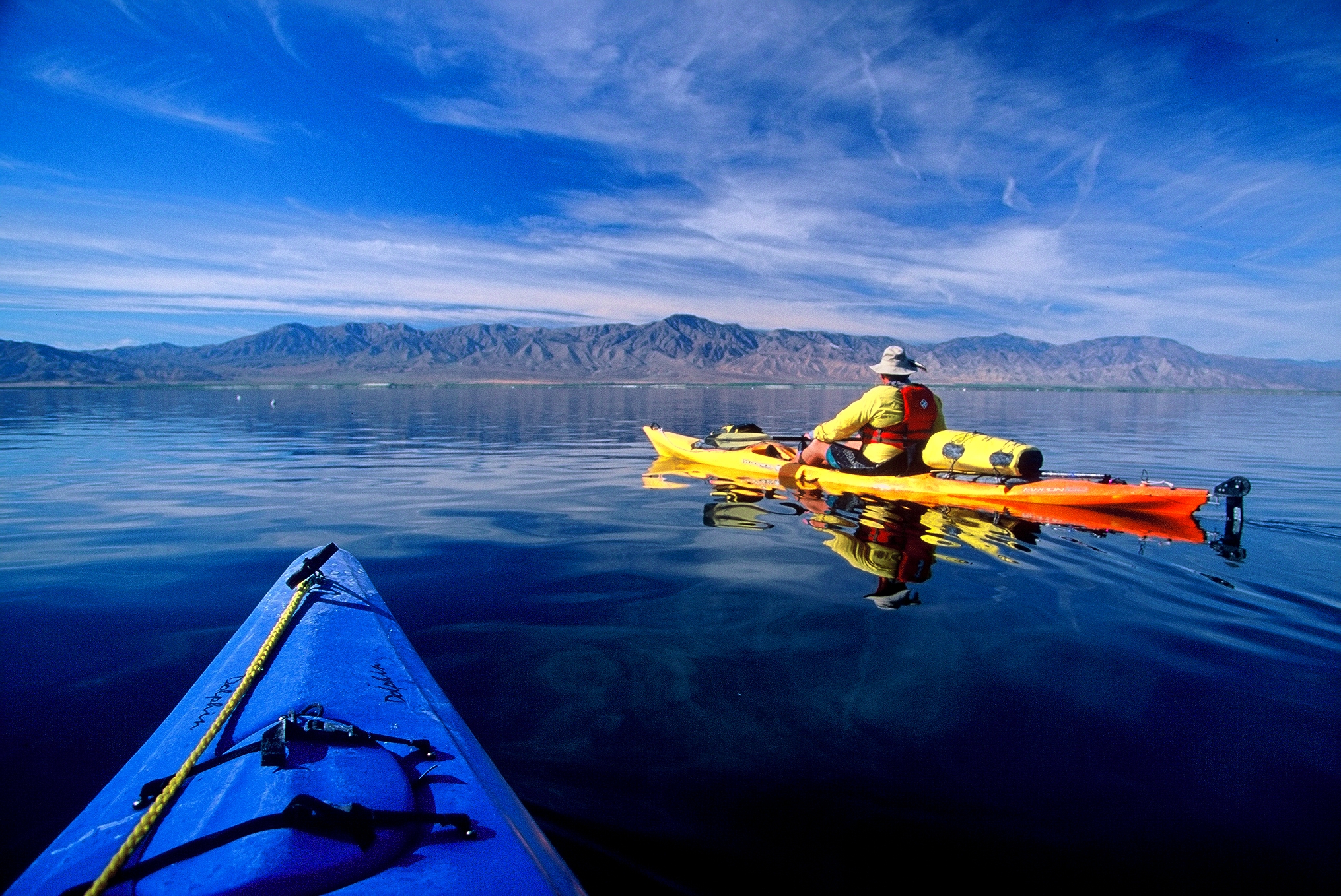
The Salton Sea becomes a hidden gem for winter paddlers
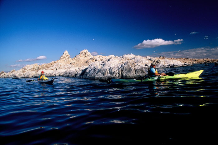
Rounding Mullet Island.
Words and Photos by Charles Graham
A dark wind line rose across the Salton Sea in southeastern California. Before we could seek refuge on Mullet Island, we were engulfed by frigid whitecaps. It was a 3-mile slog to the craggy, bird guano-covered islet.
After dragging our kayaks and standup paddleboards on the leeward side of Mullet Island, we ducked inside the only manmade structure left on the isle, a bunker-like, roofless cubicle that acted as a much needed windbreak against the winter chill. We shivered while searching our maps for a decent campsite. We were in the midst of exploring California’s largest lake and much of its 110 miles of briny shoreline. Our excursion at a stall, it seemed fairly bleak at that moment with five salt-crusted paddlers attempting to keep warm.
Filling the Sink

Camping on a mudflat.
Formerly known as the Salton Sink, flooding on the Colorado River breached levees and dikes in 1905 and again in 1907 and transformed one of the lowest elevations in North America into the Salton Sea. The tourist attraction that eventually developed was a boon for the region that lasted for over 50 years. The Salton Sea became a Mecca for weekenders, boat races, waterskiing and fishing tournaments. Hollywood celebs like the Marx Brothers, Jerry Lewis and Frank Sinatra frequented the Salton Sea. It became known as “the next Las Vegas” when at one point it received more visitors than Yosemite National Park.
However, more flooding followed, stymieing further development and the resort-like atmosphere. Eventually over the years those floodwaters have receded leaving the Salton Sea with it’s current high salinity levels—25 percent saltier than the Pacific Ocean. During the summer when temps are consistently at triple digits, there have been mass die-offs of fish. The tilapia are the only fish able to withstand such high salinity levels.
Come winter time though, the Salton Sea becomes a hidden gem for paddlers, and it’s a major stopover for migratory birds. There are over 400 species of birds documented on the Salton Sea, with 80 percent of the entire American white pelican population wintering on the tranquil shorelines.
Geological Wonders
As we continued to shiver, we could see the plump white birds soaring in V-shaped formations over thermal plumes and then roosting closely together on knobby peninsulas.
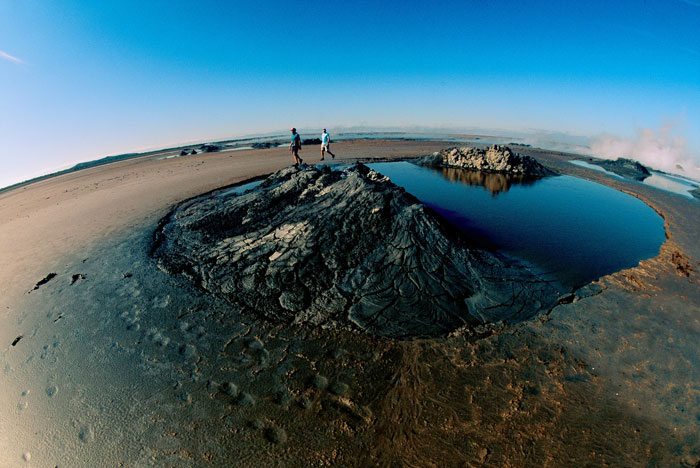
Boiling thermal mud pots.
Only 100 yards east of Mullet Island was an expansive mudflat where the thermal plumes steamed out of boiling mud pots. The region is a geological natural wonder of extinct and dormant volcanoes, thermals and Obsidian Point – where the glassy lava rock is embedded in all the rock surrounding this briny protrusion three miles south of Mullet Island.
We found the mouth of the Alamo River a mile south of our windbreak and camped there for the night. The runnel flows up from Mexico and feeds the Salton Sea, one of the few reliable water sources in the region. It was too shallow to paddle there, so we waded and portaged our kayaks in ankle deep water until we could paddle across the mouth of the Alamo.
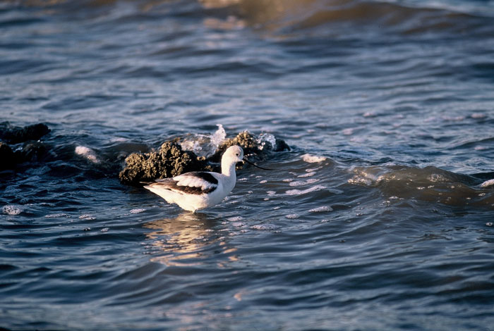
We tucked ourselves in the cattails and watched American avocets, western sandpipers, egrets and great blue herons wade in the shallows. The wind was calming down enough for the birds to forage in the salty water and for us to pitch our tents without them taking off like kites.
The next morning we paddled back toward Mullet Island, and then hiked across the mudflats to the boiling mud pots. I was barefoot, and the mud surrounding the boiling thermals was cool, but the pots were hot. We stayed upwind of the thermals and noticed we weren’t the only ones enjoying these unique geological features. Some shorebirds were also soaking in the warmth a good distance from their typical briny shoreline habitat.
Navy Site
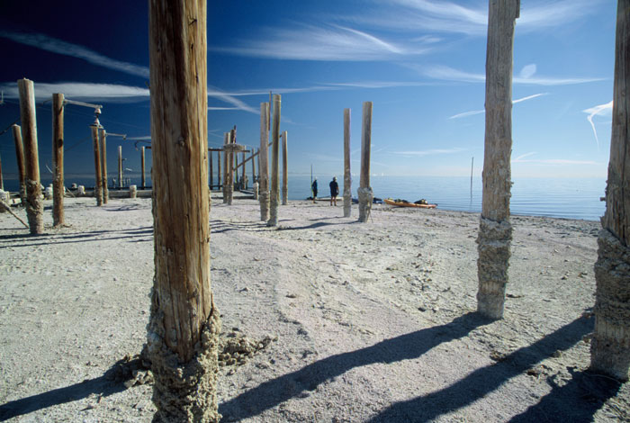
An abandoned Navy site.
Early the next morning we paddled southwest to the abandoned navy site and the sand dunes set 300 hundred yards beyond the shoreline. It was a long, 12-mile paddle, but we were fortunate not to have to fight any headwinds the entire way.
We beached our kayaks in a small cove with amazing views of the Santa Rosa Mountains National Wildlife Refuge to the northwest. Coyotes howled behind
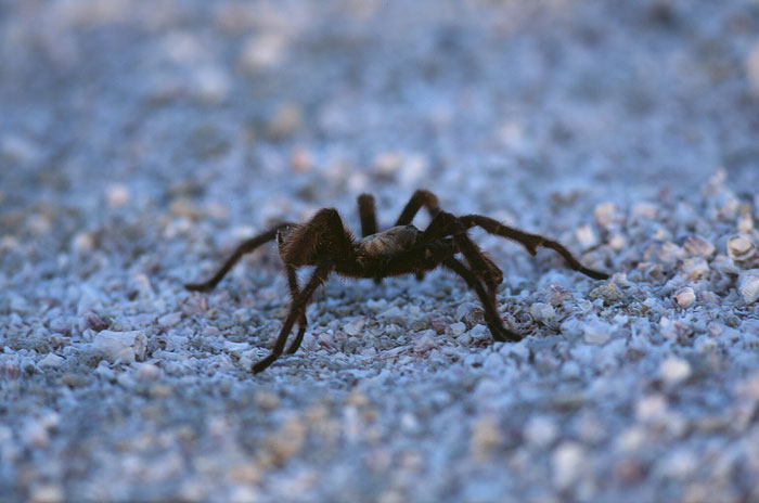
us in the well-manicured dunes as a hairy tarantula tiptoed in front of my tent.
Shooting stars filled the night sky as a melody of lapping waves lulled us to sleep. The next morning pink and purple hues eased across the mountains as we paddled down to the navy site. It appeared like something out of the apocalypse with brine crusted weather-beaten pilings. Cormorant nests clung on their tops. Rusty, corroded beams lined the dock leading into the water.
Hold the Salt
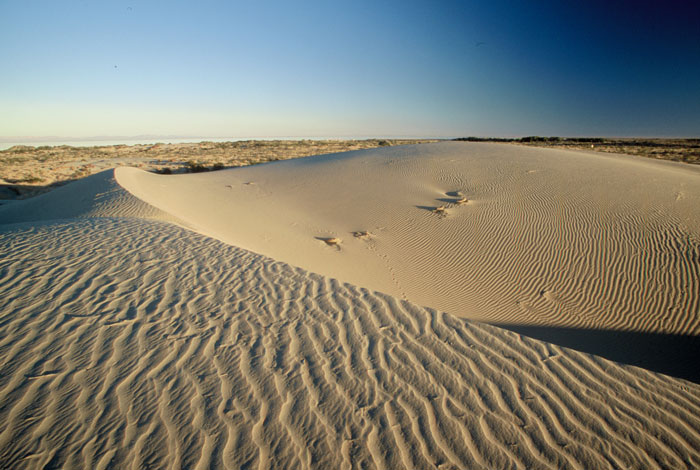
Manicured sand dunes.
We began our 15-mile crossing before sunup. The Chocolate Mountains to the east loomed on the horizon. Initially we aimed for what appeared to be an oil platform three miles off the shoreline, but when we neared the wooden structure, it became clear it was nothing more than a weather observation post.
From there it was a long, uneventful crossing to the northeast shore. Halfway across the Salton Sea’s widest point, an annoying southeast wind picked up momentum. Whitecaps were just large enough to slosh over the starboard side of our kayaks. By the time we reached our destination and hoisted our kayaks and gear to shore, the salt accumulation made the boats look like glazed doughnuts.
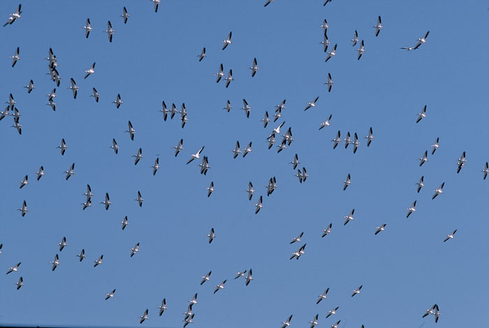
A large flock of American white pelicans had congregated in the shallows, plunging their yellow beaks in the water. They weren’t alarmed by our presence, barely ruffling their creamy white feathers as we hauled our gear to our trucks near the historic Salton Sea Yacht Club built in 1962.
We grabbed our standup paddleboards and paddled inside the harbor beneath the yacht club. The jetties forced the wind to lie down so we used old pilings standing in the harbor as a slalom course. Tired, I paused and thought of the Salton Sea of yesteryear when weekenders flocked here by the thousands.
———————————————————————————————————————————
IF YOU GO …
Camping is of the primitive variety except at the Salton Sea State Recreation Area and seven miles south at the Salt Creek Kayak Camp. Constructed by the Department of Boats and Waterways, the camp has shade, water, barbecues, showers and bathrooms. There are racks to store kayaks and standup paddleboards. The best time to paddle the Salton Sea is from winter into spring. Daytime temps are in the 70s, but nighttime temps can drop to freezing. Winter is also the best time for birding.
For more information on the Salton Sea, go to parks.ca.gov.


