The Mexican Mine Trail will once again link Downieville and Forest City via singletrack
By Kurt Gensheimer
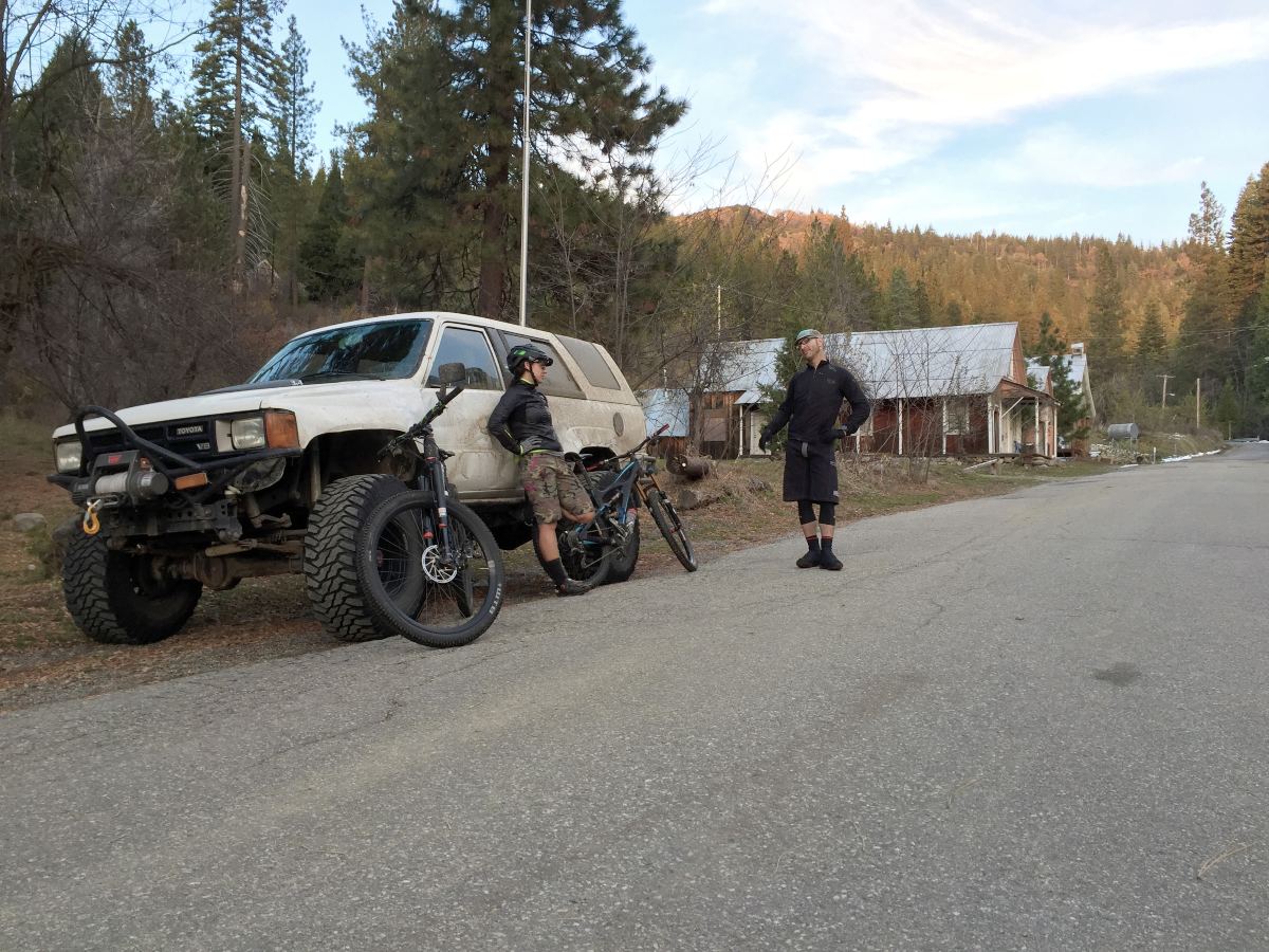
Most mountain bikers are familiar with the historic Gold Rush-era town of Downieville, California, known for its raw, rugged and rowdy trails and more than 5,000 vertical feet of descending. But far fewer people are familiar with an equally historic hamlet called Forest City, or simply just Forest, located less than ten miles to the southwest of Downieville, high up out of the North Yuba River canyon on Pliocene Ridge, only a couple miles from the mining outpost of Alleghany, home to the 16 to 1 Mine, one of the most productive gold mines in the world.
Featuring a network of non-motorized singletrack in excess of 25 miles, Forest offers a less rowdy and less aggressive riding experience than Downieville, trading jagged sharp rocks and waterfalls for ribbons of loam flowing through beautiful stands of forest with handmade rock bridges and commanding views of Bald Mountain towering above town. If the long travel full suspension trail bike is best suited to Downieville, the lightweight cross-country hardtail is best suited to Forest. 
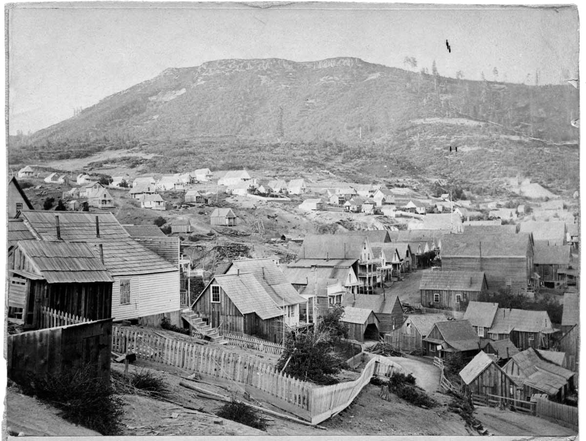
Both communities boomed during the Gold Rush, with Forest boasting a population nearing 1,500 residents in the 1860s, evidenced by hundreds of buildings peppered in the back of a deep canyon along Oregon Creek under the shadow of Bald Mountain. Today there’s multitudes more bear than humans in Forest, counting barely five people and 20 buildings left standing, claiming status as the only townsite in America owned entirely by the US Forest Service.
Back during the Gold Rush, the communities of Downieville and Forest were connected by a steep, six mile-long pack trail running up Slug Canyon to the south of Downieville, gaining the ridge past the City of Six and Ruby Mine; two of several incredibly productive gold mines in the area between the two communities. But in the last 80 years, the trail up Slug Canyon disappeared, severing the singletrack link that served as a main connection between Downieville and Forest.
In the early 1990s, a group of individuals started resurrecting the historic water ditch lines running above Forest, trails like Sandusky, Plum Valley Ditch and Truckee Ditch. Then the Forest Trails Alliance (FTA) expanded on those original trails, adding to the network of fun, flowing cross-country style singletrack circling above town. The same mountain bike enthusiasts also started acquiring land leases from the Forest Service in order to resurrect the historic homes in town so they could stay and ride, hike and work on the trails. But if you wanted to ride from Downieville to Forest, the only way was either up the impossibly steep Galloway Street south out of Downieville or the long and winding Mountain House Road out of Goodyears Bar.
However, the recent announcement by the Tahoe National Forest of receiving a $422,400 grant from California State Parks funded through the federal Recreational Trails Program (RTP) will once again connect the communities of Downieville and Forest via a singletrack called the Mexican Mine trail. The trail will also connect a third community, Goodyears Bar, five miles downstream from Downieville.
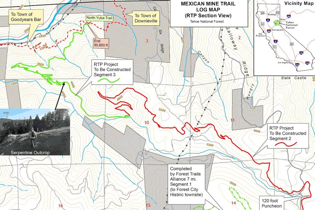
The Mexican Mine trail will run from Forest approximately 17 miles along the majestic Ruby Bluffs with commanding views of Saddleback Mountain to the north and the iconic Sierra Buttes to the northeast. The trail will drop into the lush, spring-laden Rock Creek drainage, connecting into a section of the North Yuba trail already linking Downieville to Goodyears Bar, creating the ability to tackle a giant day on the bike riding out and back to Forest, or a point-to-point shuttle via driving up Mountain House Road from Goodyears Bar.
The Mexican Mine trail project has been a long time in the making, dating back to 2007 when a small group of folks, including the Sierra Buttes Trail Stewardship (SBTS), imagined reestablishing the connection between Downieville and Forest. SBTS helped originally fund the NEPA (National Environmental Protection Act) studies required before any trail building could begin, but there were complications with wildlife surveys that delayed the process.
Five years ago the NEPA was completed and the project was considered “shovel ready,” but there was no funding available. So a small group of folks with ties to Forest City volunteered to start building the Mexican Mine connection, completing seven of the 17 total miles of new trail, primarily along the Ruby Bluffs near Henness Pass Road. Considering the final ten miles require some very remote trail work, the expense of walking in a mini-excavator and a trail crew is too great for volunteer labor. And because there has been little to no funding available for non-motorized trail projects like Mexican Mine, the project stalled out for years.
Thanks to the efforts of the Tahoe National Forest and a recent change in the California State Parks RTP program to fund more non-motorized trail projects, the $422,400 grant application request for Mexican Mine was recently approved, securing enough funding to complete the final ten miles of trail needed to connect the Ruby Bluffs to the North Yuba trail.
According to Paul Hart, the Tahoe National Forest – Yuba River Ranger District trails manager, SBTS will be hired to help complete the work, with a projected starting date of summer 2023, taking two to three summers to finish.
“Out of $43 million in grant requests, only $4.68 million was awarded, and we feel very fortunate to be one of the seven recipients,” said Hart. “This project has been in the works for 15 years, and the challenge has always been finding non-motorized grant funding for construction. This is the first time in many years that State Parks has awarded non-motorized RTP funding, and we’re grateful to have been selected.”
Not only does this connection reestablish a singletrack link between three historic Gold Rush communities, but it also has bigger meaning as a connection. The Connected Communities Project by SBTS aims to link 15 communities across four rural counties in Northern California through a network of approximately 600 miles of multi-use trail. The Mexican Mine trail will be an important link in this legacy trail project, as well as being a viable singletrack route out of Downieville headed south, gaining Pliocene Ridge between the North and Middle forks of the Yuba River.
The Mexican Mine Trail will also be an important piece of solving the Orogenesis puzzle, projected to be the longest mountain bike trail in the world, stretching nearly 5,000 miles from Canada to the tip of Baja California. Although much of the route already exists, there are a few hundred miles in the Sierra Nevada that have yet to be connected. One of the gaps in connections is from Downieville south towards Truckee and Lake Tahoe, and the Mexican Mine Trail out of Downieville will help alleviate that gap.
The Mexican Mine project is proof that when it comes to building new trails, patience and perseverance are of the utmost importance in seeing big ideas through. And given the positive track record of collaboration between SBTS and the Tahoe National Forest over the last 20 years, the light at the end of the Mexican Mine trail project is brighter than ever.
To get involved with volunteering for the Mexican Mine project, and to support the Connected Communities legacy trail project, visit sierratrails.org.
***
Main image: Fred Stamm rides along the Ruby Bluffs near Forest City with commanding views of the Sierra Buttes
Read other articles by Kurt Gensheimer here.