Embracing the challenges of a remote Sierra gem
Words by Leonie Sherman

Spend enough time in the Sierra among mountain aficionados and you can’t escape hushed tales of Mt. Carl Heller. There was the El Cap climber couple forced to turn back. The Nordic ski champion who sprained her ankle on the approach. How even Peter Croft couldn’t make it back in time for fries at the Whitney Portal store.
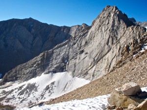
A USGS map will call this 13,211 ft. granite sculpture Vacation Peak, but every other map and guidebook calls it Carl Heller after the founder of the China Lake Mountain Rescue Group. Heller was an avid Sierra mountaineer, specializing in the obscure and aesthetic; he claimed to have climbed every peak over 12,000 ft. in the range. Apparently he took quite a few tries before succeeding on the peak that would later bear his name. 
The mile and a half long East Ridge is where he left his mark, and that’s the line everybody’s whispering about. The climb might be third class, but it might be 5.6. Like most backcountry climbing objectives, it depends on whom you ask. If the peak were an hour hike from a parking lot there would be a train of eager climbers vying for the summit every weekend, and a slew of guidebooks explaining every move of every pitch. It would be the Matthes Crest of the Whitney region.
But the approach to Mt. Carl Heller requires either a heinous bushwhack up George Creek or a heated duel over precious permits in the Whitney Zone. We’re talking a minimum of two grueling days or a bureaucratic blood sacrifice. As a result, there is barely a paragraph in the most comprehensive Sierra guidebooks, and a world of uncertain adventure rewards those willing to commit to the brutal approach.
In the 1600s, the Japanese poet and wanderer Matsuo Basho wrote that every day is a journey and the journey itself is home. To put his wisdom to the test, my partner and I set ourselves up for a thirty-mile cross-country approach, over four mountain passes. We ditched the normal climb-and-conquer style in favor of a ramble-and-see attitude, with a potentially classic line waiting for us at the end.
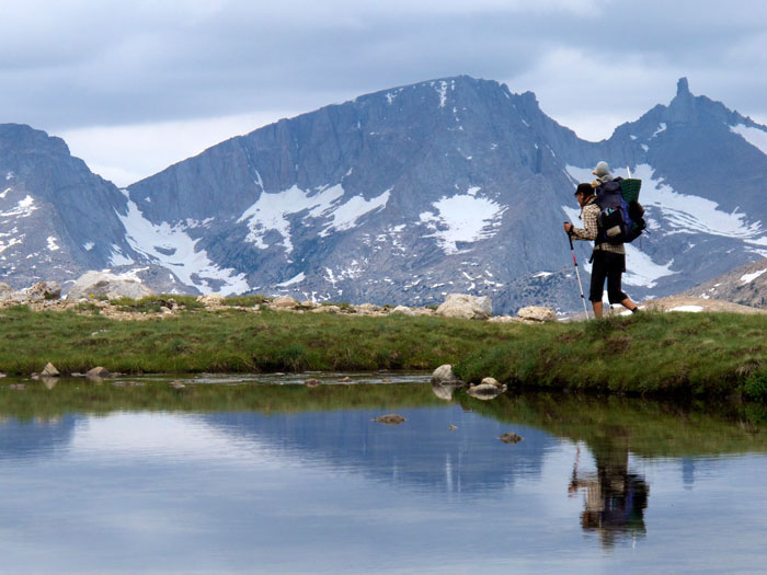
After a stroll up Kearsarge Pass and down several miles of the John Muir Trail, the adventure began as we veered off the well-trodden path up Center Basin. We picked our way across lush meadows and around wind-rippled lakes. An early afternoon storm ushered in the first monsoon rains of the season. The rain slowed our progress but we didn’t care. We were totally absorbed by the vastness of the bruised sky and the sunlight reflecting off the Kearsarge Pinnacles.
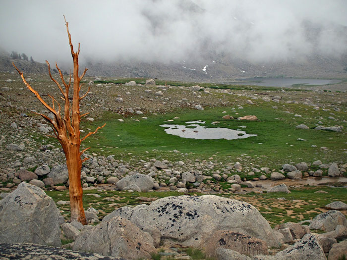
The next day took us over Junction Pass and into the upper reaches of the Shephard’s Pass trail where we encountered earnest climbers disappointed by the threatening skies. We adjusted our clammy rain gear and pushed on towards the Tyndall Plateau, a broad sweeping alpine meadow at 11,000 ft. A skyline crowded by the peaks of the Great Western Divide kept us company that day.
The grand finale of our meandering approach featured the Bighorn Plateau, a vast rolling expanse of glacial erratics and foxtail pines, studded with lakes and drained by twisting creeks. We arrived at our base camp, Wallace Lake, by early afternoon. Adjusting to the tranquil mood of the place, we passed some time watching a group of spawning fish try to fight their way up a short waterfall.
Approaching Carl Heller from Wallace Lake means climbing the ironically named Vacation Pass, which is 1200 feet of hard, scary work in the form of loose rubble and boulders. With this terror out of the way by 9 AM, we were free to focus on our reward: the East Ridge.
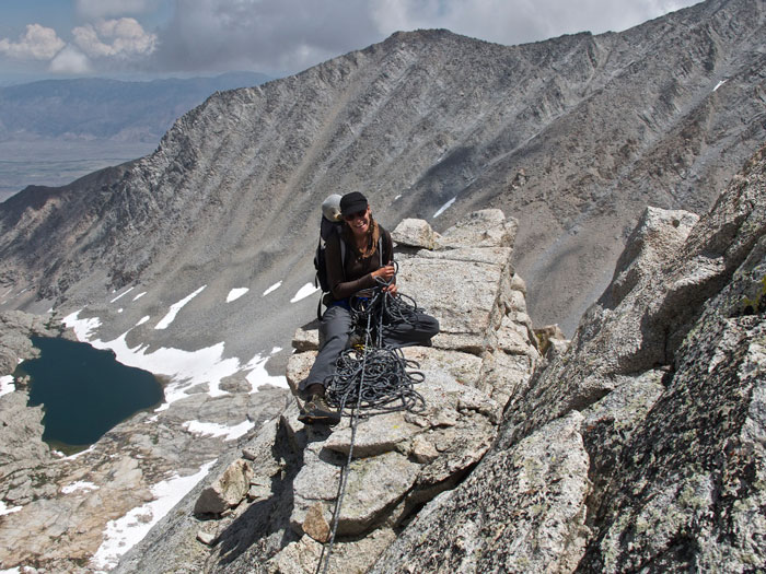
For seven hours under bluebird skies, we climbed and beamed as the world stretched out beneath us and solid granite soared above us. Most of the climb was old-school third and fourth-class ridge traversing. We laughed and cursed, sang snippets of songs, and cheered each other through the sketchy sections. When my partner judged I would benefit, he pulled out the rope and we grimaced our way through the challenging sections, painfully aware of the futility of a rope on a long traverse.
The summit register revealed that only 25 people had touched the top over the past five years. One party left behind a shot of vodka, which we gladly finished off before contemplating our descent. Normally the summit is a half-way point, but we were more than three quarters of the way through our journey.
The initial descent was loose and scary, but later our evening was filled with slab cruising and a triumphant return to camp where we finished off our tastiest food and the last of our whiskey. The next morning found us gawking at the frozen wonder of 12,800 ft. Lake Tulainyo, and rambling towards the chaos of Whitney Portal, congratulating ourselves on taking the long way round.
Six days later, we made it to the Whitney Portal store in time for fries.
Leonie Sherman is an itinerant wanderer, a mild mountaineer and a devotee of the High Sierra.