Backpacking The High Sierra Trail — Sequoia National Park
After approximately 12 hours of driving, we found ourselves car camping just outside of Sequoia National Forest. The summit of Mount Whitney was our goal – the highest peak in the United States, standing at 14,505 feet.
Armed with the Join Muir Laws guide book from the Lodgepole gift shop, we set out on a seven-day journey that unfolded amidst awe-inspiring scenery, unexpected wildlife encounters, and challenging terrains. Our guidebook helped us identify the new species of plants, trees, and animals we saw on our adventure, which allowed us to interact with the environment in a more engaging way.
Throughout our adventure, we camped under starlit skies, ranging from designated campsites with metal bear crates to impromptu tent setups along the trail. Our trip went according to plan, and we were reminded of the realities of High Altitude Pulmonary and Cerebral Edema on our descent — and what to do in that situation. 
Here is a breakdown of our trip, what to do if anyone experiences altitude illness, and some tips with a list of what to bring for your High Sierra Trail adventure.
Day 1 – Crescent Meadow to Nine Mile Creek – 8.8 miles
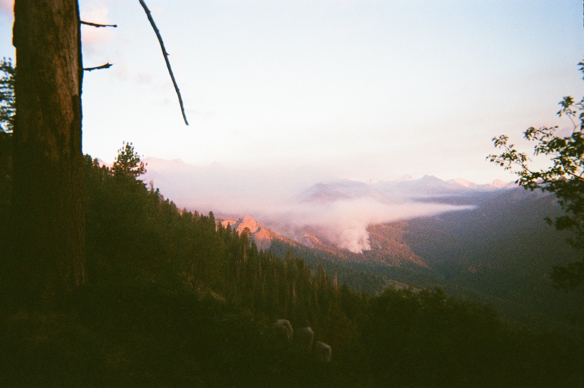
Just hours after leaving Crescent Meadow on the 72.2-mile and 15,500-foot climb, we were face to face with a teenage black bear no more than 20 feet away. Our hearts beat faster as it walked in our direction. We backed away slowly, turned the corner, and gave it some space for a couple of minutes before continuing on. It was a friendly reminder that we were not alone in these woods. Soon after that, we saw a controlled burn in the distance that the ranger had warned us about.
Day 2 – Nine Mile Creek to Hamilton Lake – 6.9 miles
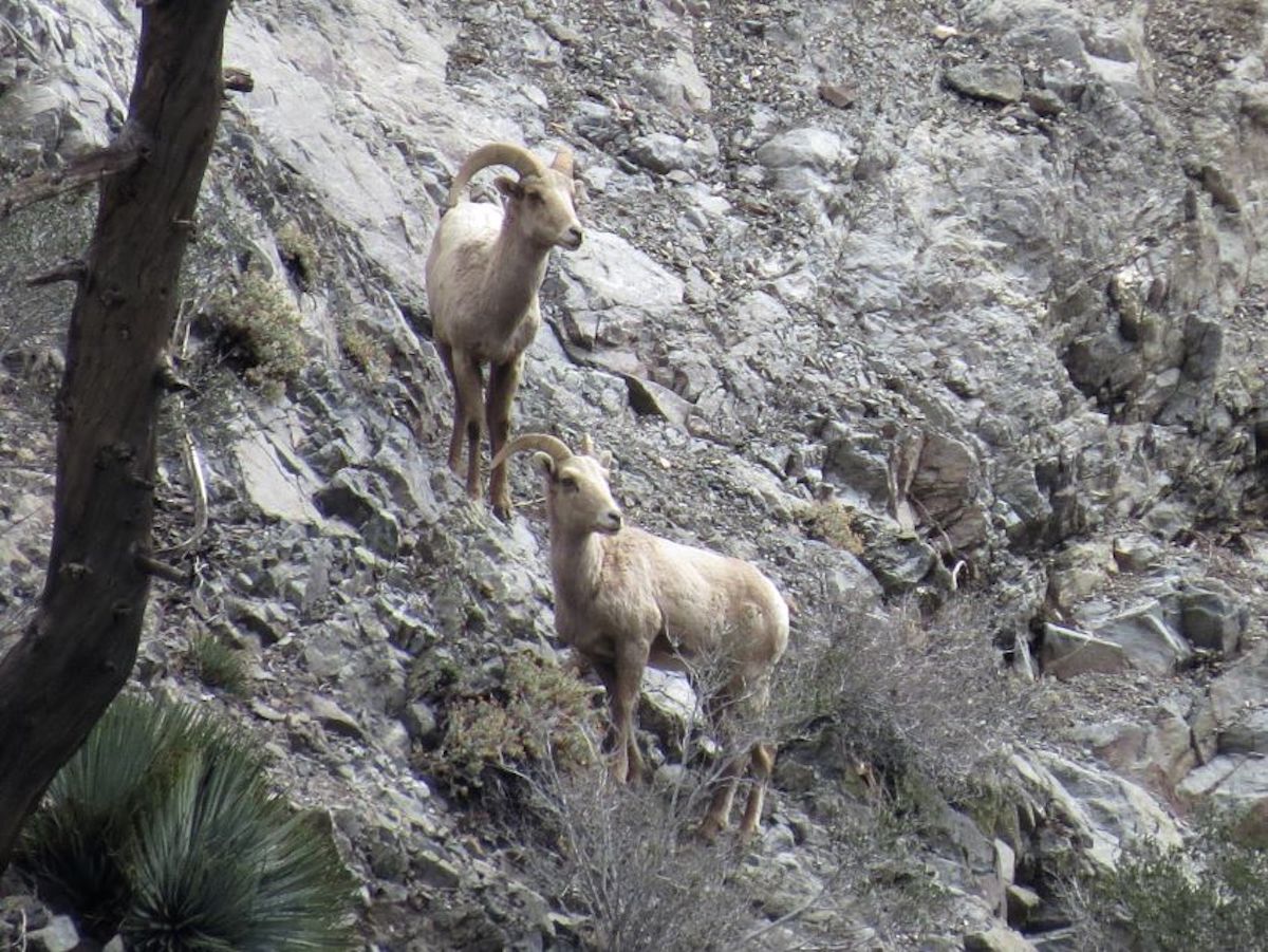
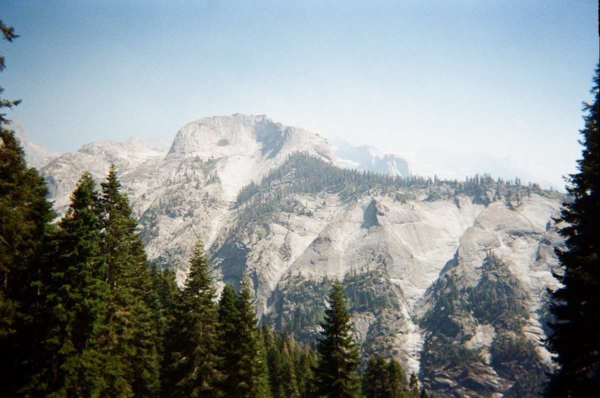
The whole trip was filled with amazing sights, but day two stood out. Dark and light granite mountains towered over us. We saw Jeffry Pines, Juniper Trees, and beautiful Sequoia Redwoods at every turn. Bobcat scat with bones and fur in it, too many Sierra Lizards to count with iridescent blue bellies, and cliffs and canyons in all directions. The highlight was having a pit toilet and jumping into the freezing cold lake at sunset.
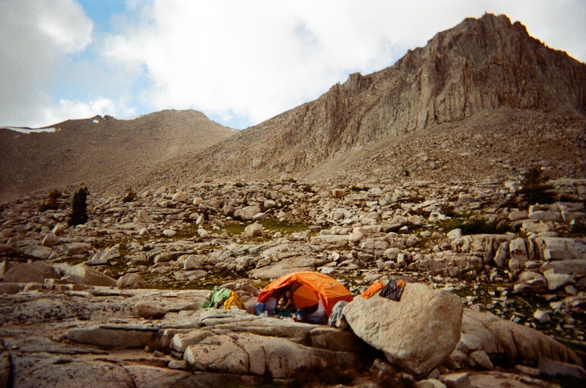
Day 3 – Hamilton Lake to Big Arroyo Junction – 7.9 miles
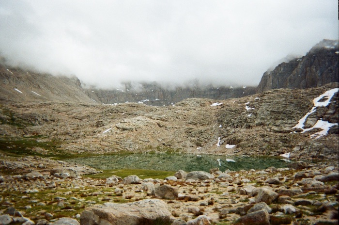
The first big challenge came when we hiked up a pass from Hamilton Lake past Arroyo Gap, beginning the day with a steep 3,000 foot climb. At the top of the pass, we were met with a snow covered lake and streams running through green meadows with wildflowers popping up all around. It was so beautiful that we decided to eat our pesto, cheese, and avocado bagel sandwiches with the view.
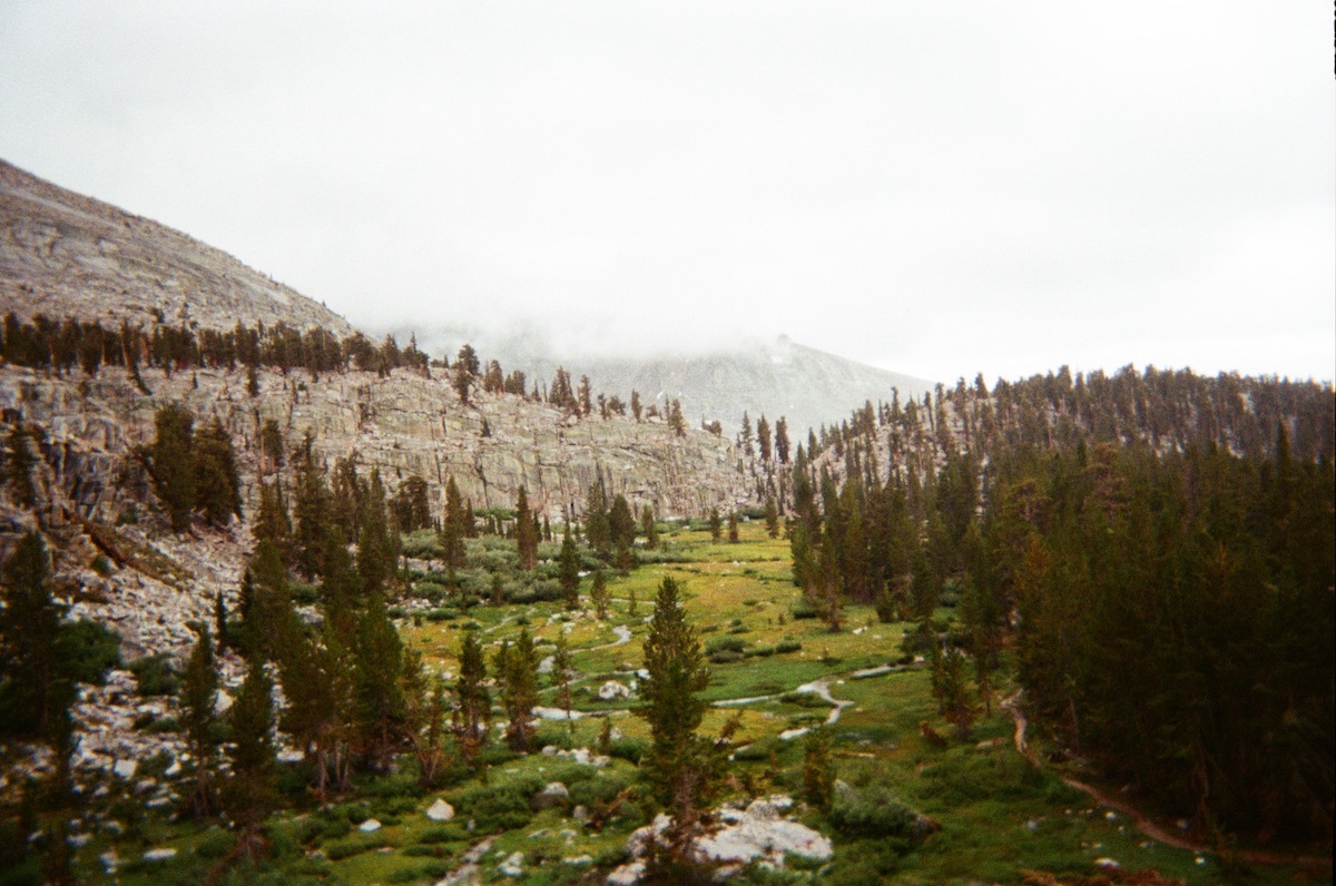
Just on the opposite side of the gap, we emerged from the mountains into a stunning wide valley teeming with Lodgepole Pines and a meandering creek (pictured above). However, what lay below remained a mystery. Descending swiftly, we enjoyed walking on flat trail parallel to the creek. The creek crossing introduced a new challenge as we attempted to traverse it with our boots on, inadvertently soaking our feet. Upon reaching the other side, we found ourselves swarmed by mosquitoes. So there we were, running away from a mosquito hoard with 4o pound packs and the sounds of our feet squishing in our wet boots.
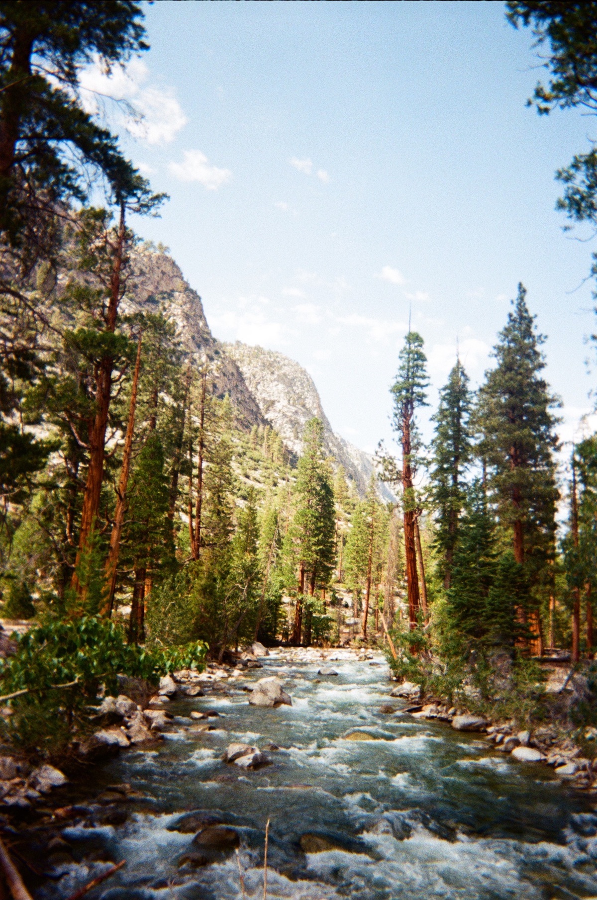
Day 4 – Big Arroyo Junction to Kern Hot Springs – 13.9 miles
One of the most amazing parts of the hike was not on top of a mountain, but in one! Kern Hot springs is a beautiful area with a pit toilet, bear crates, and several camping spots along the river. The hot spring is a concrete bathtub open on one side to Kern River with fences behind it to provide privacy. The joy of bathing after four days of dirt and sweat in our pores was amazing. We enjoyed an hour in the tub, hopping from the cold river to the steaming hot spring until fellow backpackers arrived for their turns. We even woke up extra early the next day to have oatmeal and coffee in the hot spring to start our day off right.
Day 5 – Kern Hot Springs to Crabtree Meadow – 16.4 miles
On day 5, we began to see more people coming from other trail junctions. We passed the junction of the High Sierra Trail, John Muir Trail, and Pacific Crest Trail, and were glad to see some P.C.T. hikers finishing up the Sierra portion of the trail. The diverse landscapes and shared trails added a communal aspect to our journey.
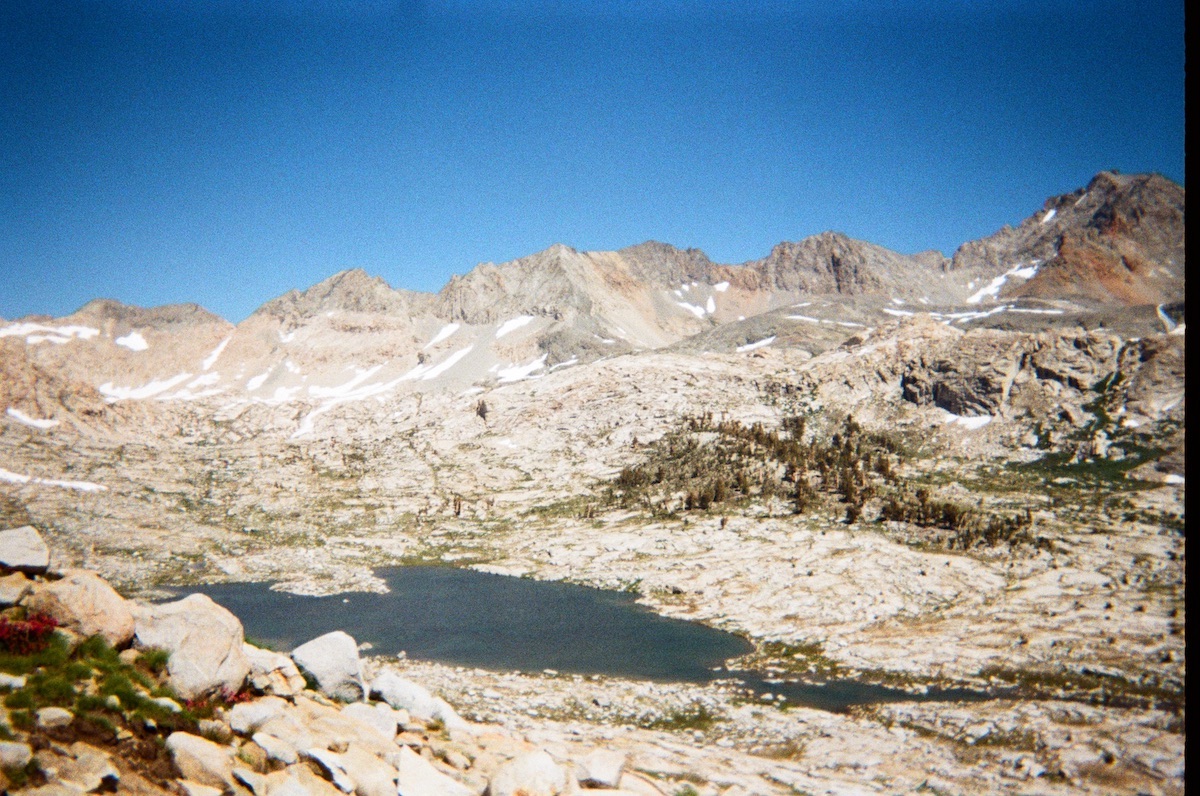
Day 6 – Crabtree Meadow to Guitar Lake – 6.8 miles
Guitar lake was our last stop before summiting Whitney, and at 11,400 feet, you can bet it was cold, but that didn’t stop us from jumping in. It was a low mileage day, so we enjoyed the sunshine, emerald green water, and views of the mountains. We were nervous for the next day; we had 4.5 miles of hard elevation gain to get to the summit, and then 13 miles back to Whitney Portal with a total 3,105 feet of elevation gain, and 6,131 ft of elevation loss.
Day 7 – Guitar Lake to Whitney Summit to Whitney Portal – 17.5 miles
The night before, we watched the sun go down over the mountain ranges we had been walking through over the past six days, and before we knew it, it was time. The alarm went off at 3:00 am to start our journey. Gazing up, we could see the headlamps far above us of those who started hiking around 12:00 or 1:00 am. We put our headlamps on, filtered water, and began hiking up to Trail Crest, where the trail from the east meets the trail from the west. At around 6:30 we reached the crest, left our packs at the junction, and started on the two mile out and back trail to the summit. The elevation made it difficult to hike even with our packs off.
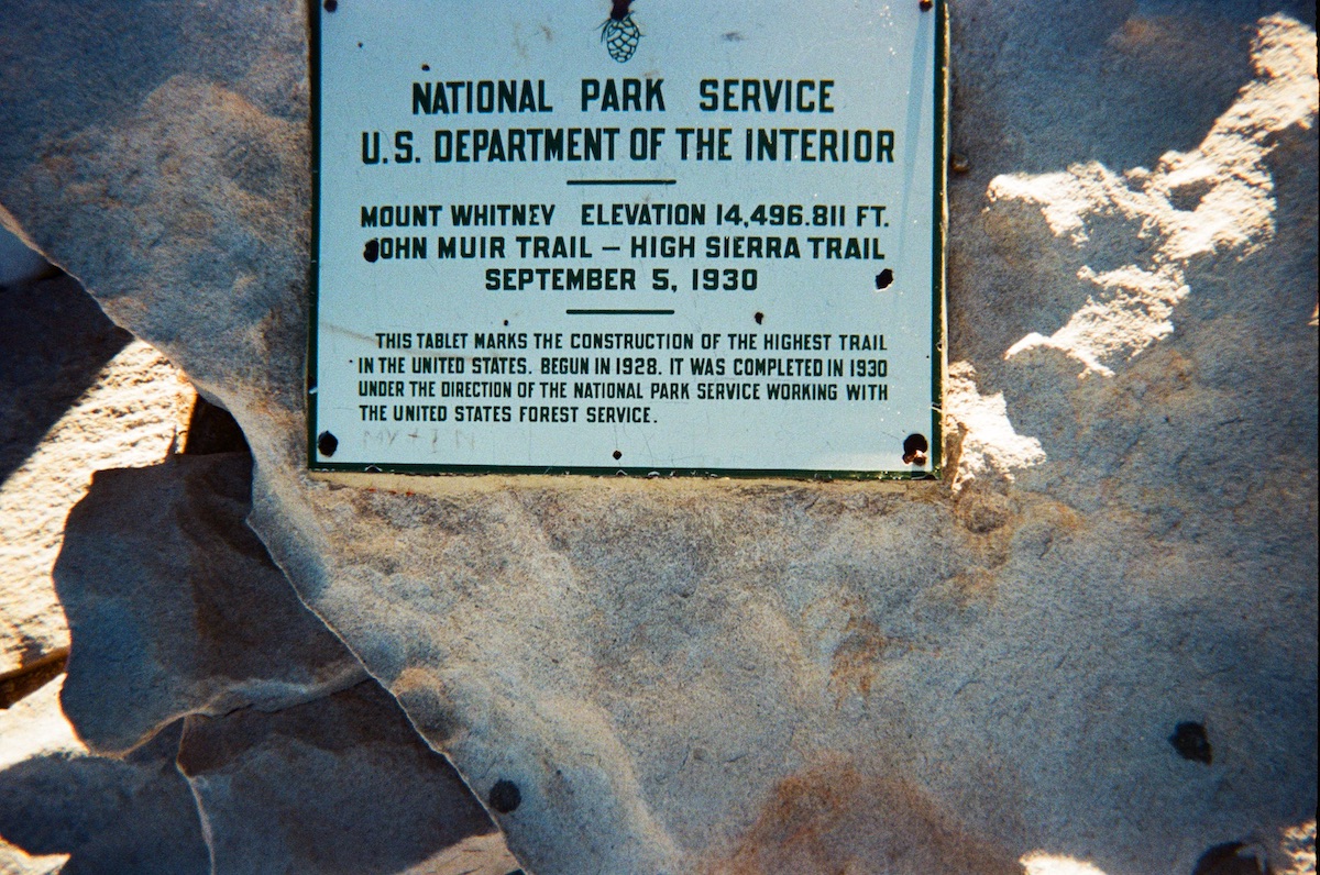
The trail was rocky, cold, and slick with ice. We paused to watch the sunrise, and then scrambled up steep rocky terrain with no trail for the final hundred feet. Finally, we walked the last few steps and made it to the summit, 14,505 feet above sea level! The journey was not over, however. We still had 11 miles and a lot of elevation loss to go.
The Descent
Back at Trail Crest, another hiker asked us to hike down with someone who was not feeling well. She did not speak english, and looked very tired. We began the walk down the steep 99 switchbacks (yes, they were counted), and her condition got worse and worse. Two hours had passed and we had barely walked one mile. “There was swelling in her brain and fluid in her lungs,” a doctor in the group had told us. The hiker had High Altitude Pulminary and Cerebral Adema (HAPS and HACS), also known as altitude sickness. The group kept her hydrated and nourished with electrolytes, sodium tablets, altitude medication, and oxygen. SOS emergency calls were made to get a helicopter.
Knowing she was in the care of others, we went on to make it back to the trailhead which was still 10 miles away. About an hour later, we heard the sound of a helicopter off in the distance and looked up as it flew above us towards Mt.Whitney. We ended up finishing the last day at 7:00 pm, after hiking almost 18 miles.
Several days after our journey we looked online to find that the hiker was alive and healthy. This rescue could not have been possible without the help of those around us calling emergency services and giving up their resources to help her. It was later found out that she was part of a tour group that had left her alone at Trail Crest to hike to the summit. If they had stayed with her and turned back right away, this situation might not have escalated so much.
Many lessons were learned from this week long treck, here is our advice is you are planning the HST in the future:
- Never leave a member of your group alone for any reason, unless it is absolutely necessary.
- Plan your transportation well in advance, it can be tricky
- Bring warm clothes, it gets cold!
- A jar of penut or any nut butter can go a long way for trail cravings
- Having an animal and plant guidebook made the trip very interactive
- Be reflective – a journal to write down your adventures and document your experiences
- If you want to really experience the trail, take ten days and enjoy the journey, consider spending a whole day at Kern Hot Springs
- Make sure that your bear box with food will fit into your pack before you go
- Check the weather before you go, we had mostly sunny days and some rain and clouds towards the end, but luckily sun broke through for the summit
For any of those planning the trail, here is our first-hand packing list recommendations:
- Long hiking pants / hiking shirt
- Warm clothes
- Hat and sunglasses
- Sunscreen and bugspray
- Stove and fuel
- Lightweight food
- Water Filter
- Headlamp with extra batterie
- First Aid Kit
- Tent
- Sleeping bag and pad
- Bear box
- Navigation Tools – map and compass (extra batteries or solar charger if using phone)
- Emergency beacon
- Rain gear(extra large trash bags work just as well)
- Hydration Packets
- Altitude Medication
- Optional but fun – Identification book, journal, camera