- Tahoe’s Nevada Beach Tops the List of Hard-to-Book Campgrounds - 07/17/2024
- Cannabis Watershed Protection Program Cleans Up Illegal Grow Sites - 07/10/2024
- French Fire - 07/05/2024
What the adventurous can do with four days
Photos and story by Nicholas Miley
Summer is upon us.
Shallow snow packs, warm weather and plenty of sunshine have many pushing into the high country of the Sierra Nevada earlier than usual, particularly last year when it was locked up in snow until July or later.
For many Californians, the Highway 395 corridor between Topaz (Nevada state line) and Lone Pine is a distant foray that requires several days off to warrant the drive. And then that often means speeding through the corridor just to get to the high-country trailheads.
Slow down. There’s so much to be found right off 395 that it’s good to have a few days to just wander up and down this strip of asphalt running down California’s dramatic backside.
I, for one, think that four days on the East Side, early in the season, are enough to tucker out even the seasoned backcountry schralpinist. Four days is what we had in May, and in that time we were able to pack in mountain biking, climbing, fishing and exploring on foot.
As many readers know, the Eastern Sierra is absolutely loaded with natural features that will appeal to all walks of outdoor enthusiasts. From rugged granite peaks to tumbling creeks, and all the geographic relief between, the eastern escarpment of our home range can serve up just about any adventure you’re willing to cook up.
In celebration of the sun’s high arch in the sky, we loaded up the Suby and headed south to ramble the dirt roads that cut easy access into the folds of the Eastern Sierra. It was a relatively quick trip, but it satisfied, at least temporarily, my need for big mountains and wild adventure.
Mountain Bike Horse Creek Loop
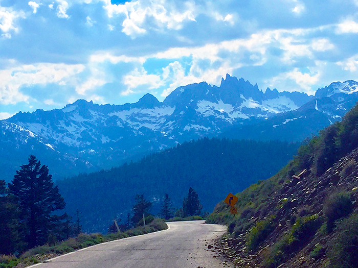
Bridgeport is the most northern vantage point from which the Sierra reveals its massive, needled peaks. Angular and attractive, the Sawtooth Range slices its visage into the minds of all who look upon its lengthy crown. Skirting the flanks of this granite ridge is a series of trails that avoid the wilderness restriction on bicycles, while still giving access to an alpine cycling experience.
If you’re game for a rugged ride, head out from the backpackers’ parking area at Mono Village (the resort at the west end of Upper Twin Lakes) and start the climb up Horse Creek Trail. This is the route regularly used to approach Matterhorn Peak. Ascend this trail for about 1,200 feet until it comes out on a meadow that grants sweeping views of the range. This is where the junction with Cattle Creek Trail is located; take this trail.
The Cattle Creek Trail heads east over two ridges and the creek of the same name. The trail terminates at the creek connecting Upper and Lower Twin Lakes. From here you can ride the road on the north side of the lake back to your car or connect the loop via the trails on the south side. This ride shouldn’t take more than two hours, but the views may prolong the pedal.
Soak in Buckeye Hot Springs
Top off the ride with a soak in nearby Buckeye Hot Springs. Head back east on Twin Lakes Road until you see Doc and Al’s Resort on the left. Turn here onto Buckeye Road (which turns to dirt) and continue for a few miles until the road make a big switchback high above the creek. Look for the huge dirt pull out on the right. Park and scramble down into the canyon. The tubs sit under an outcropping of mineral deposits that drip hot water into the creek on the opposite bank. A little creek scramble is required and the water is cold but not too high this year. Alternatively, you can follow the road over the bridge to the parking area directly above the springs.
Fly Fish Robinson Creek and the East Walker
I know, fishing isn’t much of an athletic endeavor. But it’s a fine way to recover from one, and an excellent opportunity/excuse to sip a cold pilsner and enjoy the thrill of exploring a mountain stream with the intent of hooking a silvery flash of piscine energy.
Outside of Bridgeport, several tumbling streams are home to hearty trout. Robinson Creek flows east out of Twin Lakes and has easy access off Twin Lakes Road. A seven-foot fly rod is helpful here as the flora along the banks is dense.
Catching 14-inchers in Robinson Creek isn’t uncommon, but if netting trophies is your goal, make the trip to the East Walker. This famous fishing river drains Bridgeport Reservoir northeast of town and is easily approached via the Sweet Water Road (Hwy 182) off of 395, heading northeast from the south end of Bridgeport’s town center. Park just below the dam and work your way down stream along the well-established paths. Although this river gets a fair amount of pressure, the trout here are large, fighting fish. Bring a 5-weight rod and you’re A-game.
Tableland Bouldering
The volcanic tablelands north of Bishop were formed by the sputterings and spewings of the Long Valley Caldera around 700,000 years ago. This massive deposit of minerals to the surface has formed numerous rock outcroppings, cliffs and boulders ripe for climbing. Too many to count and often hard to give directions to, I encourage the reader to leave the established areas and explore the washboard roads along the west side of the Lower Owens River north of Bishop, for here a lifetime of bouldering can be found free from crowds.
Biking Lower Rock Creek Trail
Once the bouldering has you beat and your pads can’t bear another go on that addictively appealing line, head south a bit to the Old Sherwin Grade that joins 395 a few miles south of Tom’s Place. Just after turning onto the north end of this loop is a large pullout on the west side of the road. From here, hop on your bike, cross the road and drop into eight miles of downhill bliss.
The Lower Rock Creek Trail zig-zags its way down a shallow canyon that shares many attributes with the larger Owens River Gorge just to the east. Columnar jointed cliffs and volcanic-scree fans bordering a lush riparian zone define this single-track experience.
If you can’t arrange a car shuttle, no biggie. Get up early to beat the heat, park the car in the terminus lot at the hairpin turn in Paradise and peddle up the Old Grade to the upper end of the trail. Despite being on the road, the views of the Wheeler Crest provide a thorough distraction while climbing. For all levels of riders, this one is not to be missed.
Scrambling on Obsidian Dome
Okay, so now you’re worked – or at least I was – but you’re still ahead of schedule as you make your way back north on 395. It’s time to do some site-seeing. For all you roadside geography buffs and natural historians, Obsidian Dome is worth the short detour. Simply look for the well-marked sign for Obsidian Dome Road about six miles south of June Lake Loop. This road heads west and ends at the dome.
Obsidian Dome is part of the Mono-Inyo Crater system that has formed along a volcanic fissure beginning at Black Point on the northwest shore of Mono Lake and ends at Mammoth Mountain. As the name suggests, Obsidian Dome is the site of a concentrated obsidian formation. As a result of the quality and quantity of this valuable resource, the remnant chippings of this stone are found in native campsites across California. Scramble to the top and soak in the view.
A Note on Camping
Part of the draw of the Eastern Sierra is the ease of access to wilderness. Weaving around Highway 395 is a matrix of dirt roads that allow one to ramble from meadow to stream to crag without humping big loads to gain seclusion. There is a perfect campsite just waiting for you to discover if you just take that turn down that road you’ve never been on before.


