A strenuous scramble to the rooftop of Yosemite
— By Matt Johanson
Time: Two to three days 
Distance: 25 miles round trip
Difficulty: Class 3; strenuous
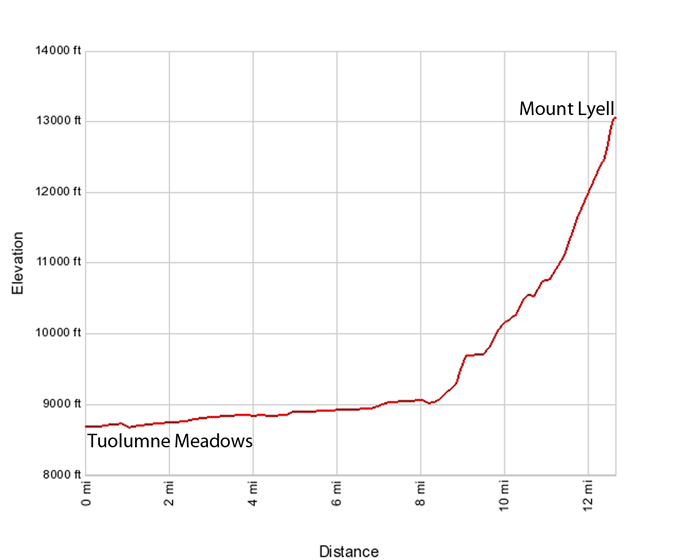
Parking and Trailhead: Tuolumne Meadows Wilderness Center, elevation 8,680 feet
Summit Elevation: 13,114 feet
Best Season: July through September
Permits: None needed for day use but required for overnight travel; visit Tuolumne Meadows Wilderness Center.
Overview: The tallest mountain in Yosemite makes Mount Lyell a long and difficult climb. It’s also a very rewarding challenge and offers great adventure. Much of the journey involves simply hiking in Lyell Canyon. Near Donohue Pass, climbers leave the John Muir Trail and ascend the mountain’s northern drainage. The final push requires class 3 and possibly class 4 rock climbing.
Climbing the Climb:
While some complete this adventure in a day, most take two or three days. This is a big one and it’s not a race. Set aside enough time to do it right.
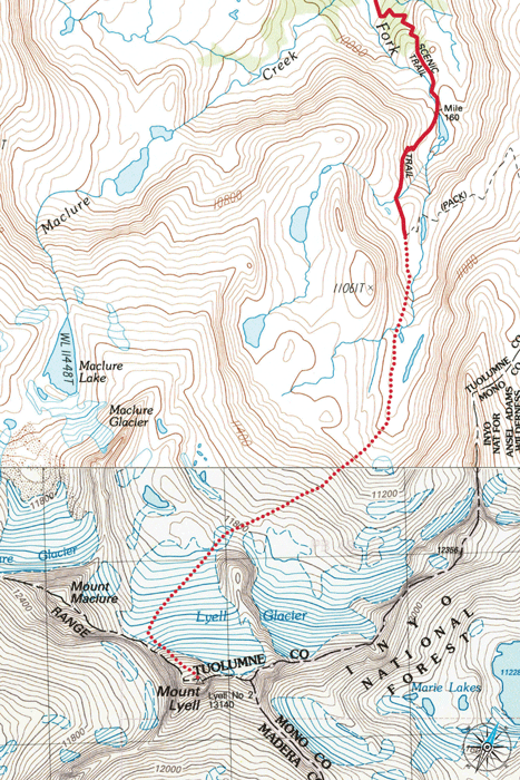
At Tuolumne Meadows Wilderness Center, pick up the John Muir Trail heading east through a meadow and past the rangers’ office. Following signs for Donohue Pass, cross a bridge over the Lyell Fork of the Tuolumne River. Hike south on the Muir beside the river for several miles to the end of Lyell Canyon.
Next the trail climbs towards Donohue Pass and the real work begins. From the start of the climb, the trail crosses over a bridge in about a mile. Many switchbacks later, the southbound trail turns sharply east toward Donohue Pass. Instead, leave the Muir and continue south up the mountain’s drainage. Hike up the granite canyon beside a creek as you climb above the tree line.
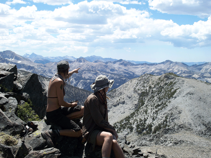
When Lyell comes into view, climbers have a choice. Some climb up the glacier to the mountain’s east arete and scramble up rock to the summit; this is the most direct route and will require ice axes and crampons. Others aim for the Lyell-Maclure saddle and ascend up talus on the mountain’s northwest ridge. This is longer but more moderate. Your level of experience, gear and snow conditions should all factor into your choice. The map illustrates the northwest ridge approach.
Savor a hardest-earned summit in Yosemite and the king-of-the-world view. Retrace your steps to your base camp and Tuolumne Meadows.
Insider Tips:
A big snow year and early-season outing mean safer and easier climbing near the summit. The opposite is also true. After a dry winter, climbers will encounter loose rock and class 4 terrain. Take an ice axe and crampons. If you leave them behind, you are sure to want them.
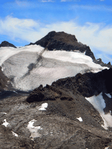
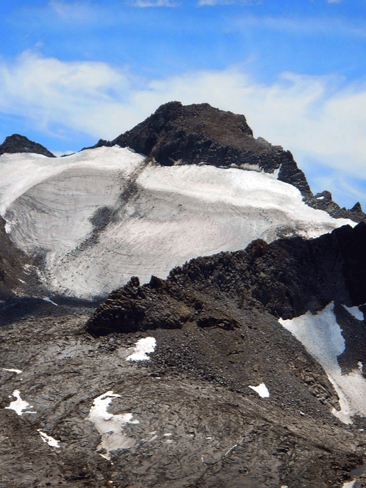
Don’t wait too long to climb Mount Lyell, because its glacier is shrinking.
Matt Johanson is the author of “Yosemite Adventures: 50 Spectacular Hikes, Climbs and Winter Treks.” This is one installment. Signed copies and Matt’s other writing can be found at mattjohanson.com.
——————————————————————————————————————————-
Distance and Details
Start: Tuolumne Meadows Wilderness Center
1.8 miles: Junction with trail to Tuolumne Pass and Vogelsang (go left)
6 miles: Junction with trail to Ireland Lake (stay left)
10.2 miles: Bridge
12.5 miles: Mount Lyell