


A Pacific Crest Trail Journey: Part 4
Tramping through the snow all day wore me out, but the sufferfest had just begun. Late in the afternoon when I usually built camp, I realized that I’d lost the trail beneath the snow. I had followed the tracks of others who I believed were experienced hikers and on course in the San Jacinto Mountains. When I caught up with them, I discovered that both assumptions were wrong.
Backtracking and finding the correct trail took an hour. The four others (young and loud, but friendly) gratefully followed me as daylight faded. Then a storm erupted before I could pitch my tent, wetting my clothes and sleeping bag. After 12 hours of hard trekking, a cold night awaited.
Hiking the Pacific Crest Trail through Southern California defied my expectations of sunshine and mild weather. The aftermath of a record-breaking winter changed the PCT experience for everyone. 
In fact, so much snow blanketed SoCal’s mountains in spring that many hikers changed their plans. Most PCT hikers start at the Mexican border and trek northbound, or “nobo.” But the big winter led some to hike southbound (“sobo”) instead. I also opted to walk through the Mojave Desert first while snow melted in the mountains. Only time would tell if this strategy would work.
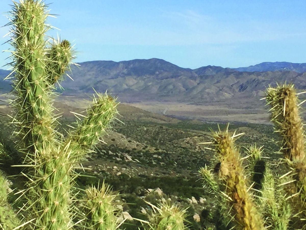
Starting from Walker Pass, my path led through Joshua trees, pinyon pines, cacti, countless lizards and snakes, including rattlers. I enjoyed the desert ambiance even though lengthy hikes up to 35 miles separated natural water sources. This required hikers to carry five liters (12 pounds) of water or more, but the cool temperatures of April eased my passage.
Less helpful was the wind. During my first evening out, a fierce gale made me scramble to pitch my tent. When I had nearly succeeded, wind blew so hard that it ripped a large hole in the fabric! The mistake was mine; lightweight shelters aren’t designed for such punishment. So I bundled up in my sleeping bag through below-freezing nights. Thousands of wind turbines near Tehachapi showed that one should expect such weather here.
As a Northern Californian, I felt conflicted about the Los Angeles Aqueduct, which parallels the trail for 17 miles and delivers billions of gallons per week to SoCal. But as a Star Trek fan, I enjoyed hiking through the Vasquez Rocks. The park boasts fascinating geology and has provided the landscape for hundreds of productions including films, television shows, and music videos.
When I climbed into the San Gabriel Mountains, snow still covered much of the path. Some carried ice axes and crampons to ascend Mount Baden-Powell; everyone said that was tough going. I joined others who opted for an easier hike along Highway 2. That alternative still traversed big snowfields and rockslides, but the concession made me feel guilty; strike one.
I reached Vincent Gap at dusk and endured a frigid night with a dozen other hikers. Several of us sheltered from the icy wind and cooked dinner in a filthy bathroom. This marked a low moment for sanitation but a warm one for laughter and camaraderie. A week earlier, others even slept in stinky outhouses to escape late-season snowfall.
My new tent, a food shipment and a box of cookies from my old friend Pam all awaited me in Wrightwood. As I departed Angeles National Forest and approached the town of Cajon, a McDonalds near the trail inspired absurd excitement in famished hikers for miles around.
A highlight of the San Bernardino Mountains was Deep Creek, which looked and felt like a miniature Grand Canyon. Within it are hot springs that attract tourists (some dressed, some not) from miles around.
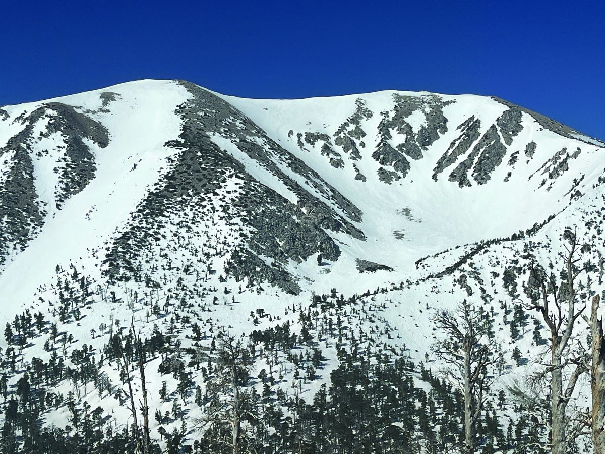
San Gorgonio Mountain, 11,503 feet tall and the highest peak in SoCal, tempted me greatly. The shortest route from the PCT to its summit and back totals 20 miles, no cheapie. I rose at four, left camp at five, and got about halfway up by 9am. The approach trail was covered with blowdown trees, loose rock, and eventually miles of snow. A coyote howled in the distance, as if in warning. On pace to finish well after dark, I made myself turn around; strike two.
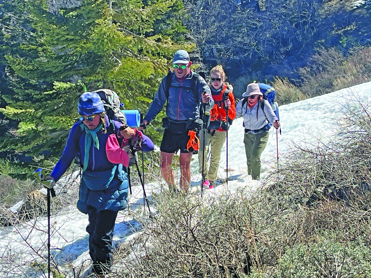
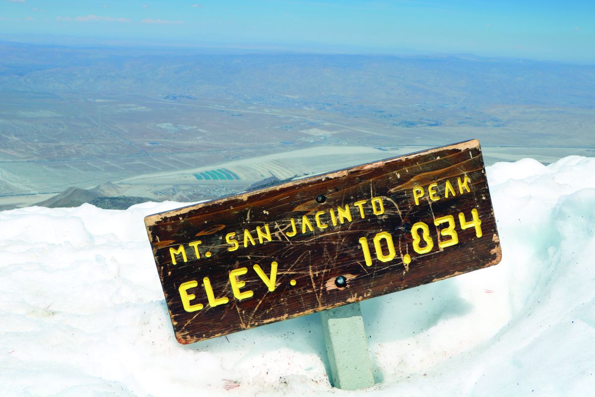
After disappointments on Baden-Powell and San Gorgonio, I was extra motivated to achieve the hike’s last major summit, San Jacinto Peak. A few weeks earlier, snowfall was so heavy here that officials completely closed the trail. But while I trekked through the desert, the sun melted much of the snowpack. I strapped my microspikes onto my shoes and climbed with several others in the early-morning hours. Snow was tiring but not dangerous and we celebrated on the summit at 10am. No strikeout for me! San Jacinto’s view boasts an incredible variety of Southern California geography, including the Mojave Desert, Sand to Snow National Monument and Tahquitz Peak.
Perhaps I celebrated too soon because the day was far from over. Descending took hours longer than expected, one of my hiking poles broke on the way, and I still had miles to go before my intended camp. Then I followed the wrong tracks, lost the trail in the snow, recovered, and bailed out those other hikers before the heavy thunderstorm soaked everybody. But a few days of snowy suffering are better than a few weeks, and I consider the desert-first strategy a success.
I ate like a horse that night and managed food better overall on this segment than earlier ones; I only lost 10 pounds instead of 15 like in NorCal and Oregon. My secret was to eat packaged meals made for two people instead of one. After 20 miles per day or more, I had no problem finishing a double-sized RightOnTrek dinner of hearty beef bolognese, high country pad thai or chicken coconut curry.
As usual, trail angels made the hike possible and far more enjoyable. Providing me invaluable assistance were my wife Karen, brothers Dan and Steve, and old friends John, David, Marie Antoinette, Raffi and Melissa. Trail angels who supported me included Fruit Bowl, Tacos-and-Beer, Hypsie Gypsy, Oak, Beer Sack, Joy, Split, Strider, No-hawk, Robert, Grape, Papa Smurf, Mountain Mama, Nitsy, Todd, Farmer John and Wheels. I can’t write enough about their kindness in providing hikers with food, water, transportation, shelter and more.
In fact, after experiencing such generosity on earlier outings, I vowed to give more “trail magic” back to the community this time. I found a few ways, like picking up the check for others at restaurants, giving hikers food, leaving beer at trailheads and donating money to trail angels. I ran into a few distressed hikers low on water near the Mexican border. Luckily, I was carrying enough to give them some.
As I hiked the last steps to Kennedy Meadows, which marks the unofficial border between SoCal and the Sierra Nevada, other hikers gathered at the general store broke into applause, as they do for each new arrival. That made me smile. Completing SoCal’s 700 miles took me six weeks, divided into three segments over two years.
Many hikers decided to skip the Sierra Nevada for now because of heavy snowpack. Having already trekked through my favorite mountain range, I’m also taking a detour to my biggest unfinished section: the Cascades of Washington.
***
Main image: A pack of hikers approach the snowy summit of San Jacinto Peak.
Read more by Matt Johanson here.


