Light winter promises good hiking on the PCT
After a hard day of high-elevation backpacking a dozen miles around Ebbetts Pass, I would have settled for crackers, peanut butter and water. Instead, a group of trail angels I’d never met before invited my companion and me into their roadside camp to enjoy hot cheeseburgers and cold beer. That’s the spirit of the Pacific Crest Trail: mountain-sized challenges balanced by world-class company. The 2,650-mile path between the borders of Mexico and Canada never fails to deliver both.
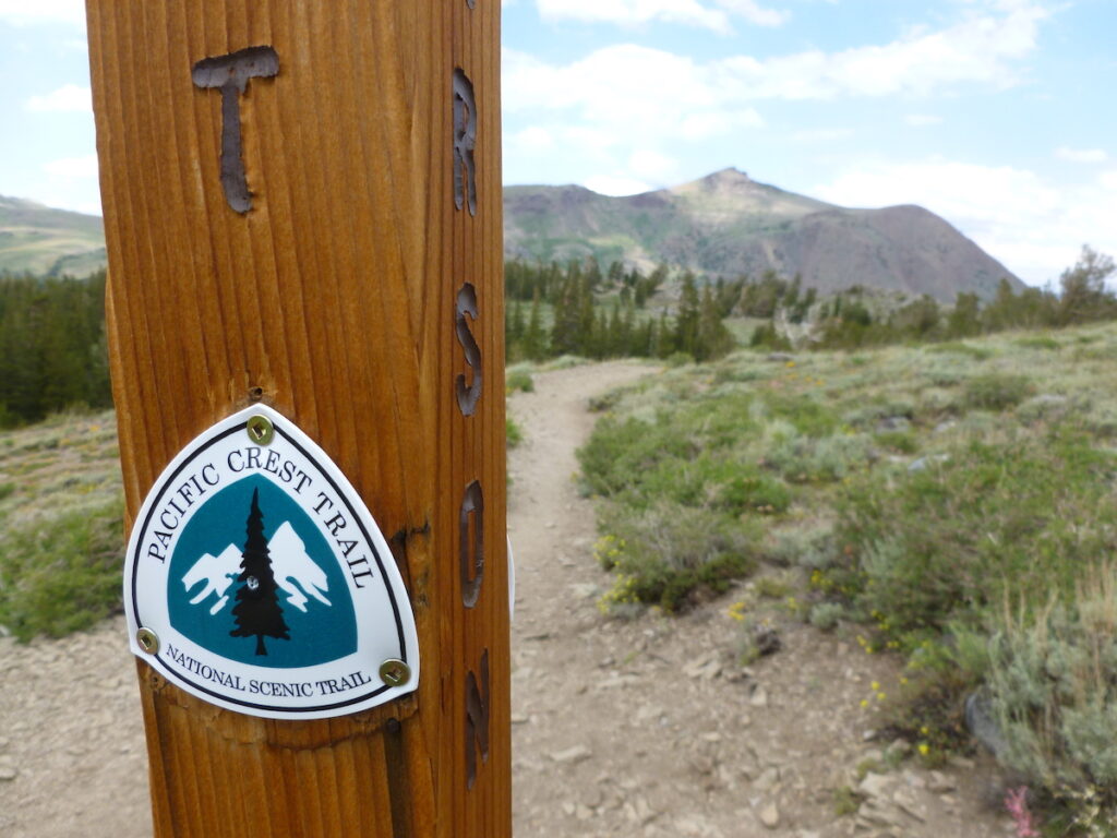
[dropcap size=big]S[/dropcap]ome 7,000 hikers tread the path each year, including around 10 percent who trek the entire distance and the others who do complete portions. Thru-hiking marks a lifetime achievement for many, but completing even a short section delivers rewards and builds skills for longer journeys.Hundreds of hikers have already started north through the desert from the Mexican border, but it’s not too late to start planning your own adventure. As the pandemic recedes slowly, this looks like a good year to go. This winter’s light snowfall will mean fewer mosquitoes, easier hiking and a longer backpacking season. If you’re eager to discover this wonderful world, consider these three segments for an introduction.

Angeles National Forest (24 miles)
This section north of Los Angeles closely traces Highway 2 west of Wrightwood. With an average elevation of 6,000 feet (and a high mark of 9,406 feet), it offers cooler temperatures than the hot desert to the southeast which thru-hikers complete in spring. But it’s also low enough to be free of heavy snow and accessible from late-spring through late fall in most years.
Hikers who appreciate a gradual warm-up might prefer an eastbound hike starting at Three Points Trailhead near Camp Valcrest. Our trek through the San Gabriel Mountains includes multiple stream crossings and several optional summits, including Winston Peak, Throop Peak and Mount Burnham. Complete the hike below the switchbacks beneath Mount Baden-Powell (named for the founder of the Boy Scouts) at a large trailhead and parking area. The town of Wrightwood stands about seven miles to the east.
This segment crosses Highway 2 several times, providing easy access by PCT standards and allowing hikers to easily shorten or extend this suggested portion. Parking at popular trailheads in this area requires an Adventure Pass.
Highway 80 to Sierra City (37 miles)
Throughout much of the Sierra Nevada, the PCT traverses elevations above 10,000 feet with distances of 100 miles or more between road access and resupply opportunities. In comparison, this short segment northwest of Lake Tahoe tops out at around 8,400 feet, making it much more accessible and a reasonable choice for beginners, conditions permitting. This section is normally accessible by late June, though heavy snow years may require a later start.
Find the trailhead north of Highway 80; there’s a backpackers parking area south of the highway that’s free in summer. Our route takes us right beneath scenic Castle Peak. Once you’ve gained Castle Pass, you can climb north to visit Castle Peak’s three summits, or hike south to ascend the more modest Andesite Peak. Less than a mile from the pass, our trail passes near the Sierra Club’s Peter Grubb Hut, a beautiful and rustic ski cabin. Continue north past Basin Peak, another short and optional adventure and the highest point of this segment.
From here we gradually descend, passing many streams and meadows on the way to Jackson Meadows Reservoir, about 25 miles from Highway 80. Another 12 miles, all downhill, takes us to Highway 49, about 1.5 miles east of Sierra City.
Shasta-Trinity National Forest (57 miles)
This section showcases some of the North State’s best scenery including Castle Crags State Park and Mount Shasta, encompassing elevations between 2,100 feet and 8,200 feet, gaining elevation in the northbound direction. In a normal year, backpackers can reasonably access this area by July.
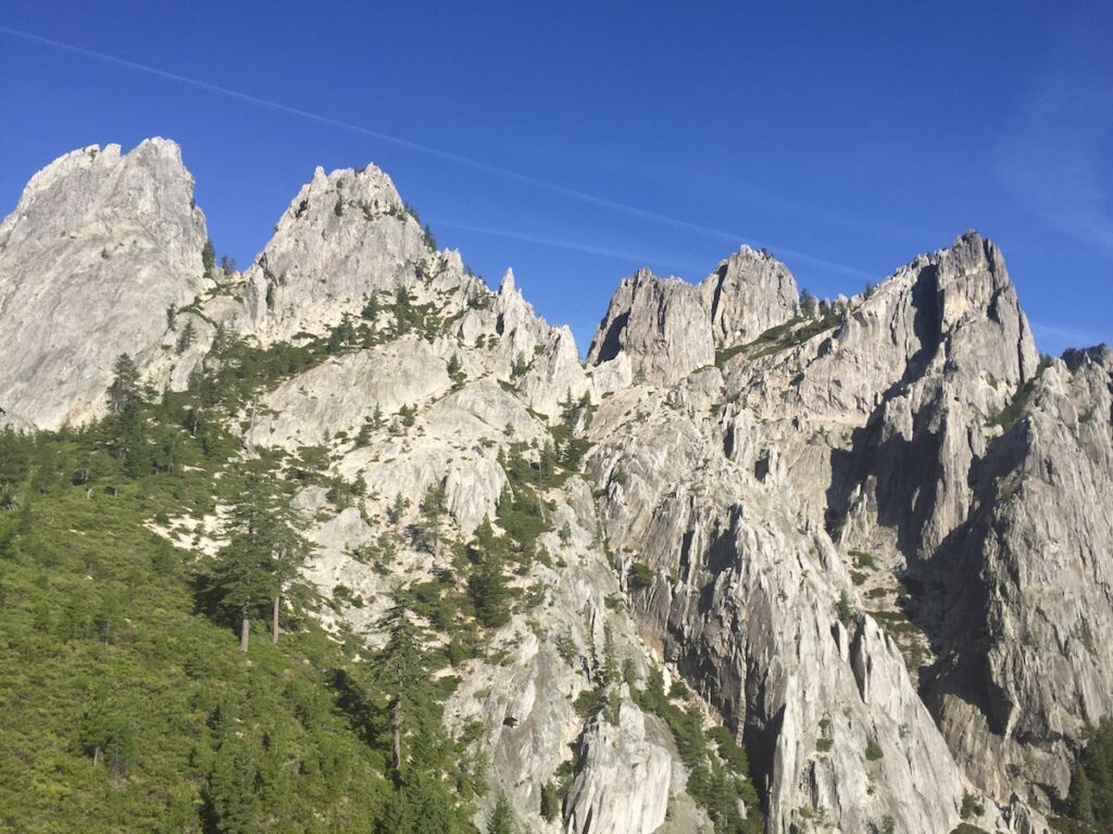
Join the path south of Dunsmuir on Highway 5 at Castle Crags State Park, which protects a spectacular range of granite spires which formed 170 million years ago. More recently, miners and Modocs fought a historic battle here in 1853. Hiking to the striking spires area involves a detour off the PCT of about three miles round-trip, definitely worth it if you have the time.
The PCT leads past many ponds and lakes as it winds northwest through Shasta-Trinity and Klamath national forests. Some 34 miles from the suggested start are Deadfall Lakes. Here you’ll find a worthy detour to the nearby Mount Eddy, highest of the Klamath Mountains, which affords visitors awesome views of Mount Shasta to the east.
At 37 miles, our path crosses Forest Road 17 at a trailhead and parking area. Hikers might catch a ride here to the town of Weed and Highway 5. Otherwise, the PCT crosses State Route 3 in another 20 miles to the northwest, about 57 miles from our start and six miles southeast of the town of Callahan. This is the kind of place where many PCT hikers b
reak out a hitchhiker’s thumb.
Whichever section you choose, you can expect to be challenged on the way, physically and otherwise. There’s a lot to learn out there and a short article like this can’t possibly express it all. But you can expect to learn on the way, especially if you use one of the many excellent guidebooks and/or cell phone apps. You can also expect to meet fellow hikers who are almost always kind and generous with their experience and help.
You may someday even find yourself returning the favor by giving back something to the PCT community in the form of extra food, water, rides to town, or maybe even burgers and beer.
Read more stories by Matt Johnson here.