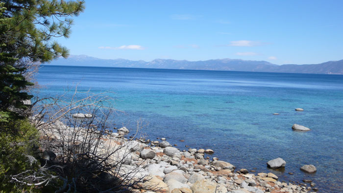
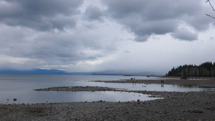
With water levels at an all-time low, it’s easy to imagine the 72-mile hike along Lake Tahoe’s shores
By Tim Hauserman
The Tahoe Rim Trail is a 165-mile loop around Lake Tahoe. It traverses the side of lofty mountains, and meanders along ridgelines high above Lake Tahoe. It passes by sparkling mountain lakes and saunters through deep forests of red fir and western white pine. It’s well worth the two weeks it takes to hike it. But wouldn’t it be cool to hike a 72-mile version instead? 
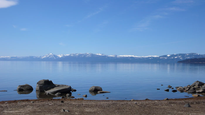
Our recent drought has left Lake Tahoe well below its natural rim. The Truckee River, instead of being a bustle of watery energy, is now a shadow of its former self. While walking along Tahoe’s increasingly expansive shoreline this winter a crazy idea came to mind. What would it be like to actually walk along the shoreline of Lake Tahoe? Instead of glorious glimpses of the lake from a distance, you would be walking right next to it. You could hear the waves, and whenever your heart desired it, take a good stare into her crystal clear waters. Instead of 26,000 feet of climbing and an equal amount of bone jarring descent over 165 miles, you would have a civilized 72 miles of gorgeous, mostly level walking.
Wait, wait, don’t start stuffing your backpack yet. While everything below the natural rim is considered public land, just above the high water mark there are tons of monster homes owned by folks who might be less then thrilled with you camping on their lawn or going pee pee in their bushes. There are also perhaps some steep cliffs that might require you to get wet. And then, there are lots of bouldery and rocky sections. But it’s fun to imagine … and perhaps try out a few sections.
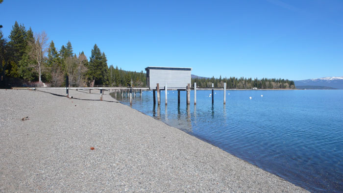
Let’s imagine the route. We begin in Tahoe City at the Truckee River Dam, and then go clockwise, just like the guidebook to the Tahoe Rim Trail. We start out with easy walking along the paved pathway just above the lake’s shore to the campground on the eastern edge of town. Now it’s time to start trekking along the wide rocky beach. In about a mile, you reach a steep bank, with homes sitting high above. The beach widens as you walk past Star Harbor, public restrooms and the Coast Guard Station. Next skirt across the little peninsula that is known as Lake Forest Island when the water is high. Now you have a lovely stroll below fascinating eroded sandstone cliffs to the Skylandia public beach and pier, with restrooms and picnic tables just up the bluff.
The sandiness continues into the Dollar Point subdivision, but as you approach the point itself, the terrain becomes bouldery, and drops off quickly from the shore. Either a quick swim, or some clamoring through manzanita might be in order. Roll along the shore passing the Chinquapin condos and beautiful homes to reach Waterman’s Landing, a small cafe just above pebbly Carnelian Bay beach. You’ve walked 5 miles. More rocky terrain brings you around Flick Point, and on to Tahoe Vista … where an especially long, wide and lovely beach takes you all the way through Kings Beach. A few homeowners have created rock walls well out onto the beach, but they are easy to negotiate. You pass a string of public facilities before hitting the boulders again near the Nevada border. A quick word of advice: in California, it is legal to walk in the area between the low and high water mark. In Nevada, you are only allowed to walk below the low water mark. In other words, you’re gonna get wet if you want to avoid trespassing.
Just at the Nevada state line is the spectacularly beautiful Buck’s Beach with its to-die-for combination of boulders and sand. You’ve reached what is normally a sublime place to wind your kayak amongst the boulders and patches of green water just off shore, but trying to walk this stuff requires the skill to play in the rocks, and some of those rocks might be slimy. Wear river shoes. You pass some spectacularly large homes, at the base of the steep slope that makes up Crystal Bay, before reaching the northern terminus of the lake at the row of lakeside condos that make up the beginning of Incline Village. Now you pass perhaps the most expensive string of fancy homes on the lake. Here you will see huge beaches that will provide a lovely stroll. A word of warning: Some of these beaches sport pools, picnic tables and other public looking facilities, but they are not for you, unless you own property in Incline. Hungry or thirsty? Stop in at the Long Eagle Grille right on the beach for eats and drinks. At the end of Incline, you start heading south on the east side of the lake, and find a mix of lovely little beaches, and gigantic boulder fields. Next you reach perhaps the nicest beach of all, the sublime Sand Harbor.
The fun continues south of Sand Harbor. More bits of sandy wonderfulness, more gigantic boulders, until you reach George Whittell’s famous Thunderbird Lodge. Most of the east shore of Lake Tahoe was once owned by Whittell, and his estate is a fascinating combination of eccentricity and beauty. Just a bit further south is Chimney Beach. Soon, doffing your clothes becomes an option as you’ve reached a clothing optional area … just remember to put them back on when you come back to the civilized world. Now Highway 28 highway lies far to the east, so except for the hikers who have hiked down from the road, and the myriad boats coming over to swim in the warm coves, you will have the place to yourself. Go by not so secret Secret Harbor, then see Whittell’s summer cabin of stone at Skunk Harbor. Next stop, Glenbrook, a lovely cove and one of Tahoe’s oldest communities. While loaded with logging history, it’s very private. Walk quietly.

With the highway now returned to the lake’s edge, you wind by the homes of Logan Shoals, and are obliged to sneak up to the road to go through Cave Rock. More homes await at Skyland before you reach the busy beehive of Zephyr Cove. It has a sandy beach and is the home of the MS Dixie paddlewheel. A bit more hopping and skipping brings you to the mile long Nevada Beach, one of the lake’s best, with lakeside campsites. Skirt past the lakeside Edgewood Golf Course and you are back in California and the busy burg of South Lake Tahoe.
While South Lake Tahoe is a busy place, it’s mostly level and sandy along the shore, so enjoy your romp. It’s all one big beach … until you get to Tahoe Keys. A harbor. Not sure what you do there. Swim? Take a long walk around it? But once you do, a string of beaches await: Pope, Camp Richardson, the Valhalla Center and Baldwin Beach. It’s all quite nice, with just a bit of rockiness before reaching the southern tip of Emerald Bay. While walking along the shore of the bay is probably possible, why not jump on the lovely Rubicon Trail which sits just above the shore. It takes you to Vikingsholm, before you head along the north side of the bay, passing right through the boat campground, a relaxing place to camp. Three more trail miles brings you past eagle and osprey nests to the incredible Bliss State Park beach and campground.
Take a break on this blissful beach, or keep walking, because the sand of the Gold Coast is just as spectacular. The awesomely wide and spectacular beach passes ancient homes on multi-acre parcels, before eventually narrowing and becomes more rocky as you pass by the tightly bunched homes of Rubicon Bay. Another bend brings you to Meeks Bay, where two campgrounds and a store await.
You are now just 10 miles from your starting point and a complete circumnavigation, with your first stop being Sugar Pine Point State Park. Walk past the Ehrman Mansion with its sweeping lawn and ancient boathouses, then along the park’s shoreline before heading back along private land again in Tahoma. Stop for a drink at the Chamberlands Bar on the pier above a public beach, then get a beautiful gander of the wide McKinney Bay with Eagle Rock and Blackwood Canyon in the distance. You will have to do a bit of inland jaunting to get past the marinas at Obexers and Homewood, but then enjoy a long sandy romp along a string of Homewood lakefront homes. A narrow strip between lake and road brings you to Fleur Du Lac, where the movie, Godfather II was filmed. And poor Fredo met his demise and his body was dumped into the lake here. Not really though: the movie—and the Tahoe Shore Trail—is fictional.
Hop over Blackwood Creek, and pass by a small campground just across the highway from the beach, before reaching the public beaches of Hurricane Bay, where the inland bike trail might be your best bet. At the end of the Bay you pass by more sumptuous lakefront estates, and the mouth of Ward Creek, before heading towards Sunnyside Lodge. Grab some fried zucchini on the deck, or just finish off the home stretch. A few more rocky miles bring you past Tahoe Tavern to the beginning of the Truckee River, and the end of your journey.
Tim Hauserman wrote the official guidebook to the Tahoe Rim Trail, now in its third edition.