Jerry Ashburn: Adventure Pioneer to Riverside Host
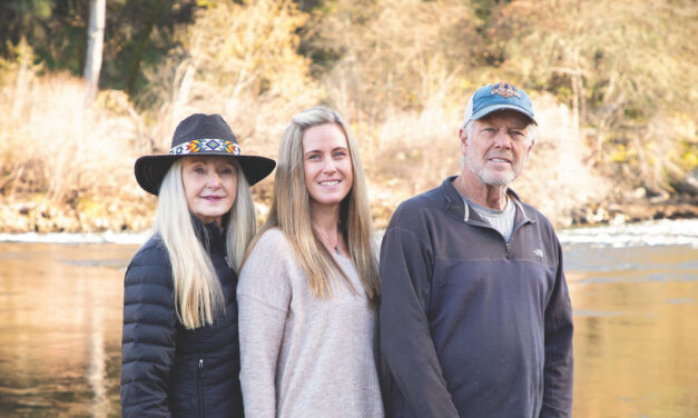
Jerry Ashburn’s enduring legacy with EarthTrek Expeditions If you’ve ever passed through Coloma –...
Read More


Jerry Ashburn’s enduring legacy with EarthTrek Expeditions If you’ve ever passed through Coloma –...
Read More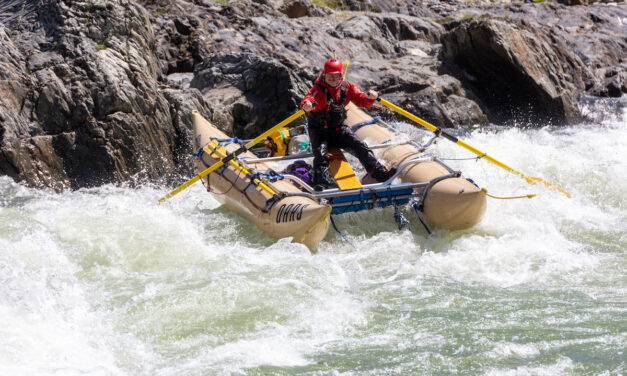
The big runoff has raft guides on their toes With 2023’s record snowpack and the “great runoff” in...
Read More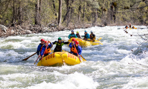
California 2023 Rafting Written by Kate Rhoswen With record-level snowpack in the West, it’s going...
Read More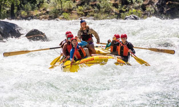
Story and photos by Dylan Silver / OARS California’s Tuolumne River is mountain whitewater at its...
Read More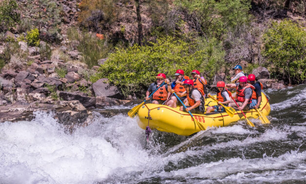
When it comes to the best one-day whitewater rafting trip in California, the Middle Fork American River stands above the rest. This declaration comes from whitewater pioneer, OARS, which has led rafting trips in California, and all over the Western U.S., since 1969.
Read More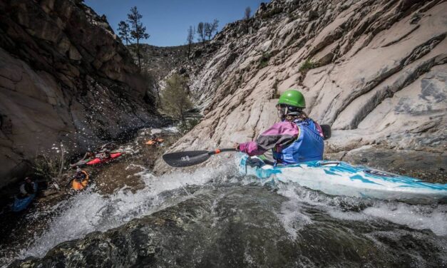
California and Nevada 2021 River Opportunities By Anthea Raymond • Main photo by Jonah Grubb /...
Read More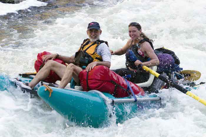
Based in Lotus near the American River, kayak and swift water rescue instructor Gigi McBee has been on a campaign to keep herself and other paddlers safe on the river for over 20 years. Through commitment and hard work she has become a role model and an inspiration, making many in the kayak community safer in whitewater.
Read More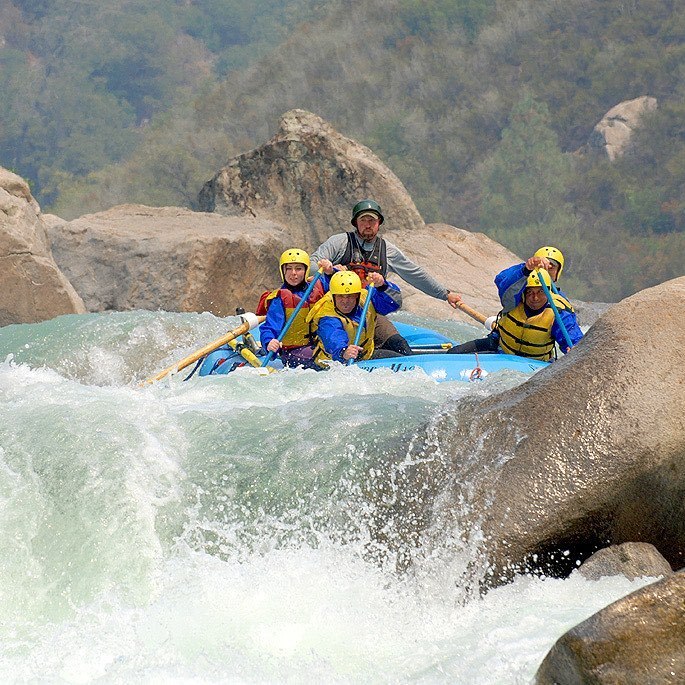
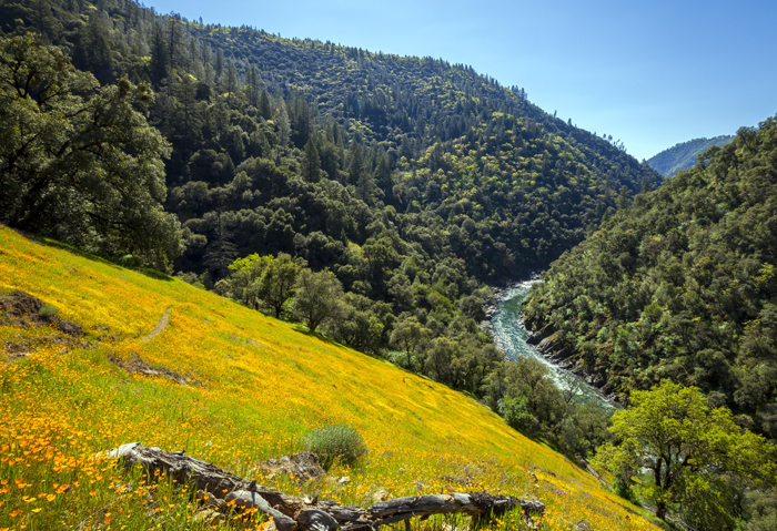
AT THE WESTERN EDGE OF THE SIERRA FOOTHILLS, in the heart of Gold Country, Auburn State Recreation Area protects 48 miles of the North and Middle Forks of the American River and 30,000 acres of riparian, chaparral and coniferous habitats.
Read More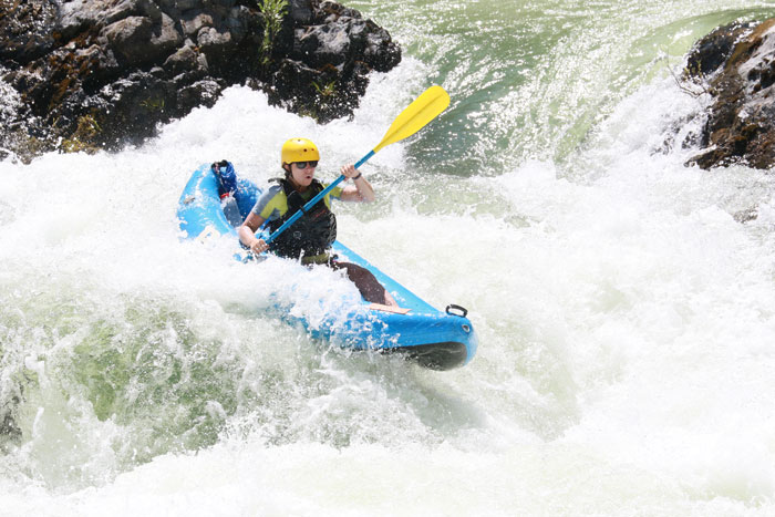
A couple weeks back, my partner and I found ourselves driving through the night from Santa Cruz to Big Flat in the Shasta-Trinity National Forest.
Read More


From pioneering adventure travel to river glamping, Jerry Ashburn’s legacy continues to shape the experience along the South Fork of the American River. 🌊
Click the link in our bio to read Anthea Raymond’s latest article about the story behind EarthTrek Expeditions and discover the journey that began over forty years ago. 🔗 ⬆️
Story by @lariverbeach 📝
Photos by Jerry Ashburn, Dylan Silver and James Kaiser at @oars_rafting 📸
#Whitewater #Kayaking #AdventureTravel #RiverGlamping #SouthForkAmerican
Last weekend our writer @ellasuring joined @envirosports for a trail marathon in the Marin headlands! Filled with breathtaking views, single track trails and a supportive community, the event offered so much.
Thanks so much to @anavi._.d for capturing these amazing photos, and to @envirosports for making it happen. You can find more of these events at the link in our bio 🔗
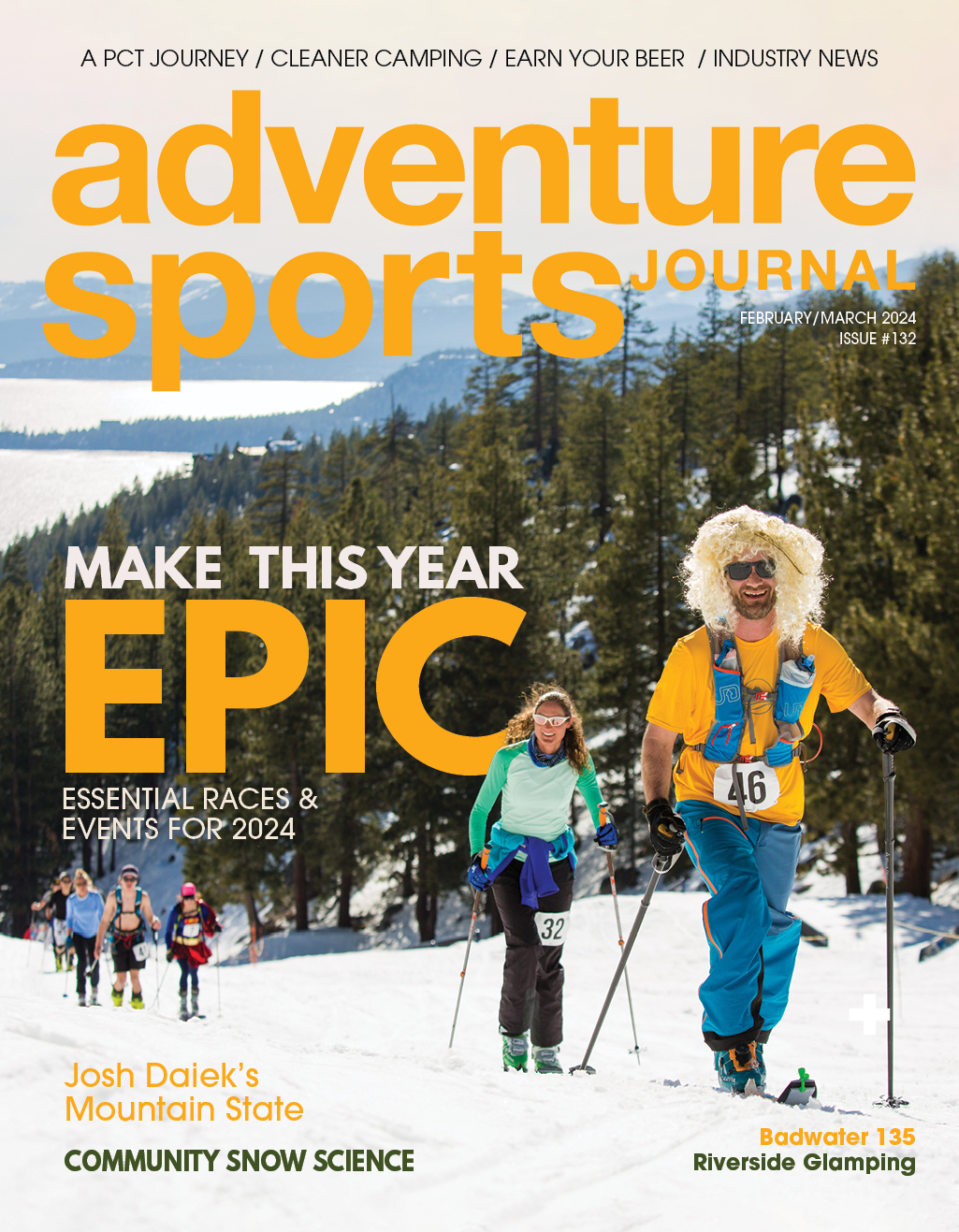
Spring brings warmer days, but the skiing stoke doesn’t have to end! ❄️
Dive into the heart of Nevada’s Great Basin with @joshdaiek and his film ‘Mountain State.’ From daring couloirs to remote ghost towns, this film covers the highs and lows of skiing in Nevada. 🗻
Click the link 🔗 in our bio to read Kurt Gensheimer’s article and discover the untamed beauty of Nevada’s hidden ski gems.
OR watch ‘Mountain State’ and ‘Mountain State 2.0’ on @salomon TV’s YouTube channel. 📽️
#SkiFilm #Salomon #Backcountry #MountainState #SkiNevada
@travelnevada
There’s still time for spring skiing at @bvadventure
With over 65 kilometers of groomed paths and a cafe on the trails, it’s a great destination for the whole family.
#xcskiing #adventure #california
All State Parks in Big Sur Area Closed Due to Highway 1 Road Slip Out 🛑
Due to the road slip out on Highway 1 at Rocky Creek in Monterey County, all State Parks in the Big Sur Area are now closed to day use and camping. ⛺️ That includes Pfeiffer Big Sur State Park, Andrew Molera State Park, Limekiln State Park, Julia Pfeiffer Burns State Park and Point Sur State Historic Park.
State Parks will continue to work closely with Caltrans and CHP to assess impacts to the highway and will update closures as road conditions allow. 🚧All camping reservations will be cancelled, and refunds will be processed.
An exact timeline on when these parks will reopen depends on road repairs. For more on those repairs, please contact Caltrans. 🚥
📸 Road Closed by Sundry Photography & Julia Pfeiffer Burns State Park, California Martina Birnbaum
------------
Looking to beat the crowds this season for some spring skiing? Just 3 hours from the Bay is Bear Valley Mountain Resort. Our writer @ellasuring explored the area this weekend and was greeted with short lift lines and friendly faces to share in the stoke!
@bearvalleyresort is located between Tahoe and Yosemite and is the perfect casual ski destination for friends and families. With a variety of terrain levels, rentals, a lodge and lots of dining options, it’s the perfect winter getaway.
#california #skiing #snowboarding #winter #mountains #snow #adventure
We’re teaming up with @elevationoutdoors_mag @out_there_outdoors_magazine @biolite @lectricebikes @orukayak @geticybreeze @unchartedsupplyco @hollywoodracks @bearpawshoes @theprobar @luno.life to send one lucky winner home with an epic set of outdoor gear. If you’re ready for adventures this spring, visit the link in our bio to enter for a chance to win the prizes below.
Lectric eBikes XP 3.0
Oru Kayak “Lake”
Icy Breeze Platinum
BioLite FirePit+
Outdoor Adventure Media Magazine Subscription
Uncharted Supply Duffel, First Aid Plus, and Don’t Die Hat
Hollywood Racks Destination E
Bearpaw $300 Gift Card
PROBAR $300 Gift Card
Luno $300 Gift Card
Must be 18+ and a resident of the USA to enter. Winner will be contacted via email within one week of the close of the giveaway. This giveaway is not endorsed, promoted, or sponsored by Instagram. Visit the giveaway page for all rules.
Make your spring backcountry travels count! ⛷️Join @communitysnowobs to measure and report snow depths while adventuring. Urban snow data is equally crucial! ❄️
Click the link 🔗 in our bio for more information and learn how you can get involved.
Anytime, anywhere, your measurements contribute to real-time snow condition modeling.
📸 @brookemaush @katreenwjones and Liz Carey
#SnowDepthMonitoring #CitizenScience #RealTimeData #CommunityScience #SnowScience #BackcountrySkiing #CommunitySnowObservations #Outdoors #Snow #Adventure
🌸 Embrace the vibrant magic of spring in California`s desert state parks! 🌼 Get ready to be amazed by a sea of rainbow colors as the wildflower season blooms in all its glory. 🌈✨ Don`t miss out on this impressive display of nature`s artistry! 🌺🌵
Learn more about the bloom at the link in our bio!
© California State Parks, all rights reserved. 2024.
#SpringinCalifornia #WildflowerSeason #NatureAtItsFinest
🏕️ As the popularity of dispersed camping grows, an increasing number of campers are leaving the beaten path. Picture the disappointment of arriving at your chosen adventure spot after hours of planning and travel, only to find it strewn with litter.
🌿 Let`s safeguard the unspoiled magnificence of our natural surroundings!
Click the link in our bio 🔗 for five essential tips to ensure your next outdoor escapade respects and preserves the beauty of our wild spaces.
Photo and story by Krista Houghton
Disconnect to Reconnect: James Murren shares his annual tradition of a ‘Digital Detox’ in this issue’s Earn Your Beer column. 🌵
This year, he turned to the deserts of Anza-Borrego Desert State Park to reset. Read about his soul-refreshing experience. Cheers to adventure and unplugging! 📵
Featured Brews — The Butcher by @societebrewing and Bigfoot Barleywine-Style Ale by @sierranevada 🍻
Photo by Left Coast Photographer 📸
See the link in our bio to read more. 🔗
The grand finale of the 23-24 @alpenglowsports Winter Speaker Series is THIS Thursday. Dave Nettle concludes the series with his presentation, “Ski Touring the Tyrol.”
🔹 Event Details:
📅 Date: Thursday, March 7th
🕕 Time: Doors open at 6pm, Show starts at 7pm
📍 Location: Palisades Tahoe Olympic Village Events Center
🎟️ Admission: FREE for all ages!
📺 Livestream: Tune in via Alpenglow Sports’ Youtube Channel
🔗 See link in bio for more info.
Prepare to be transported on a journey through the stunning Tyrol region, filled with humor, expert tips, and breathtaking adventure. Plus, enjoy the lively atmosphere with bar offerings and giveaways, with proceeds benefiting @slowfoodlaketahoe, the nonprofit beneficiary for the evening.
Don’t miss your chance to be part of this unforgettable event and support a great cause! RSVP for the livestream or join them in person!
📸 Dave Nettle
#AlpenglowSpeakerSeries #AdventureAwaits #SkiTyrol #DaveNettle #AlpenglowSports
