


The driest place in North America was hammered by catastrophic flooding last year, and the hottest place in the world got hotter
As Death Valley National Park reels from the impacts of Hurricane Hilary and another heat record-breaking summer, park staff are scrambling to provide access while preparing for the next disaster.
“Death Valley National Park is part of the basin and range, a vast area between the Sierra Nevada mountains and Wasatch Range where the earth’s crust has been stretching east to west for 17 million years,” explains Death Valley National Park Management Analyst Abby Wines. “The stretch marks are alternating valleys and mountains that mostly run north and south in this region. Death Valley is the deepest and, in my opinion, the most beautiful, of the valleys that formed this way.”
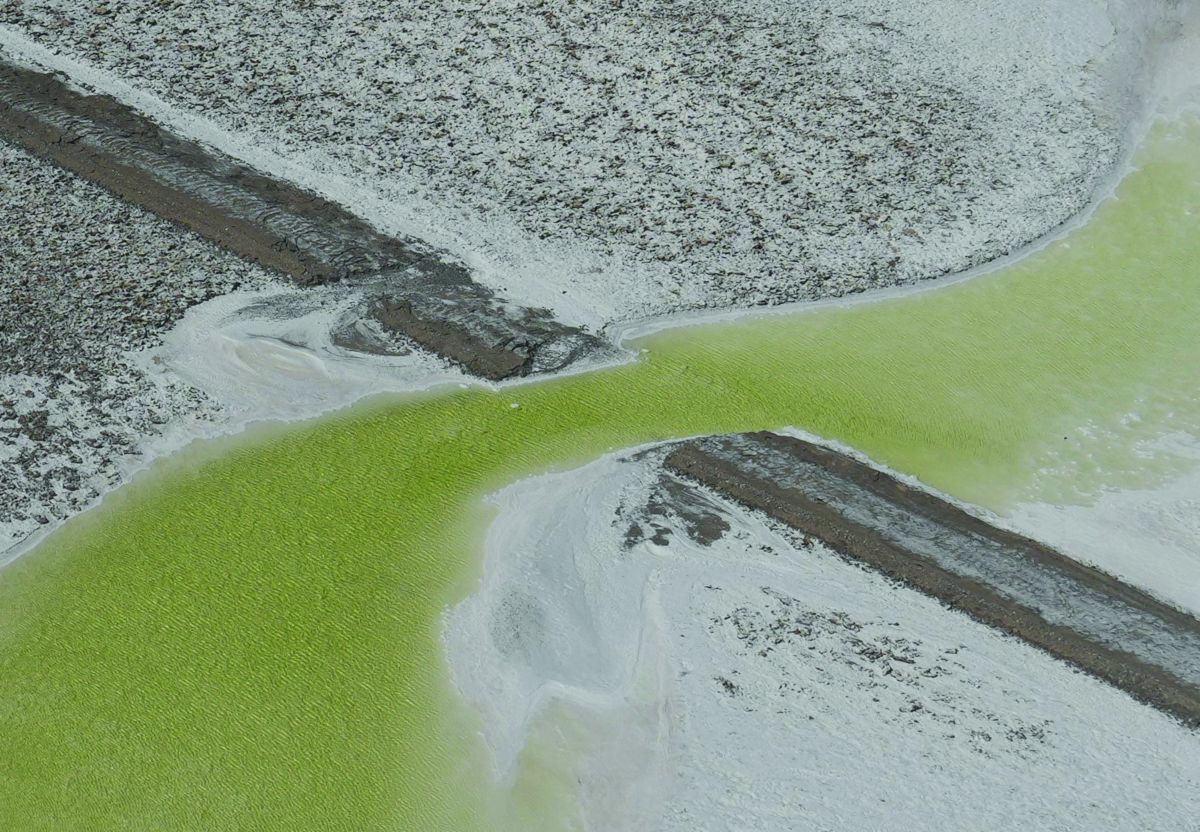
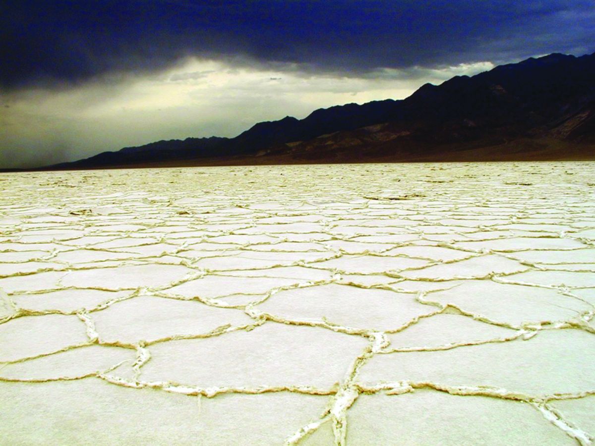
Flash floods have long been part of the landscape in the three million acre swath of the Great Basin desert that is now Death Valley National Park. They carried massive boulders to their current resting places in the middle of vast salt plains, eroded thousands of sheer canyons, and deposited alluvial fans at the base of each one. But some years pass with no precipitation at all, and Furnace Creek gets an average of just 1.6 inches of rain a year, making it the driest place in North America. 
“On August 5, 2022, Furnace Creek got 1.7 inches of rain,” explains Wines. “At the time we were super impressed, it was our rainiest day on record. That was a ‘thousand year’ rainfall event, meaning there’s a 0.1% chance of that type of event happening in that specific location in a given year. And then on August 20, 2023, Hurricane Hilary dropped 2.2 inches of rain at Furnace Creek. Stovepipe Wells got three inches, and the slopes of Hunter Mountain got over six.”
The park partially reopened five days after the 2022 floods. But after Hurricane Hilary, Death Valley National Park remained completely closed for 56 days, by far the longest closure in their history.
“2022 was horrible; we had nine major flooding events between January and July. Road crews would work clearing debris and filling in shoulders, and then the day before opening the road we’d get hit with another storm and have to start all over,” says Wines. “It felt like we were living the movie Groundhog Day. And then Hurricane Hilary was like a giant Groundhog Day from a year ago.”
Though 2.2 inches of rain may not sound like much, it has a devastating impact when it comes all at once on a parched desert. “Our dry, hard-packed soil can’t absorb the rain, so it gets funneled down the mountains into canyons and out onto the valley floor,” explains Wines. “That’s why 2.2 inches of rain is a major catastrophe in Death Valley, whereas in Miami, where I grew up, it’s just a summer Tuesday.”
Hurricane Hilary came in two pulses, with a respite between noon and 6pm; during that break CalTrans closed Highway 190, the park’s main artery, and rangers were able to evacuate visitors. “By the time the second wave came, there was no way for anyone to get out of or come into the park for 24 hours,” explains Wines. “We couldn’t get an ambulance or even an air ambulance in; we were completely isolated.”
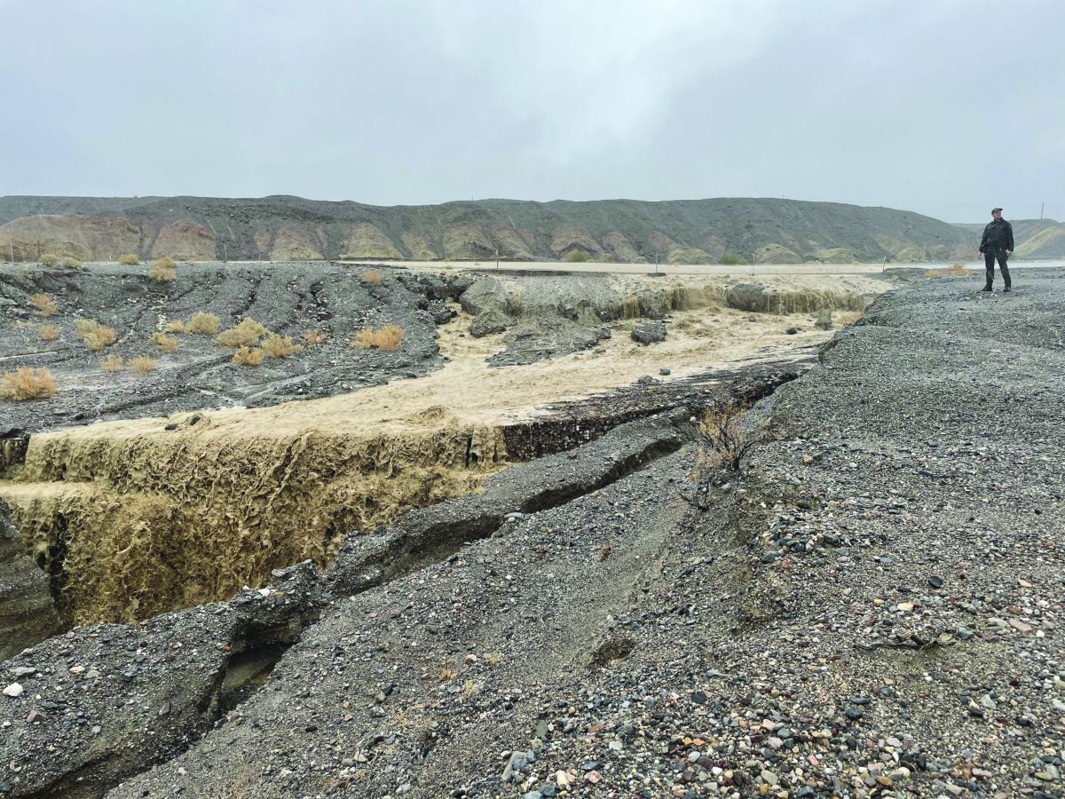
Of course, massive floods are only a problem when they impact humans or the infrastructure we want to protect. Unfortunately that means every single road in Death Valley poses a problem, because they all run across the mouth of a canyon or up a wash. During Hurricane Hilary, every single paved road in the park had at least one section collapse from a flash flood undercutting the road bed. Many unpaved roads were completely obliterated.
“Parks are getting a lot more expensive to maintain because of these natural disasters, which appear to be driven by climate change,” says Wines. “Last year Congress added about a quarter of the yearly budget in a one-year appropriation to repair areas that have been damaged by natural disasters and make those areas more resilient to future disasters.”
To achieve that resilience, roads are being shored up with concrete barriers and rock baskets. “We’ve already been doing that in some projects for the past 12 years,” says Wines. “Places where we did that didn’t have significant damage from last year’s or this year’s floods.”
But making the park resilient to increasing heat is more difficult. Death Valley is currently the hottest place on earth and seven of its ten hottest summers have been in the past decade. Climate models predict it will get hotter. “Death Valley has set multiple daily, monthly and annual records in recent years,” explains Wines. “I’ve been here 18 years and every summer feels hotter.”
Two people died from heat last year in Death Valley, but most humans who visit during the hottest months have access to air conditioning. The parks flora and fauna are not so lucky; they cannot escape the searing heat.
“Many of the plants and animals that live in Death Valley are living on the edge of survival under current conditions,” explains Wines. “An increase in temperature or a change in precipitation patterns, even slight, has the potential to push some of these plants and animals into threatened status, or even to extinction.”
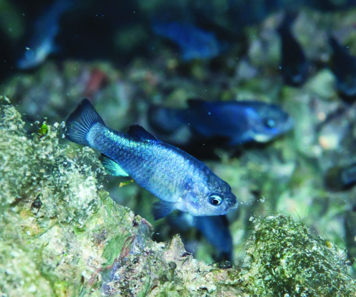
About a third of Death Valley’s bird species have declined over the past century. The endangered Devils Hole Pupfish may be unable to produce viable eggs if the water temperatures continue to rise. A plot of Joshua trees in the western part of the park failed to produce seedlings for the first time in 20 years. Threats to California’s once-stable population of Joshua trees are so intense that the species is being reviewed for listing under the Federal and California Endangered Species Acts.
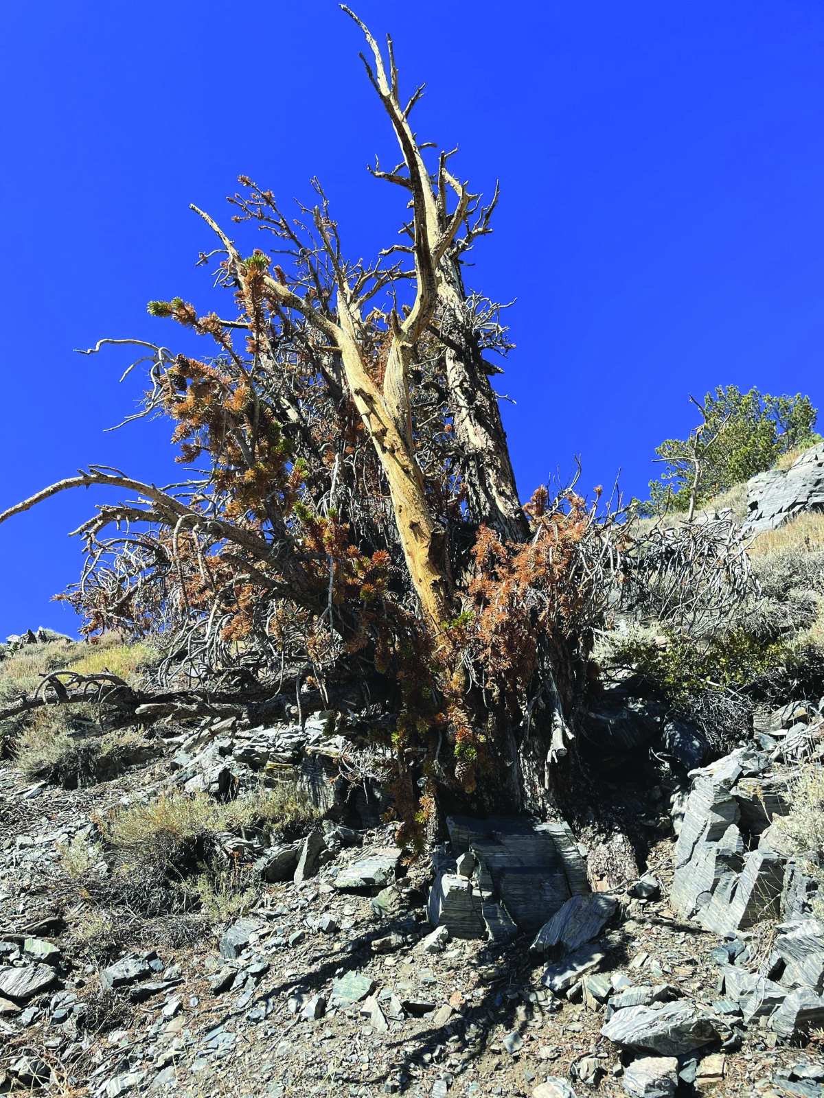
Meanwhile the oldest living things on earth are dying at an alarming rate. “Bristlecone pines are trees that live thousands of years,” says Wines. “So it’s really unusual to see more than one of these ancient trees dying in front of you because they live so long. In 18 years of working for the park, I should maybe see only one of them die. But there’s an area on Telescope Peak where 70% of the bristlecones have brown needles and are actively dying. Maybe a couple dozen of them. That’s a canary in a coal mine.”
But despite the unprecedented challenges, Wines hopes visitors will come enjoy the cooler winter temperatures and Death Valley’s myriad opportunities for recreation. “Even with climate change, Death Valley will always be a vast wild playground,” she says. “Humans need places like this to feed our souls, to rejuvenate, to find solutions.”
***
Main image: A park ranger stands near an overhang of undercut road pavement, looking at pieces of pavement which have broken off and fallen into a wash (NPS / Abby Wines)
Read other articles by Leonie Sherman here.


[…] https://adventuresportsjournal.com/death-valleys-battle-with-climate-extremes/ – Death Valley’s Battle With Climate Extremes […]
[…] https://adventuresportsjournal.com/death-valleys-battle-with-climate-extremes/ – Death Valley’s Battle With Climate Extremes […]