Exploring the Amargosa River Basin
– By Anthea Raymond

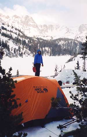
Wedged between Death Valley National Park and Mojave National Preserve, the Amargosa Basin hosts a network of tiny oases — perennial pools bordered by grasses and, in places, willows and cottonwoods. Thermal waters keep rare birds, plants, and animals alive through 120-degree summers and icy winters. Those same springs attract outdoor explorers and “soakers” who come for hot water, big skies, and quiet in the cooler months.
Today, researchers, conservationists, and residents are working to protect and restore the area, and to bring its patchwork of public and private lands under a more coordinated approach.
Running through the basin is the Amargosa River, which lies mostly underground and flows on the surface only when it rains. Near the former mining towns of Shoshone and Tecopa, water bubbles to or close to the surface year-round, feeding wetlands, seeps, and springs.
“The area is like an archipelago, where the ‘ocean’ is the dry desert uplands and the springs are like islands,” says Sophie Parker, Director of Science at The Nature Conservancy. “These oases support life that can only be found on those islands.”
Each “island” of habitat shelters rare species, many of them found nowhere else on Earth.
Most famously, the basin harbors the endemic Amargosa vole, a marsh-dwelling rodent once thought extinct. The federally protected vole is making a comeback in marshland outside Tecopa and in Shoshone, where it was reintroduced by University of California, Davis researchers.
The basin is also home to desert pupfish, the small, minnow-like fish best known from Death Valley. In Shoshone, pupfish ponds behind the RV park help propagate them as part of ongoing wetland restoration.
Friends of the Amargosa Basin, a local nonprofit, works with scientists, landowners, and visitors to support this network of springs and wetlands and to raise awareness of the basin’s unique species, helping knit together the region’s scattered habitats into a more recognizable whole.

SHOSHONE WETLANDS, TRAILS, AND RESTORATION
Shoshone’s main drag and over a thousand acres around it are owned by one person, Susan Sorrells. She inherited the land from her family. Instead of focusing solely on Shoshone’s mining history, she has restored wetlands and created public trails that bring visitors to the river’s edge.
Three short trails wind along the Amargosa River on her property. One begins behind the Shoshone Museum, which houses fossils, geological and historical materials, and an eclectic book collection. Out back, a single blue pole planted in the brush marks the start of a route to the river. A series of poles leads to a plank bridge. On many days the river there is a slow trickle far below the banks, but the steep cut and exposed layers hint at its power during floods; in 2023, high water washed away a lane of the nearby highway.
The restored wetlands and ponds in Shoshone, including the pupfish ponds, are part of Sorrells’ effort to orient the town toward eco-tourism instead of mining. Signs of the mining era remain — especially in Dublin Canyon just outside the village — but the trails, wetlands, and museum now share equal billing.

TECOPA HOT SPRINGS AND A FRAGILE MARSH
Just down the road from Shoshone, Tecopa is built around its hot springs. The area’s thermal waters have been harnessed into a cluster of small spas and campgrounds that draw soakers from California and Nevada.
At Tecopa Palms Therapeutic Hot Springs Resort, Ray Reed and his wife Yvonne run private 104-degree soaking tubs with no added chemicals. Fresh mineral water constantly flows through the baths.
In return, Reed asks for strict cleanliness and multiple showers from patrons. That’s partly out of respect for other soakers, and partly because his runoff helps replenish nearby marsh used by the Amargosa vole and many bird species. What goes into the tubs eventually reaches the habitat.
Borehole Spring, a favorite mud-bathing spot, sits next to a section of marsh on public land. The Borehole itself is man-made — the accidental byproduct of a failed attempt to drill a mine that tapped into the hot aquifer instead. That unexpected overflow created the warm pool that people soak in today. What began as an industrial accident is now a popular soaking site, but its proximity to delicate marsh makes it especially vulnerable to trampling, erosion, and fire.
In February, a nine-acre fire broke out near the spring, leaving a swath of blackened turf. The all-volunteer Southern Inyo Fire Protection District stopped the blaze at the road and kept it out of town. There are no professional emergency services in the region, making a recent fundraiser for the fire district especially meaningful. Local business owners pitch in where they can; Dan Leseberg, co-owner and head brewer of the family-owned Death Valley Brewing, also serves his community as a volunteer EMT.
Today, bulrushes — tall, reed-like marsh plants — have returned around the Borehole, and bathers are back in the water. Multiple signs along the approach trail now warn “Area closed for restoration.” Invasive plants, trampling, and erosion are ongoing concerns. For visitors, the message is simple: stay on signed routes, respect closures, and keep soaps and products out of the springs.

CHINA RANCH AND THE CANYON
South of Tecopa, China Ranch Date Farm sits in a slot of green at the edge of Amargosa Canyon. The privately owned working farm grows at least eight varieties of heritage dates and draws visitors with its palms, baked goods, and trails. The ranch lies over at least five underground springs, making it a true oasis.
From the trailhead near the ranch, hikers can follow Willow Creek into the heart of the Amargosa’s Wild and Scenic section. A roughly three-mile loop leads through canyon walls, alongside willows and reeds, and in wetter periods to a small waterfall. More than 200 bird species are known to use this stretch of water.
The Nature Conservancy holds a conservation easement at China Ranch and is working with partners to better understand and protect the area’s ecology. “We’re setting a baseline to see what’s there — in the air, in the water, and in the soil,” Parker says.

FOLLOWING THE THREAD OF WATER
The Amargosa Basin doesn’t announce itself the way some western landscapes do. Its drama is quieter: a vole slipping through cattails, a pupfish flashing in shallow water, a trickle of river that can turn into a destructive flood overnight.
For visitors, following the thread of water — spring to marsh to canyon — means stepping into a landscape where every pool matters. For the people who live and work here, it means balancing soaking, trails, and small-town revival with the needs of wildlife and the underground river that ties everything together. In the end, it really is the water that holds this place.

—–
COMMUNITY & CONSERVATION
>> Vole Fest
Each March, the nonprofit Friends of the Amargosa Basin (FAB) hosts “Vole Fest,” a community celebration of the endemic Amargosa vole. The mix of science and small-town fun includes habitat tours and a trivia night at Tecopa’s Death Valley Brewing.
The 2026 event is scheduled for March 21, with FAB executive director Cameron Mayer, who studied geography at California State University Long Beach, hoping to again serve as emcee of the trivia night. “It’s a very popular event,” Mayer says. “We challenge people’s knowledge of the basin’s history, wildlife, and geology.” For updates on Vole Fest events and schedules, visit friendsoftheamargosabasin.org.
>> Toward a National Monument
Mayer is also helping lead the effort to establish an Amargosa Basin National Monument. In early November, Inyo County supervisors voted unanimously to support the proposal. Monument status, he says, would streamline management of lands currently governed by piecemeal conservation designations. Mayer works closely with five Native American tribes with ties to the region, as well as local landowners, to build a shared vision for the basin’s future.
***
Read Other Articles by Anthea Raymond Here