Nor Cal Trail Runners Tell Us About Their Healthy Obsessions and Favorite Dirt

Trail running is an equal opportunity sport. It doesn’t require much money or skill, and everyone can break a personal record of some sort. That is, if you bother to be competitive at all, because you certainly don’t have to. You can run for purely therapeutic rewards.
With thousands of miles of open space in Northern California, it’s no wonder that runners of all shapes, sizes and abilities take to the trails daily for a dose of low-cost physical and mental therapy.
But how can you discover this region’s most fantastic trail runs without feeling like a member of the Lewis and Clark expedition? Well, you might start by following the footsteps of some of our readers on their favorite Nor Cal trails. Here they give you the details. Breaking a sweat is up to you.
Runner:Catra Corbett, Fremont
Bio: I am 42 years old. I have been running since 1996 and running ultramarathons since 1998. I have run over 200 ultras, 51 of them 100-milers. I hold the women’s speed record on the John Muir Trail, 212 miles from Yosemite Valley to Mt. Whitney in 5 days, 15 hours and 50 minutes. I also hold the overall yo-yo record on the Muir Trail, 424 miles in 12 days, 4 hours and 57 minutes. In 2002, I ran the Marathon Des Sables in Morocco, a six-day 151-mile race through the Sahara Desert. The runners have to carry a 20-pound pack with all your gear. I was the 19th woman overall and second American woman. Also in 2002, I completed a solo 100-mile run through Yosemite with a nine-pitch rock climb called Nutcracker at mile 57 with my then-husband and noted climber Ammon McNeely. For more info, visit my website: www.trailgirl.blogspot.com.
Average weekly mileage: 80-150
Favorite epic run: Ohlone Wilderness Trail, Alameda County. It starts from Mission Peak in Fremont and weaves for 28 miles through the Sunol Regional Wilderness to Del Valle Regional Park near Livermore. I run a solo 100-mile training run on it every May. I finish off my journey with an official race called the Ohlone 50k, from Mission Peak to Del Valle. In the Sierra, I love doing repeats up and down Half Dome starting from Curry Village in Yosemite Valley. Steep single-track granite trails with the most spectacular views.
Distance and elevation gain: From Mission Peak to Del Valle, it’s 28 miles one way with several long uphills. If you just do the Mission Peak portion, it’s a nice steep 2,700-foot climb to the top on a fire road; 6 miles round trip.
Terrain: This trail run is a combination of singletrack and doubletrack all in pine forest. There are some steep sections broken up by some cruiser flats.
What makes it great: It’s my backyard. I was born and raised in Fremont and when I started trail running that’s where I began. On a clear day, the views are awesome. It’s a tough run – it’s the trail that has made me strong. Mission Peak is one of the most beautiful little mountains in my eyes. It seems easy but it’s all uphill from the start.
Location and parking: Mission Peak Regional Preserve, Fremont. Trailhead is off Mission Boulevard. There are maps at the trailhead. Parking is free and plentiful.
Dogs Allowed: Yes.
Runner:Matt Keyes, Auburn
Bio: After training for a road marathon on the trails around Auburn and deciding the training was more enjoyable than the event, I’ve been hooked on running trails. (Editor’s Note: Last year, at age 32, Matt ran the infamous Western States 100 from Squaw Valley to Auburn in just over 25 hours, 9 minutes.)
Average weekly mileage: Varies from 20s when I’m coaching my two kids’ soccer teams to 75ish when training for a long run.
Favorite epic run: Any of the single-track trails around Auburn, but one of my favorite sections is from our home in downtown Auburn to the fire station in Cool on the Western States Trail.
Distance and elevation gain: About 7 miles one-way. Total elevation change is probably somewhere around 2000 feet.
Terrain: Most of the route is on single track. Typical of most of the stuff around here, the trail condition varies with the seasons from dusty to muddy and if you’re lucky right in between. There are long stretches of fairly level ground and the entire route is runnable. There are some great downhills, varying from screaming along and jumping rocks and water bars to a section of “Holy crap, I think I might be flying!” downhill.
What makes it great: Near perfect single track that descends into the American River canyon, crossing historic No Hands Bridge with views of the confluence of the north and middle forks of the river. This trail has the stuff: technical single track, views of the river, a waterfall, chances to get your feet muddy if it’s been raining. The downhill stretch coming from Cool toward the river is some of the best downhill running I’ve found. As many times as I’ve run it, I still feel like a kid flying down it. If you allow enough time, you can stop at the local downtown Auburn coffee shop, Depoe Bay Coffee Company (893 High St.), which roasts its own beans, and replace some of those calories with a nice hot or blended stimulant to suit the weather.
Location and parking: If starting from Auburn, the Overlook parking lot on Pacific Street is a good starting point. If starting in Cool, the fire station off Highway 49 is the place. Water is available along with porta-loos at either starting point.
Dogs: Dogs are allowed and not required to be on a leash on the trails.
Runners:Sarah Spelt & Wendell Doman, Walnut Creek
Bio: After several years of running road marathons, we discovered trail ultras about 15 years ago and have been running trails ever since. In addition to putting on more than 25 events annually with our family business, Pacific Coast Trail Runs (www.pctrailruns.com),each member of our family typically runs a few 100-milers every year, either as organized events or just as fun runs.
Average weekly mileage: Varies from 25 to 100-plus, depending on what we have going on.
Favorite epic run: Any section of the Diablo 50-Mile course, but one of our favorite sections is from Mitchell Canyon gate over Eagle Peak to the summit of Mt. Diablo.
Distance and elevation gain: About 7 miles one way, climbing from 586 feet to the summit, 3,849 feet.
Terrain: Mt. Diablo has a bit of everything, which is one reason we love running and training there. The section up over Eagle Peak, though, is very technical singletrack that passes Mitchell Rock and then runs along a ridgeline before you emerge on a fire road that takes you through Juniper Campground and within a mile of the summit. The last mile heads back on singletrack trail.
What makes it great: We love running on Mt. Diablo regardless of the trail we’re on, but the trail up over Eagle Peak and on to the summit combines all our favorite components in a short distance – technical exposed up-and-down singletrack over rocky ridges, spectacular views of surrounding towns from the ridgeline, a runnable downhill with a seasonal stream crossing, a good long climb up to the campground, and the reward of seeing San Francisco, Oakland, the Sierra, and more from the summit of this fabulous mountain. Run it at sunrise and it’s truly awe-inspiring.
Location and parking: Mitchell Canyon Gate is one of the entrances to Mount Diablo State Park, and is accessible through the town of Clayton. Parking is available for $3. Take Coulter Pine Trail to Mitchell Rock trail to get started on your run.
Dogs: Dogs are not allowed on the trails.
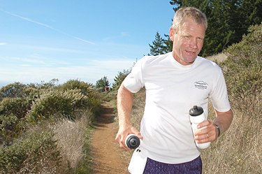
Runner: Scott Dunlap, Woodside
Bio: I’m a 37-year-old trail and ultra runner (see my blog at www.runtrails.blogspot.com), who also enjoys biking, hiking, and getting outside in general.
Average weekly mileage: 60
Favorite epic run: Purisima Creek Loop, located in the Purisima Creek Open Space Preserve, San Mateo County.
Distance and elevation gain: 12 miles, approx. 4,000 vertical feet
Terrain: Mostly shady singletrack and fire roads lined with views, redwoods, and ferns.
What makes it great: I’ve run hundreds of trails in California, and this offers all the best of Cali in one run. You start with epic ocean views and then run down the ridge into the redwood canopy. Entering the redwoods transforms the seascape into a lush canopy of ferns, moss, and trees where the oxygen is rich. I just can’t get enough of this run! This is where I take all my out of town guests, runners and hikers, alike.
Location and parking: The Purisima Creek Redwoods Open Space Preserve’s main entrance and the North Ridge Trail trailhead are located on Skyline Boulevard (Highway 35) 4.5 miles south of Highway 92. Take Harkin’s Ridge to Soda Gulch Trail, then down Purisima Creek Trail and then run back up Harkin’s Ridge.
Dogs: No.
Runner: George Lake, Truckee
Bio: 43 years old. Enjoy marathons. I also enjoy hiking, mountain biking, and snowboarding. Recently gave up working in network security to pursue adventure travel guiding and teaching math.
Average weekly mileage: 20-45
Favorite epic run: Truckee River Legacy Trail / Martis Valley / Dry Lake
Distance and elevation gain: From four to 25-plus miles, with minimal elevation change (adding the Dry Lake section will add a 700-foot climb)
Terrain: A little of everything: Mostly fire road and maintained trail along the Truckee River and Martis Creek with some pavement connecting sections, and some steepish singletrack and fire road on the Dry Lake option.
Location and parking: The Legacy Trail starts from the Truckee Regional Park (plenty of free parking). There are plans to extend this trail but it currently ends after a couple of miles, at which point you can turn right and run along a bit of road to Martis Creek Lake. From there, continue east and across Highway 267 for a nice loop through Martis Creek Wildlife Viewing Area. And/or cross the dam and head up the hill to Dry Lake then follow the fire road back down to Martis Valley.
What makes it great: Great views and the convenience of being able to leave from town without having to drive. And the flexibility is great: Knock out a few easy miles on the Legacy Trail or get in 25-plus with a nice hill climb.
Dogs: Dogs are mandatory, almost (this is Truckee). No leashes are required on any of the individual trails but bring a leash for road crossings if hooking up the trails for a longer run.
Runner: Mike Erbe, Santa Cruz
Bio: I am a 51-year-old wanna-be triathlete and although I’ve been running for years, it is only in the last six or seven that I have run trails. My favorite running races include the Mt. Madonna Challenge, the Wharf to Wharf, and the Firecracker 10K, all of which are in the Santa Cruz area.
Average weekly mileage: 20
Favorite epic run: UC Santa Cruz/Pogonip Preserve trails in Santa Cruz
Distance and elevation gain: 6-10 miles with 300-1,000-plus feet of climbing
Terrain: From the starting point in Harvey West Park in Santa Cruz, the run up through Pogonip to the university is amazing. It is mostly singletrack and quite hilly with trails that wind though woods and meadows. Numerous trail options are available depending upon your time and energy.
What makes it great: This is a great run because of the constant variation in scenery, terrain, and trail options. Pogonip Preserve, coupled with the adjacent university land, features a vast network of running trails. Singletrack abounds (as do the hills) and there are also some sections of fire road. The sandy soil drains well so the footing is great even when it’s been raining. And the university has a rubber track overlooking Monterey Bay if you’re inclined to toss in some mid-run speed work.
Location and parking: A great place to start is from the bottom of Harvey West Park, a city park. From Highway 1, turn onto Highway 9 toward Boulder Creek. Turn left on Fern Street, and left on Limekiln. Eventually, Limekiln turns to Evergreen and leads to the park. There is plenty of free parking and a place to change/shower (or swim if you are a tri-person) after the run.
Dogs: Dogs are allowed on only a few of the trails within Pogonip Preserve.
Runner: Terri Schneider, Aptos
Bio: Speaker, writer, coach. Show me a trail and I’ll run it! (www.terrischneider.net)
Average weekly mileage: 20-100
Favorite epic run: I’ve run trails all over the world and always come back to my local favorite (it’s kind of home base), Big Slide/West Ridge loop in Nisene Marks State Park, Aptos.
Distance and elevation gain: About 19 miles, lots of up, lots of down
Terrain: If you get creative on the front end you can do this run on about 85 percent single track. That is my preference. The single track ups and downs are steep and challenging but the trail is usually well-maintained, barring any slides or treefall. The intermittent fire road sections are a nice place to cruise easy.
What makes it great: I’m totally psyched that given the numbers of runners in Nisene Marks Park each week, hardly anyone else runs single track. Woohoo! That means most of the time I have miles and miles of trails to myself. I’m all about going solo or with one or two training partners. Trail running to me is a Zen experience.
There are certain sections of single track in Nisene Marks that have unparalleled views of the ocean and other areas of the park. The trails are quiet, smooth, challenging and you are completely ensconced in redwood forest. The perfect backdrop for a Zen experience. When my mom asks me if I’m going to church on Sunday, I tell her “Yes! I’m going running in Nisene Marks.”
Location and parking: Enter Nisene Marks via Soquel Drive in Aptos. You can park at the entrance to the park if you want to do the whole run, or you can drive in to the parking lots along Aptos Creek Road to shorten the run. If you enter the park via the kiosk, there is a fee of $6. Or you can buy an annual California State Parks pass for $125.
Dogs: Dogs are allowed on leash up to the second steel gate in the park (about 3 miles in).
Runner: Francesca Stone, South Lake Tahoe
Bio: I’m a Special Events Coordinator for Barton, the local hospital, exercise addict, trail runner and dog/animal lover.
Average weekly mileage: 30+
Favorite epic run: Eagle Point to D.L. Bliss State Park via the Rubicon Trail
Distance and elevation gain: The Rubicon can be run in one direction (6.3 miles), or as an out and back (12.6 miles). If you decide to do it in only one direction, you must leave a second car at one end, or leave a bike and ride back to your car via the road (mountain bikes are NOT allowed on this trail).
Terrain: Dirt singletrack, lakeshore views, man-made features
What makes it great: A classic Tahoe trail run should have stunning mountain vistas, lake access, dog-friendliness and, of course, a great altitude pump. One of my favorites that meets the above criteria is Eagle Point to Bliss State Park on the Rubicon Trail. And yes, there are often eagles at Eagle Point so look up from the trail once in a while.
There are so many great spots to stop along the way that it’s easy to get distracted. I like to run the trail out and back, then have lunch at the car. I can then hike it round trip again, taking some time to explore the Vikingsholm Castle, soak up the sun on the beaches or boulder some of the great problems around Rubicon and Bliss.
Location and Parking: Eagle Point Campground is 8 miles from South Lake Tahoe on Highway 89 north. A State Park Pass or day pass is required to drive into Eagle Point or Bliss State Park Campgrounds. Free parking is available along the highway but this will add some mileage to your day.
Once inside Eagle Point Campground, drive about a quarter mile to the Lower Eagle Point Campground parking area. From here, the single-track trail slopes gently to the lakeshore then skirts Emerald Bay, eventually leading to a gradual climb with unobstructed views of Tahoe’s South Shore and towering Freel Peak. The trail rolls on for several more miles rounding Rubicon Point and the historic lighthouse before terminating in the Calawee Cove parking area of Bliss State Park. For more information on D.L. Bliss/Emerald Bay State Parks, check online at www.parks.ca.gov.
Dogs allowed: Yes, it’s a dog-friendly park.