Hike to these scenic Yosemite waterfalls
Spring brings good things to the Sierra Nevada, like the opening of mountain passes, blooming wildflowers and snowmelt to awaken rivers and creeks. Nothing shows nature’s transition from winter to summer like those streams when they fall over steep rocky cliffs, and no place in California boasts more magnificent waterfalls than Yosemite National Park.
Some great viewing opportunities require only a few minutes of walking. Reaching others takes a full day of high-altitude hiking. Both extremes and choices in the middle are all worthy options. These favorite outings are arranged from least to most exerting.
Bridalveil Fall
Bridalveil Creek falls over a steep drop in a long, elegant flow that resembles a bride’s veil, as the name suggests. This is the first grand sight reached by those entering Yosemite Valley from the west and certainly merits a stop. Turn right off Southside Drive towards Highway 41 and quickly turn left into the parking area. The hike to the viewing area is a quarter-mile long with some gentle climbing.
Lower Yosemite Fall
A half-mile hike on a paved trail takes visitors to the base of one of the world’s highest and prettiest waterfalls. Park on Northside Drive near Yosemite Lodge or take the shuttle to the Lower Yosemite Fall stop. The viewing area affords a fine look at the lower cascade, though the approach walk shows off the entire waterfall. For variety, make the outing into a loop by crossing the bridge at the viewing area and returning on the pleasant wooded trail east of the main route.
Wapama Fall
Discover the park’s wonder outside Yosemite Valley at a powerful yet little-known waterfall at Hetch Hetchy Reservoir. Find the road heading northeast to Hetch Hetchy west of the Big Oak Flat entrance.
From the parking area, cross O’Shaughnessy Dam and walk through the tunnel. Continue east along the shoreline over moderate climbs and drops. Early-season visitors will first see Tueeulala Falls. Wapama Fall, a 2.5-mile hike from the parking area, tumbles down a staircase of granite almost year-round.
Mind your watch, because Hetch Hetchy Road closes between 5pm and 9pm, depending on the season; check the park website or inquire at the entrance station.
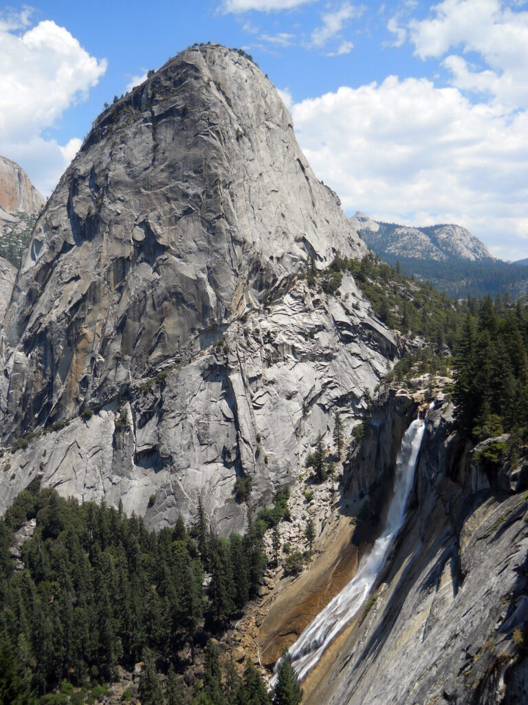
Vernal Fall & Nevada Fall
Vernal Fall and Nevada Fall have enthralled millions of visitors on the park’s most popular hike. These two scenic wonders on the Merced River can be enjoyed on a single loop hike of about seven miles.
From Curry Village, walk a half mile or take the bus to Happy Isles. Here begins a steady 400-foot climb to Vernal Fall Bridge, where you’ll get your first good look at the 317-foot namesake. This segment is a doable hike for most anyone, including families with small children.
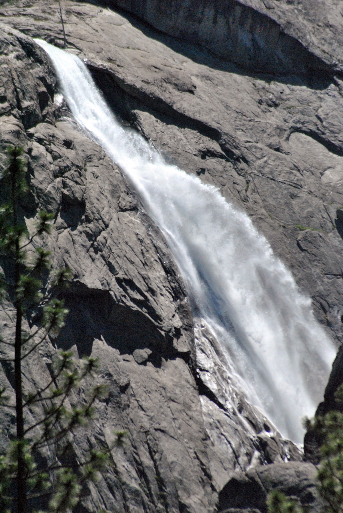
Shortly after the bridge, hikers reach a fork in the trail. Some turn right up the switchbacks of the John Muir Trail, which rejoins the Mist Trail above Nevada Fall in about three miles. Most turn left to stay on the Mist Trail, which ascends some 600 rocky stairs to the top of Vernal Fall. Now’s the time to put on your rain gear, for the Mist Trail earns its name, especially in spring. The drenching hikers receive is a small price to pay for a great close-up look at the waterfall.
Enjoy the view from the top of Vernal Fall but respect the warning signs and railing separating hikers from Emerald Pool. The algae-covered rock beneath the current is incredibly slick. Fatalities have occurred here when visitors waded into the water and were swept over the fall.
Crowds thin out considerably by Nevada Fall, about two miles away and 900 feet higher. Cross a footbridge just past Emerald Pool. About a mile later, beneath Liberty Cap, turn right toward the Nevada Fall footbridge. Enjoy looking down on the raging Merced River and the 594-foot waterfall.
For more variety, go back on the John Muir Trail. This affords hikers a terrific view of Nevada Fall and Liberty Cap, and another of Vernal Fall at Clark Point.
Chilnualna Falls
Chilnualna Falls consists of a 240-foot waterfall and several impressive cascades in a little-known part of Yosemite. The half-day, seven-mile outing near Wawona provides an interesting alternative to better-known hikes in Yosemite Valley and Tuolumne Meadows.
From Wawona Road just north of Wawona, turn east on Chilnualna Falls Road. Drive about 1.5 miles past a school, grocery store and cabins to a parking area.
A sign points to the trailhead and there’s quickly a fork dividing hikers and horseback riders. Take the hikers’ option which passes by the picturesque Lower Cascade of Chilnualna Creek. After steep stone stairs, the trail turns, climb
s and winds its way northward up a ridge.
The climb eases as hikers ascend on switchbacks through a forest of oak, pine and cedar trees. Hikers will get their best view of Chilnualna Falls after turning east on the final switchback. Enjoy it here, for though it’s a quarter-mile distant, the trail offers no closer view. But the worthy Upper Cascades of Chilnualna Creek await above the main waterfall.
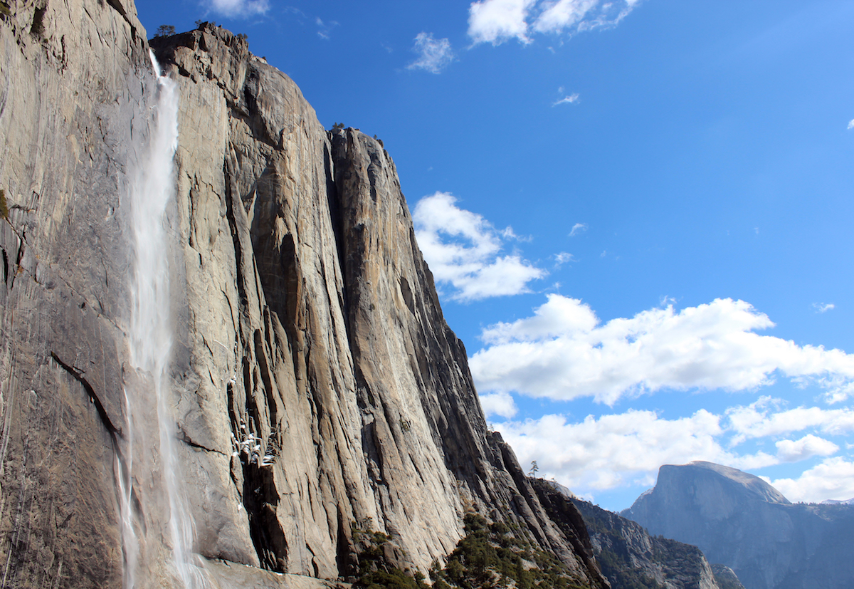
Upper Yosemite Fall
This physical hike is both the most difficult and most rewarding of our magnificent seven outings. Gaining 2,692 feet of elevation, the Yosemite Falls Trail provides a challenging workout but repays faithful travelers for every step. Those who go the distance (seven miles round-trip) get to stand beside the brink of a raging Upper Yosemite Fall.
The trail begins north of Camp 4 and so does the climbing. Welcome to the world of switchbacks. You’ll complete dozens of them and gain about 1,000 feet by Columbia Rock, a good spot to enjoy the view, rest and assess your progress.
From Columbia Rock, the route flattens for about a mile, still with some ups and downs; watch your step on the sandy switchbacks. Then you get your first look at Upper Yosemite Fall. Soon after that, a spur splits from the main trail to an outlook with the trip’s best view of the entire 2,425-foot waterfall: Upper Yosemite Fall, the Middle Cascades and Lower Yosemite Fall. The route’s next landmark is the winter closure gate. Most reach this in about half the time they take to reach the trail’s top.
Now the switchbacks return. Early in the season, a cool mist will ease your ascent. After the waterfall dries up in summer, expect a solar beating. There’s manzanita and gravel requiring careful footing, but no shade on the upper portion of the trail that gains some 1,600 feet. Good thing you’re tough!
The climbing ends at the upper winter gate. From here, a narrow and exposed path drops about a quarter-mile to a fenced viewing ledge beside the upper lip of the waterfall. Hikers get to stand just a few feet away from the thundering river as it shoots into the void. Enjoy your stay and retrace your steps to return to Camp 4.
This spring the waterfall season looks to peak early, so get out there!
Read other articles by Matt Johanson here.