


Discover Sierra gems beside the JMT this summer
Words and photos by Matt Johanson
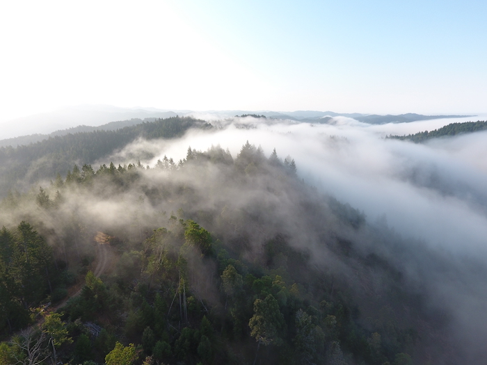
As summer begins, snow melts, wildflowers bloom and hikers turn their minds to backpacking season. Thousands of them covet a journey along the magnificent John Muir Trail, the 210-mile trek from Yosemite to Mount Whitney, yet this route has become so popular that rangers reject 97 percent of permit applications. But alternatives abound in the splendid Sierra Nevada mountains. Here are some choices which you might even enjoy more and will not require months of frustrating efforts to get an elusive JMT permit.
Tuolumne Meadows to Sonora Pass

This section of the Pacific Crest Trail leads through northern Yosemite and Emigrant Wilderness. It’s physically demanding but delivers access to rarely-seen peaks and seldom-visited lakes. The 70-mile trek takes five to seven days. Get a permit at the Tuolumne Meadows wilderness office.
Starting at Lembert Dome, the hike leads north to Glen Aulin High Sierra Camp, where most passersby stay a night. Continue north into Cold Canyon as the number of surrounding hikers drops to nearly zero. Miller Lake is a good goal for the second night. Enjoy the grand and countless granite peaks and domes for which Yosemite is rightly known.
Benson Lake is a detour from the PCT but most worthwhile. You won’t regret hiking a few extra miles to enjoy this High Sierra gem. Once back on the PCT, climb to Seavey Pass and through Kerrick Canyon. Wilma Lake and Dorothy Lake are highlights and worthy overnight stops. Many of these lakes offer excellent fishing, even for novices, so pack along a rod and reel to improve your dinners.
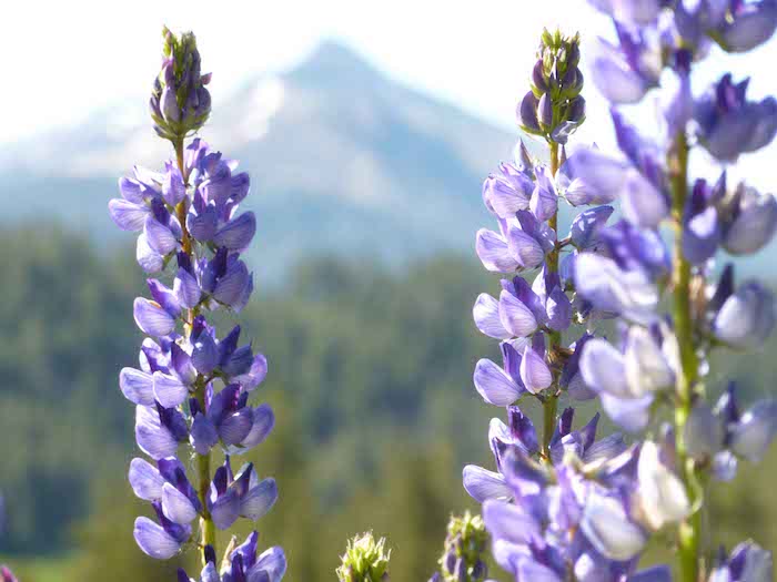
After leaving Yosemite and pushing into Humboldt-Toiyabe National Forest, consider spending a night at Kennedy Canyon because few appealing camping options and precious little water are found between here and Sonora Pass. Make sure to fill water bottles before leaving. Beware of snowfields on north-facing slopes early in the season on the final push. Your final miles twist and turn as you descend more than a thousand feet past whitebark pines and seasonal wildflowers.
Sonora Pass to Echo Summit
If the previous segment left you hungry for more, then you can keep right on going north on the PCT from Sonora Pass. The next stretch leads through Carson-Iceberg Wilderness and Mokelumne Wilderness, a 67-mile trek that takes four to six days. Get a permit at the Stanislaus National Forest office at Pinecrest.
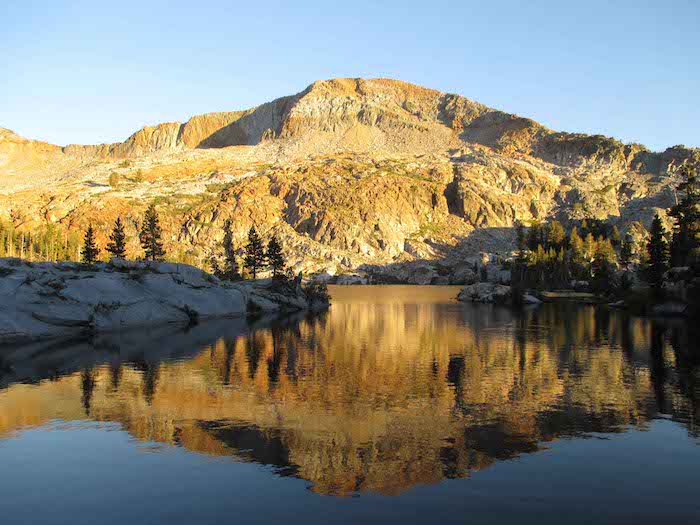
Starting at a trailhead of 9,623 feet and climbing steeply from there, you should plan some time to acclimate if coming straight from sea level. Plan to spend one night between Sonora Pass and Ebbetts Pass. There are no lakes on this portion so keep your eye out for appealing streams when choosing a campsite. In contrast to Yosemite granite, this area features vast and fascinating areas of volcanic rock.
When you reach Highway 4 at Ebbetts Pass, you might encounter “Trail Angels,” who give free food and drinks to backpackers! These generous souls, many of them former thru-hikers, definitely deserve their nickname. A pond beneath Ebbetts Peak makes a good spot for your next camp. Continuing north, our route passes Tamarack Lake and Lost Lake on the way to Carson Pass. If you want to bag a peak on the way, Elephants Back (9,585 feet) provides a good opportunity for a short detour; the southwest slope is the easiest to climb.
After Carson Pass, hikers will reach picturesque Meiss Meadow, where the German immigrant Meiss family built a cabin and barn in the 1870s and spent summers there well into the 20th Century. The historic buildings still stand. Later, Showers Lake provides a good spot for lunch and a swim. Push on to Echo Summit where, if you’re lucky, more Trail Angels will greet you with hot food and cold drinks.
Devils Postpile to Glacier Point
Discover glorious and little-visited wilderness on this trans-Sierra trek, a 50-mile route that takes about five days. Route finding on this journey will be more difficult than the PCT segments, so carry a good map and compass. Get your permit at the Inyo National Forest office in Mammoth Lakes.
Take the shuttle from Mammoth Lakes (or drive during evening hours) to Devils Postpile. Cross the river and the JMT, taking a southwest-bound pack trail climbing to Granite Stairway. Then our path drops steeply to the North Fork of the San Joaquin River canyon, a good camping spot. Be sure to get water here, because the climb out of the canyon will be long, steep and dry. Reaching a dirt road, hike west past Indian Meadow and Soldier Meadow before reaching Granite Creek Campground. Turn north here onto a trail leading to Cora Lakes, another good campsite. Continue north and then west past Sadler Lake, Isberg Lakes and Isberg Pass, which marks the border of Yosemite. If you’re the climbing type, consider a short detour to summit Isberg Peak, 10,996 feet tall.
Continue west over Red Peak Pass, past the Ottoway lakes, and beside Lower Merced Pass Lake. Now our route descends past the wildly scenic Illilouette Creek and through a burned forest on the final approach to Glacier Point, where restrooms, a snack bar and hopefully a ride back to civilization await.
Conditions on each of these routes are generally best between July and September, though this year’s heavy snowfall will mean a later backpacking season. Now you’ve got time to plan, several excellent route choices, so get out there!


5