Inyo County offers moderate majesty for adventurous hikers
Words and photos by Matt Johanson
What dramatic extremes fill Inyo County. The large rural community on California’s eastern border boasts the tallest mountain in the lower 48 states, the lowest and hottest points in North America, and the oldest trees in the world. Mount Whitney, Death Valley and the Ancient Bristlecone Pines Forest all deserve attention.
Yet one need not climb high mountains, trek through arid desert or even venture far off Highway 395 to discover rewarding and accessible adventures. Consider the following outings on public land of Inyo National Forest or Bureau of Land Management, all easily reached in summer and fall, and free to visit.
Fossil Falls
A short walk leads to a fascinating area of sculpted rock. Owens River, which flowed at far greater volume during the last ice age than it does today, carved volcanic basalt into smooth and interesting shapes. How different this area must have been during the Pleistocene Period when volcanoes erupted often and giant lakes filled this now-dry valley.
Look for a Fossil Falls sign on Highway 395 north, about 40 miles south of Lone Pine, and follow a dirt road to a parking area with picnic tables and an outhouse. Fossil Falls is just a quarter-mile walk away on a marked trail.
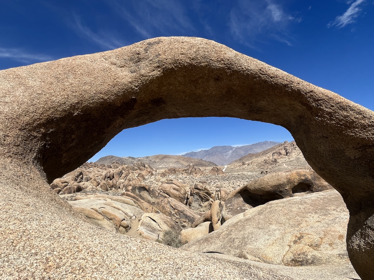
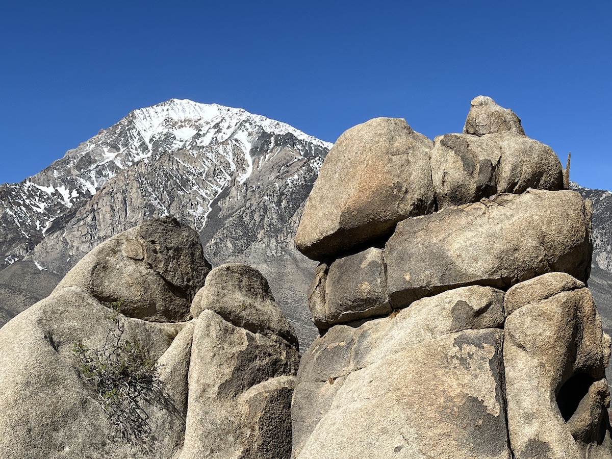
Alabama Hills
Wind erosion created the curiously shaped arches and formations of granite in this nearly 30,000-acre area between the highest Sierra Nevada peak and the Owens Valley. Hikers, climbers and photographers enjoy exploring the landscape of which 18,610 acres became a National Scenic Area in 2019.
Civil War-era miners sympathetic to the South named the hills for a Confederate battleship. An effort to rename the area began in 2020, but the government hasn’t done so yet.
Multiple short hikes lead through the Alabama Hills. If you only do one, make it the 1.5-mile Mobius Arch Loop Trail, which leads to the photogenic Mobius Arch. The “money shot” looks west through the arch at dawn to capture morning light on Lone Pine Peak and Mount Whitney.
From Lone Pine, take Whitney Portal Road west for 2.7 miles and turn right onto Movie Road.
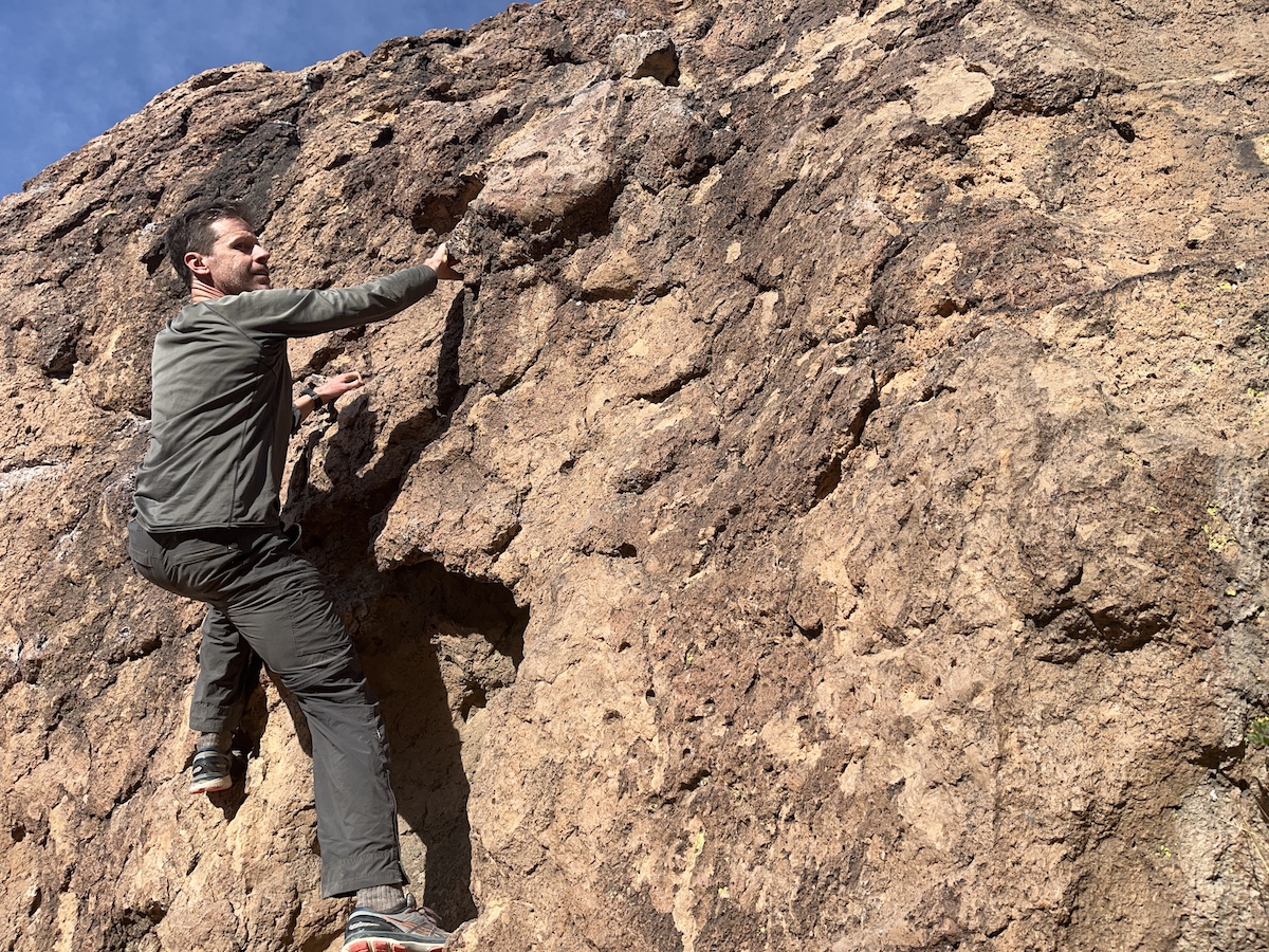
Happy Boulders
These stones live up to their name. House-sized boulders consisting of volcanic tuff rock have tumbled into narrow canyons, creating happy hiking and climbing for visitors. If you’re more of a hiker, you can still scramble low on the rocks for fun, carefully. The trail extends about a mile to the canyon’s end.
From Bishop, drive north on Highway 395 and turn onto northbound Highway 6 for 1.5 miles. Turn left on Five Bridges Road for 2.4 miles and then turn left onto unpaved Chalk Bluff Road for 2.3 miles to the parking area. The trail to the boulders leads to the north.
Buttermilk Boulders
Named for the dairy farming that was once common here, Buttermilk Boulders consists of massive glacial boulders (consisting of quartz monzonite and closer in size to mansions than houses) in close proximity to Mount Tom and neighboring High Sierra peaks. Some 500 bouldering problems attract climbers from around the world, but you don’t have to be a climber to walk around and appreciate the unique and inspiring scenery. Multiple trails lead through the area so pick one and explore.
From Bishop, take Highway 168 west to Buttermilk Road, turn right and drive 3.4 miles on a dirt road to a parking area.
Horseshoe Meadow
If you’ve come this close to the High Sierra, you really should try some high-elevation outings. A four-mile loop leads around scenic Horseshoe Meadow, by streaming creeks and past foxtail pines. Swimming in the creeks are small and beautiful fish which inspired the name of this Golden Trout Wilderness. Those rare foxtails grow only in the Southern Sierra and can live more than 2,000 years. Save this one for after you’ve acclimatized a while because the trail, while fairly flat, stands around 10,000 feet above sea level.
To make a loop, connect the Cottonwood Pass, Trail Pass and Mulkey Pass trails.
From Lone Pine, turn west onto Whitney Portal Road. After three miles, turn left onto Horseshoe Meadow Road. Drive about 20 steep, curvy and adventurous miles to the road’s end at Horseshoe Meadow trailhead.
Treasure Lakes
A half-day outing leads to dreamy alpine lakes beside a striking mountain which may inspire climbers. From South Lake, take the Bishop Pass Trail to the south and turn right toward Treasure Lakes at the junction. Our route meanders westward before turning south and climbing to the lakes. A round trip involves about six miles between 9,800 feet and 10,700 feet.
Treasure Lakes offer good swimming and fishing. Neighboring Hurd Peak, a strenuous class 3 climb, was named for engineer H.C. Hurd who made the first known ascent in 1906.
From Bishop, drive southwest on Highway 168 for about 15 miles. Then turn left onto South Lake Road and drive another six miles to South Lake. Park in the day use area.
Onion Valley, Kearsarge Pass area
If you’re annoyed that the Alabama Hills are named for a Confederate battleship, here’s a good remedy: visit the Kearsarge Pass area, named for the Union ship which sank the Alabama in 1864. A five-mile round trip trek takes hikers to Little Pothole, Gilbert and Flower lakes, which offer good swimming and fishing.
Ambitious hikers can continue to Kearsarge Pass which delivers broad and grand views of Kings Canyon National Park. That extends the trip to nine miles round trip.
From Independence, drive west on Onion Valley Road for 13 miles to a large parking area. Kearsarge Pass trailhead stands at 9,200 feet, the lakes at about 10,500 feet and Kearsarge Pass at 11,700 feet, so take your time and take it easy.
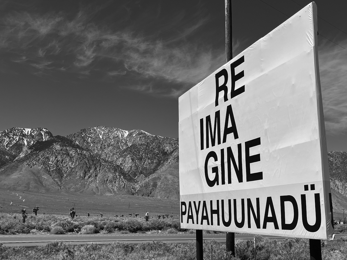
In these parts, white settlers’ removal of the Paiute and other tribes to distant reservations was the main event of the 19th century. Los Angeles’ securing rights to water and building an aqueduct to deliver it to Southern California transformed the 20th century.
Signs of both conflicts remain in the 21st century, as the Paiute regrouped on a reservation in Bishop and Los Angeles Department of Water and Power signs mark the landscape throughout the region.
The name Inyo comes from a Paiute word meaning “dwelling place of the Great Spirit,” but one need not be Indigenous to feel spiritually moved by the grand scenery. These warm-ups may inspire you to return for more ambitious outings, like the Ancient Bristlecone Pines Forest, Death Valley and Mount Whitney. Inyo County deserves your time.
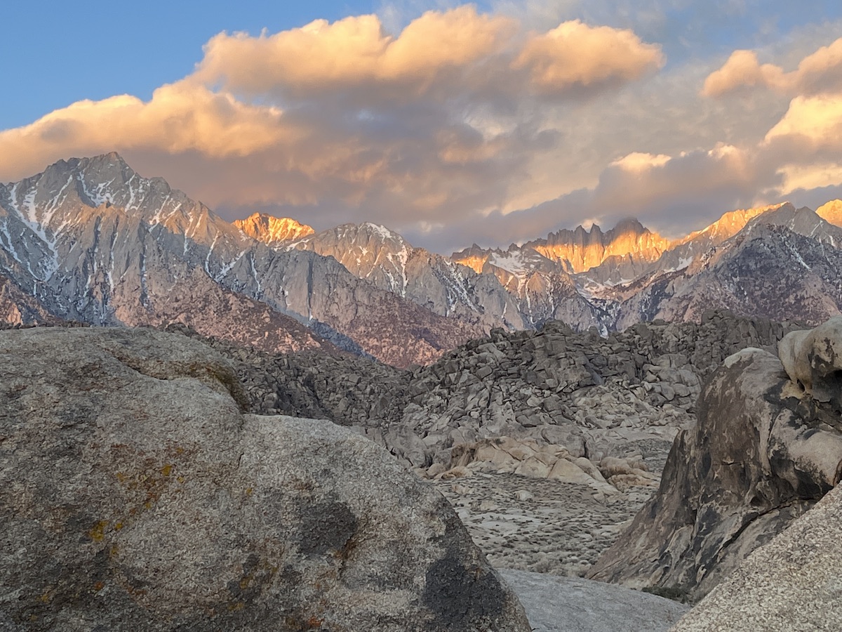
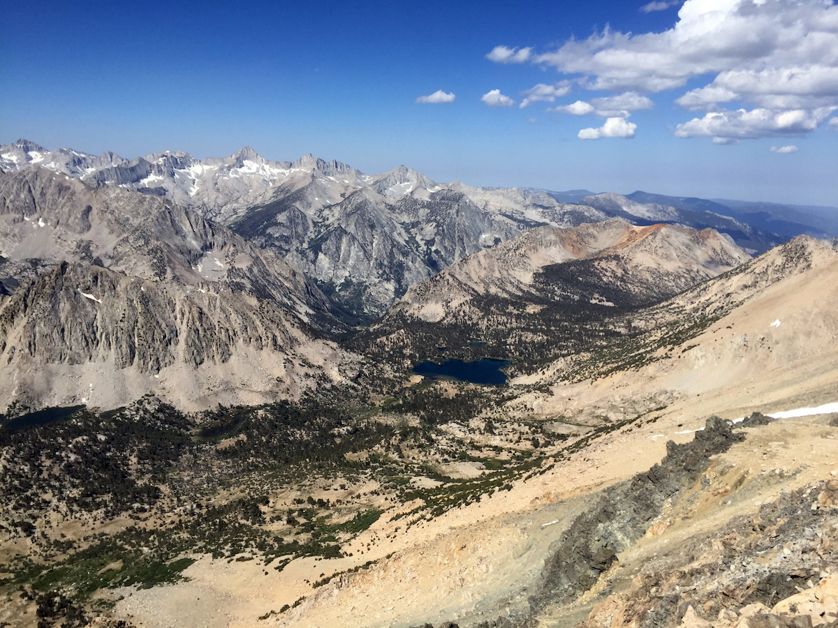
MAIN IMAGE: The spectacular southern Sierra, including Mt. Whitney as viewed from the east.