For some skiers, nothing beats “getting walled”
Story and photos by Brennan Lagasse
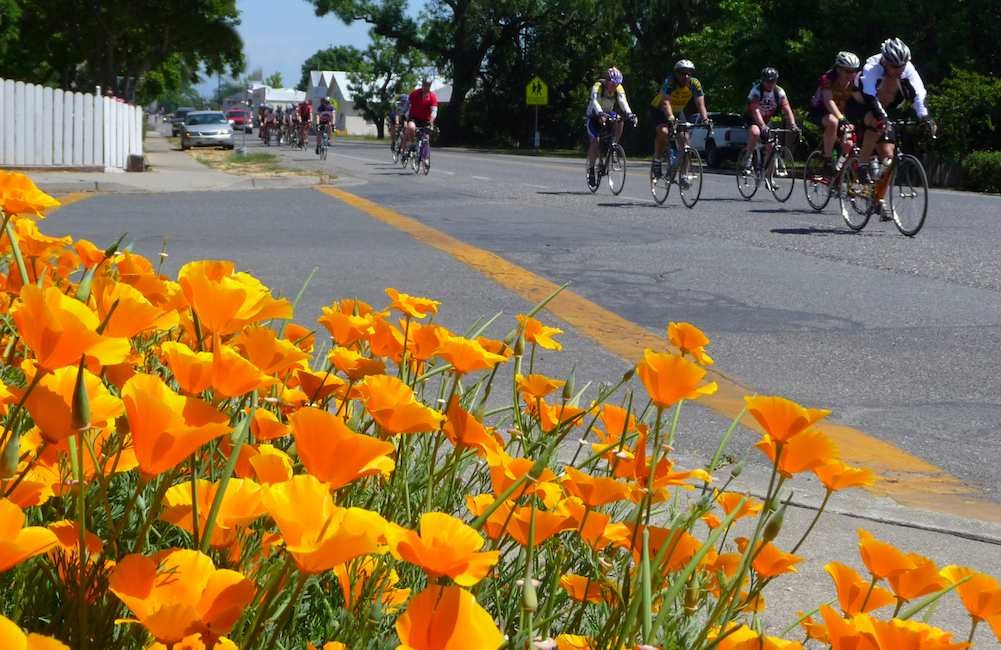
Although California’s ‘Range of Light’ is known for many things, to backcountry skiers it’s famous for some of the best couloirs found anywhere on the planet. Striking corridors of snow easily identified by the rock walls that make up their borders are plentiful in the Sierra, nowhere more so than off that black ribbon of mountaineering dreams, Highway 395.
Peak bagging, chasing powder, dropping a steep cliff face — these are all easily understood and revered for their worth in the ski world. However, those of us who look for the most aesthetic line on any given peak know couloirs offer some of the most unique and satisfying ski descents any snow slider can find. 
Some choose to look past the adventure that’s found when couloirs become primary ski objectives while others don’t, or rather can’t.
When you climb your line, you gain intimate acquired knowledge about the snow you’re planning to ski. It takes a lot longer to ski this type of terrain, and depending on one’s chosen objective, you might have to plan for long days in the field. But once you’ve ascended your line, taken in the view from wherever you’re planning to drop in, and arc your way down a sliver of snow lined by beautiful natural walls of rock, you’re hooked.
As much as I love powder and new mountains to climb and ski, I’ll choose a couloir descent over a snowfield, ramp, bowl, or ridge any day.
There’s a plethora of choices for “getting walled” in the Eastern Sierra. There are so many notable descents the tick list is literally never ending. I’ve found once you tick one off there are easily five more to replace it. It took me a while to think of just three specific couloirs to highlight. What to choose? The Matterhorn has its East and West Couloir. North Peak’s North Couloir and just about every line that drops off the Dana Plateau is pure bliss. What about the Scheelite and Mt. Emerson and its North and Zebra Couloirs? How about the Mountaineers Couloir off the highest peak in the lower 48? We could go on for days here, but I was finally able to choose a few that I think are about as worthy as any line you can find anywhere.
Here’s a breakdown of three absolute classics listed by increasing level of difficulty and reverence.
Pinner Couloir, Laurel Mountain
- Top of descent elevation: 11,800’
- Descent in Vertical Feet: 3400’
- Slope: 35-38 degrees
- Aspect: East
- Distance from trailhead: 3.25 miles
- GPS: 37.578/-118.890
- USGS Map: Convict Lake
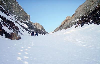
Notes: In a range packed to the brim with aesthetic couloirs, the Pinner holds its own as one of the most beautiful lines in California. There are two options for access. One is to first summit Mt. Laurel via the northeast ridge and then traverse to a large east facing bowl, which is the entrance to the couloir. But booting up the couloir is the best way to know what you’re getting into and what snow conditions will be like. Contour around the northeast face of Laurel up into Convict Canyon for this route. The couloir entrance will come into view on your right as you gain some elevation. Conditions in the Pinner can change quickly, and since it faces east, snow quality is always a question. The Pinner is a frequent flusher as well, meaning it sheds new snow often during and after storm cycles. The large rock walls shade the couloir for most of the year. The adventure with the Pinner is you can never see too far in front of your current turns. Extreme caution should be taken since this line does harbor rock fall and avalanches frequently and once you’re in it there are very few safe spots. As far as aesthetic couloirs go, this is a fairly accessible, gorgeous line; not too far from the trailhead or exceptionally steep.
Bloody Couloir, Bloody Mountain
- Top of descent elevation: 12, 522’
- Descent in Vertical Feet: 5342’ (about 2600’ for the couloir proper)
- Slope: 40-45 degrees (depending on time of year/snowfall)
- Aspect: North
- Distance from trailhead: 6.5 miles
- GPS: 37.561/-118.909
- USGS Map: Bloody Mountain
Notes: The Bloody Couloir is one of the most classic lines on California’s Eastside. Recently named as one of the 50 Classic Ski Descents of North America it’s hard to find a more prominent line off the 395 corridor. You can actually see the Bloody Couloir many miles away dropping down Conway Summit to Mono Lake, and as you get closer and closer to Mammoth Lakes it just looks better and better to ski. This line is a step up from the Pinner in terms of steepness and overall rowdy factor and your experience will greatly depend on the time of year you choose to ski it. It’s seen tracks as early as October and as late as July. The approach can be considerably shorter if the high-clearance four-wheel drive road leading to the base of the couloir is passable. Otherwise it’s just a long slog to the base and boot up. Generally, the Bloody is considered to be about 42-43 degrees, but less snow in November or ample snow in May causes the pitch to either grow or back off.
North Couloir, Red Slate Mountain
- Top of descent elevation: 13,163’
- Descent in Vertical Feet: 5583’ (about 2000’ on the peak proper)
- Slope: 45-50 degrees
- Aspect: North
- Distance from trailhead: 8 miles
- GPS: 37.509/-118.869
- USGS Map: Convict Lake
Notes: In my opinion, this is the one. Building in difficulty and grandeur from Pinner and Bloody, the North Couloir of Red Slate Mountain is one of the most beautiful ski lines in the lower 48, let alone California. The North Couloir splits off the top of Red Slate and once a backcountry ski mountaineer views this gem for the first time, it’s just about impossible to think about anything else until they ski it. It’s a perfectly silhouetted peak on the Sierra Crest, with a perfect couloir right down the middle. The danger factor and exposure is much higher on Red Slate, and a lot of that will depend on which way you access the North Couloir. Either take the west ridge to the top, or climb the North Couloir if that’s what you plan to ski. Once at the top of the couloir either head left across an extremely exposed face where a fall is not an option or head right, if possible, through what’s known as the alternate entrance. This is a much less exposed and safer way to get into the North Couloir. The couloir proper is much bigger than it looks from afar, about 100 feet wide. It’s a straight down fall line, 2000 feet of sustained steep skiing, and easily one of the most memorable runs found on the Eastside.