


Old Coulterville Road offers a Journey Through History
Words and photos by Matt Johanson

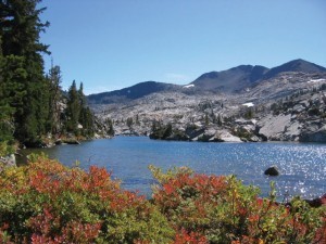
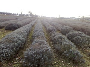
Dawn arrived on a clear and chilly day, revealing a gentle stream, wooded hills and a dirt road that extends beyond the horizon. From this spot beside Bower Cave in Mariposa County, Yosemite Valley is 25 rugged miles away.
Today the picturesque scene appears much as it did in 1870, when local prospectors gave up on mining gold in favor of other enterprises, like tourism. No road connected Yosemite Valley with the outside world then, and a trip from San Francisco took days and required the use of steep and rocky mule trails. 
Speculators believed a toll road to the valley that accommodated horse carriages would pay better than a gold mine, and the Coulterville and Yosemite Turnpike Company won sole rights from park commissioners to build one. An engineer figured construction would cost $20,000. Dr. John McLean, the company’s owner, put his life savings into the project.
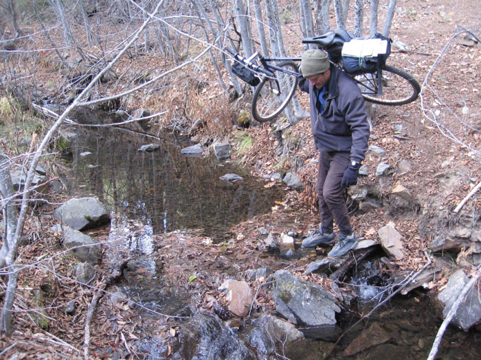
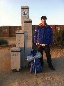
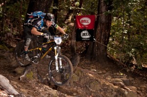
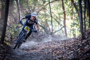
Retracing McLean’s route was our objective when my cousin Andy Padlo and I arrived with our mountain bikes some 140 years later. Carrying light rations and just-in-case overnight gear, we started early on the route’s long initial climb on a well-traveled dirt road beside homes and ranches. A few hours later, we’d passed Pilot Peak, covered a dozen miles and climbed 3,500 feet. Before long, we passed the park border (no fee!) and enjoyed a visit to the Merced Grove of Giant Sequoias. The adventure was off to a good start.
McLean probably felt the same as his construction crew progressed on the project he believed would make him a fortune. But to his dismay, California revoked his road’s “exclusive” contract and permitted a Tuolumne County rival to build a competing road through Big Oak Flat. The race was on to finish first.
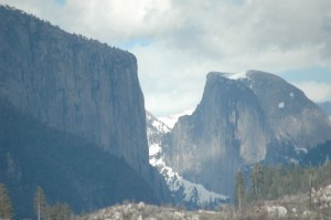
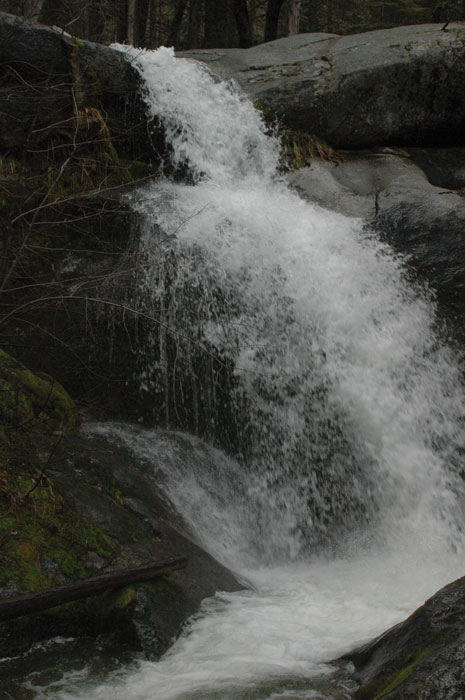
Those wishing to follow that race today must carefully navigate McLean’s original route amid the park’s many other trails and forest roads, we learned. As a local history buff, Andy had collected maps and writings about Old Coulterville Road for years. Our ride took us past rarely-seen Little Nellie Falls and an excellent vista of both El Capitan and Half Dome before we reached the road’s last and steepest portion.
That segment where the road drops into Yosemite Valley was the most difficult phase of construction, and by carving a road three times steeper than the steepest mountain road permitted today, the Coulterville crew won the race against the Tuolumne team in the spring of 1874. Now visitors could travel from San Francisco to Yosemite without horseback riding in only 36 hours, even if the route “frightened women travelers and caused various accidents,” an observer reported.
“Fifty carriages passed over the road on June 18, and the procession was over a mile long,” reported a local newspaper. “Great enthusiasm prevailed. Gun powder, as well as other fireworks, was brought into requisition, making the grand old heights luminous and ringing. Flags were flying, and the entire Valley was illuminated by bonfires on the cliffs.”
No such fanfare greeted Andy and me when we completed the road though we did treat ourselves to a lodge cafeteria dinner. We figured we’d earned it because the final drop posed unusual challenges including many downed trees and an enormous rock slide at the end of the “road.” So after overcoming the unique challenge of bouldering with bikes on our shoulders, we eschewed the usual backpacking fare while reflecting on the road’s little-known story.
Old Coulterville Road attracts only a handful of Yosemite visitors because winning the race to reach the valley first did not secure its future. Only 29 days after it opened, the Big Oak Flat and Yosemite Toll Road Company completed its route which it opened to the public toll-free. This road became Highway 120. Before long, the Mariposa route that became Highway 140 followed suit.
Naturally, the free roads attracted more traffic and became the preferred routes into the park, to McLean’s lasting fury and financial ruin. The Coulterville route ultimately cost $105,000 in 1870s dollars but never made even half of that back. His family pursued a legal claim against California until 1917, unsuccessfully.
“I would have seen them all in hell before I would have put a dollar in a road if I knew another road would be allowed on the same side of the valley,” McLean groused. “But I had already spent $11,000 on the road from Hazel Green when the action took place. I had no choice but to finish.”
Entrepreneurs may find a cautionary tale in McLean’s story but I appreciate his effort to open the park to a world that didn’t know it in his day. Visiting Yosemite, with its abundance of discoveries and activities, never disappoints, and traveling there under one’s own power gives frequent visitors a new experience, we found.
After a day of bicycling on long-forgotten dirt roads past giant sequoias, a secret waterfall and rare mountain views, the incomparable valley became not so much a destination as a reward, and the historic ambiance was an added bonus.
“If you listen close, you can almost hear the wagon wheels creaking,” Andy said.
Matt Johanson is writing “Yosemite Adventures,” a guidebook of hikes, climbs and winter treks. His writing can be found at www.mattjohanson.com.
———————————————————————————————————————————
If You Go
Old Coulterville Road begins near Bower Cave at the intersection of Bull Creek Road and Old Yosemite Road/Forest Road NF-S201. About 25 miles later, it ends in Yosemite Valley at El Portal Road/Highway 140 near Elephant Rock.
One interesting segment with relatively easy navigation goes from Bower Cave to the Merced Grove (about 14 miles). Take the second left at the Five Corners intersection. From Merced Grove, you can hike about 2 miles to Highway 120 (biking is not permitted between the highway and the grove).
Another worthy portion is the steep final descent into Yosemite Valley. From Highway 120, turn into the Foresta development and stop at the large trash bin on the left. Behind it, pick up the two-mile trail to El Portal Road. Watch out for fallen trees and boulders!


Cool read, even cooler adventure. I’ve driven and explored the beginning of this route. When was this trip of yours taken? California had quite some rain this last Winter 2016/17, thankfully but our roads are definitely in poorer shape.