Kings Canyon: High Country Winter Treks
Those seeking winter wonder without the crowds and traffic of Lake Tahoe can find an attractive alternative at Kings Canyon National Park. Striking scenery and moderate trails in the Grant Grove area provide rewarding day trips for beginning and advanced cross country skiers and snowshoers.
Grant Grove Village, with a visitor center and store, makes a perfect starting point. Highway 180 leads directly there from Fresno. Visitors can find parking, trail maps, rental gear, food and supplies. Most of the marked snow trails begin here, too. Here are a few favorites listed from easiest to more challenging.
General Grant Loop Trail
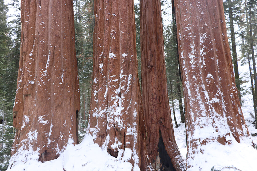
This four-mile outing, which takes two to four hours, leads through a wondrous grove of giant sequoias. General Grant Tree, the best-known of these, boasts numerous distinctions: it’s the largest tree in the park and second-largest in the world. President Coolidge named it the national Christmas tree and President Eisenhower declared it a shrine to the nation’s war dead. Ulysses Grant, the 18th President and Civil War general, never laid eyes on the tree or the park. Still, he fought to end slavery, making him more worthy of tree-naming than others so honored. 
Follow green trail markers north past the stables. After about a mile, the trail splits as the loop begins. Turn left for the shortest trip to General Grant Tree. From here, you can simply return the way you came, but why not continue the clockwise loop for the full experience.
Panoramic Point / Park Ridge Lookout
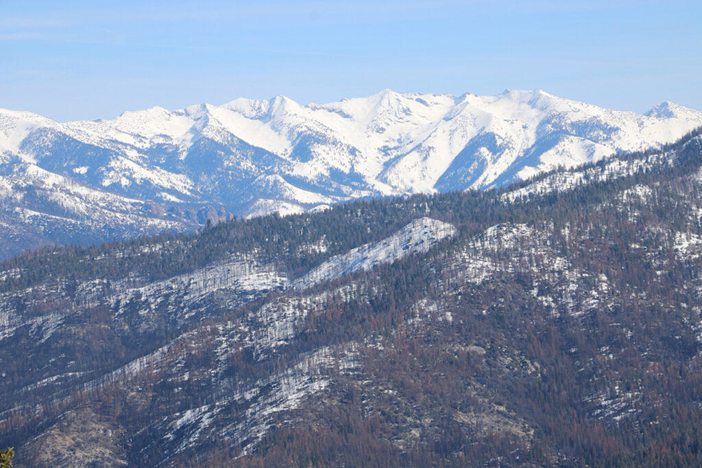
This trail leads to a spectacular vista at Panoramic Point on its way to a second rewarding view at the more distant Park Ridge Lookout. Most visitors trek to Panoramic Point and return, making a five-mile outing in two to four hours. The full journey to Park Ridge Lookout and back covers ten miles, taking six to eight hours.
Yellow trail markers lead the way. The park does not groom trails, but if you’re lucky, a snowcat may have compressed the powder for part of the way.
These two vistas show off Hume Lake and distant High Sierra summits of Kings Canyon and Sequoia National Parks.
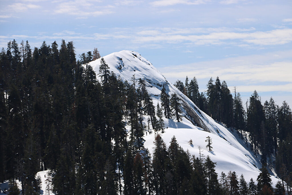
Buena Vista Peak
This outing does not appear on the park’s ski trail map but provides a fun adventure for those willing to explore without trail markers. To climb the little mountain that deserves its name requires two miles of cross country travel and about two hours. Be advised, this trailhead may be inaccessible during and after heavy snowfall.
Drive about four miles southeast on Generals Highway from the Y intersection and park at the Kings Canyon Overlook. Cross the road and walk 500 feet south to a trailhead sign (which may be snowed over).
Trek south past Jeffrey pines, incense cedars and large granite boulders. Our route curves slightly east as the summit comes into view; it’s more of a dome than a peak. Avoid the steep north-facing slope. Instead, traverse clockwise around the dome to its gentlest southeast face.
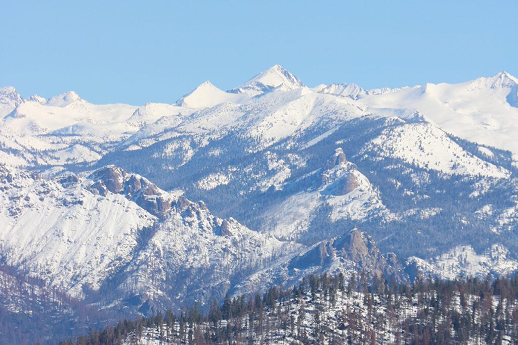
Buck Rock Fire Lookout may be visible to the northeast, as are many grand Sierra summits. This spot has particularly good views of Redwood Canyon and Redwood Mountain, home of the largest of all sequoia groves and the largest area of old-growth sequoia trees.
Big Baldy
To climb this modest mountain that looks like a bald hiker’s head involves a 4.5-mile outing and two to four hours. The approach trail traces Big Baldy Ridge which minimizes elevation gain needed to achieve the summit. This trailhead may also be inaccessible during and after heavy snowfall.
Drive about 6.5 miles southeast on Generals Highway from the Y intersection to find the signed trailhead. Red trail markers show the way. The route begins in a vibrant forest and ends on an exposed granite summit with excellent views in all directions. This trail skirts the national park boundary, so expect to see skiers, snowshoers and connecting trails from the nearby Montecito Sequoia Lodge.
Some stop at a nice vista about a half mile short of the peak, but if you’re after the true summit, keep going because you’re almost there. From the top, we see Redwood Canyon and Redwood Mountain Grove to the west and High Sierra peaks of the Great Western Divide to the east.
Kings Canyon attracts just a small fraction of the visitors who flock to Lake Tahoe and Yosemite. An even smaller number enjoy the park in winter, but those who do enjoy snowy solitude, sequoias, slopes, summits, often by themselves. That’s an experience worthy of kings, or queens.
If you go: Kings Canyon National Park charges a $35/week entrance fee. During winter, carry chains and prepare for adverse weather. Generals Highway, which connects Kings Canyon and Sequoia National Parks, closes for the winter between them. Access on its northern end, which leads to the Buena Vista Peak and Big Baldy trailheads, depends on weather and snow conditions.
Read other articles by Matt Johanson here.